


Oswego Harbor
Oswego, New York United States
Marinas near Oswego Harbor
| Name | Reviews | Max LOA | VHF | Dock Depth | Gas / Diesel | Lift / Crane | Wifi | Amps |
|---|---|---|---|---|---|---|---|---|
| Oswego Yacht Club | - | - | - | - | - | - | - | - |
| Wrights Landing Marina | - | 0.0 m | - | Low 0.0 mHigh 0.0' | - | - | - | - |
| Port of Oswego Marina | - | - | - | - | - | - | - | - |
| Oswego Marina | 0.0 m | - | Low 0.0 mHigh 0.0' | - | - | - | - | |
| Canal Landing Marina (Fulton) | - | - | - | - | - | - | - | |
| Dowie Dale Marina | - | - | - | - | - | - | - | - |
| Fair Haven Beach State Park | - | - | - | - | - | - | - | - |
| Salmon Country Marina | - | 45.0' | - | Low 6.0'High 0.0' | - | - | - | - |
| Mexico Point Marina | - | - | - | - | - | - | - | - |
| Mike's Marina | - | - | - | - | - | - | - | - |
| Mike's Marina Sales and Service | - | - | - | - | - | - | - | - |
| Shady Shores Campground | - | - | - | - | - | - | - | - |
| Shawn's Marina & Campground | - | - | - | - | - | - | - | - |
| Chinook Resort & Marina | - | 0.0 m | - | Low 0.0 mHigh 0.0 m | GYes | - | - | - |
| Holiday Harbor Marina | - | 0.0 m | - | Low 0.0 mHigh 0.0' | - | - | - | - |
Introduction:
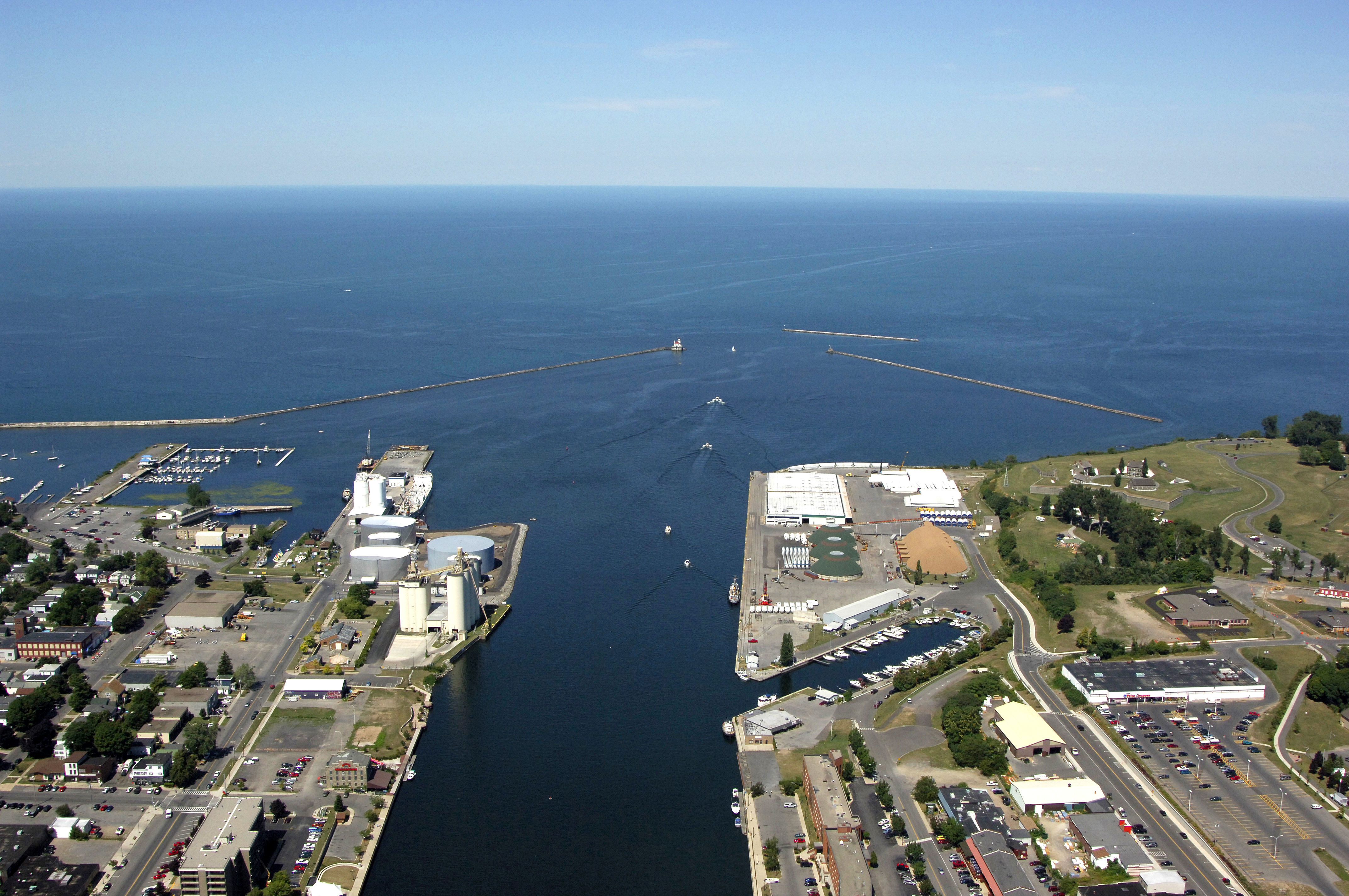
Oswego is located on Lake Ontario at the western terminus of the Erie Canal, which links the Husdon River and Atlantic Ocean. A major shipping port for gypsum and other industrial materials, Oswego is a popular stop with boaters that are either starting or finishing their journey on the Erie Canal.
History:
October, 1615 marked the beginning of recorded history with the arrival of the first European, Samuel de Champlain. The British and Dutch established a settlement at Oswego in 1722 to facilitate fur trade with the Indians. During the French and Indian War era, five local forts were built to protect the British supply route from Albany to Oswego. Three of these (Forts George, Oswego, and Ontario) were located within the present city limits.
In 1796, a full 12 years after the conclusion of the American Revolution, the British withdrew from Fort Ontario and, finally, settlers from New England and eastern New York immigrated into Oswego. Fort Ontario fell to the British in 1814 but, with the coming of peace and with the political support of the newly created Oswego County (1816), Oswegonians moved to build roads and bridges and to improve the navigation of the river. The Oswego branch of the Erie Canal opened in 1829 and, from the 1830's to the 1870's, Oswego boomed.
[i]Portions Courtesy City of Oswego[/i]
Navigating the Water:
Use NOAA Chart 14813.
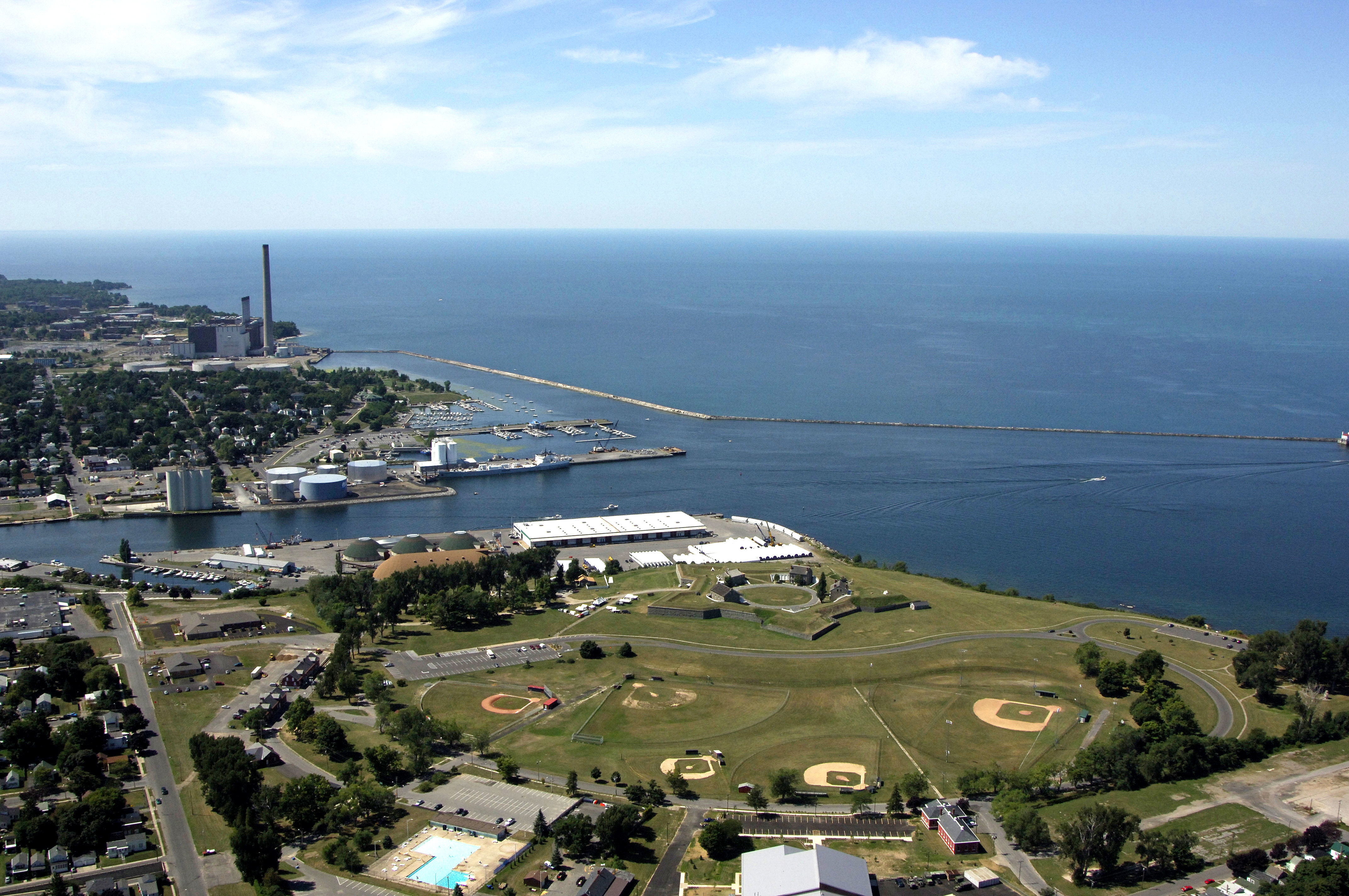
The Oswego Inlet is the western outlet of the Erie Canal system where it empties into Lake Toronto. Oswego is protected by an extensive jetty system that consists of three large breakwaters: The West Pierhead, East Breakwater, and an unnamed outer jetty to the north. With its busy commercial freight activity, the Oswego Inlet is deep, wide and well marked. The only challenge to navigation upstream on the Erie Canal are the lox fixed bridges and locks, but sailboats usually remove their masts, and tall powerboats remove any overhanging structures to clear them.
From Lake Ontario, an unnumbered flashing green light on the north jetty marks the entrance to Oswego. There is also a flashing yellow light on the east end of the same jetty; Oswego can be entered from both sides. From the north jetty, you will set a course for the West Pierhead and East Breakwater lights, which are marked with a flashing white and flashing green light, respectively. Once inside the breakwaters, there is a large turning basin and commercial channel that break off to the west, but the main yachting area in Oswego is near Fort Ontario on the east side of the Oswego River.
Local Notices to Mariners:
Local Notices to Mariners are available online from the U.S. Coast Guard.