


Deltaville - Broad Creek Harbor
Deltaville, Virginia United States
Marinas near Deltaville - Broad Creek Harbor
| Name | Reviews | Max LOA | VHF | Dock Depth | Gas / Diesel | Lift / Crane | Wifi | Amps |
|---|---|---|---|---|---|---|---|---|
| Regatta Point Yachting Center (Dozier's) | 120.0' | 72 | Low 8.0' | - | - | 100 | ||
| Walden's Marina | 70.0' | - | - | GYesDYes | LYesCYes | - | ||
| Norview Marina | - | 16 | Low 6.0' | G$6.30/galD$5.7579/gal | - | 30/50 | ||
| Stingray Point Boat Works | - | - | - | - | - | - | - | |
| Norton's Yacht Sales and Marina | 70.0' | 16 | Low 6.0' | G$6.50/galD$6.09/gal | LYesCYes | 30 & 50 | ||
| Safe Harbor Stingray Point | 65.0' | 16 | - | - | - | 30,30,50 | ||
| Timberneck Marina | - | - | - | - | - | - | - | - |
| Deltaville Yachting Center | - | - | - | GYesDNearby | - | 30/50 | ||
| The Jolly Skipper Boatyard | - | 60.0' | 9 | Low 6.5' | - | LYes | 30amp | |
| J & M Marina | - | 0.0' | - | Low 0.0 mHigh 0.0' | - | - | - | - |
| R. W. Green Boat Yard | - | 0.0' | - | Low 0.0 mHigh 0.0' | - | - | - | - |
| Chesapeake Cove Marina | 50.0' | 68 | Low 0.0 mHigh 0.0' | GYesDYes | LYesCYes | 50 & 30 | ||
| Jackson Creek Marina | 100.0' | 16 | Low 9.0' | G$3.29/galD$3.34/gal | LYesCYes | 30amp,50amp | ||
| Deltaville Boatyard | - | - | 16 | - | GYesDYes | LYesCYes | - | |
| Fishing Bay Yacht Club | - | 0.0' | - | Low 0.0 mHigh 0.0' | - | LYes | - |
Introduction:
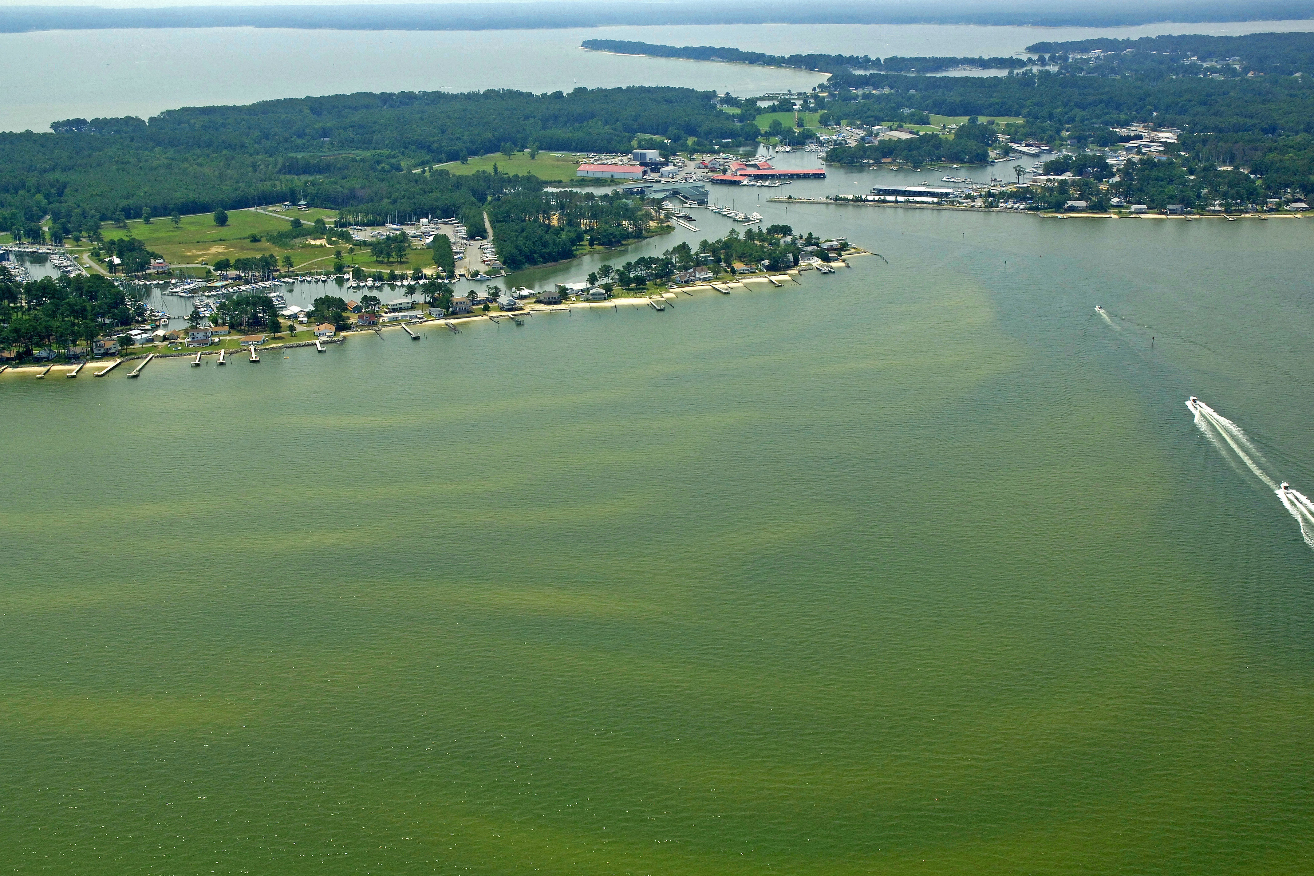
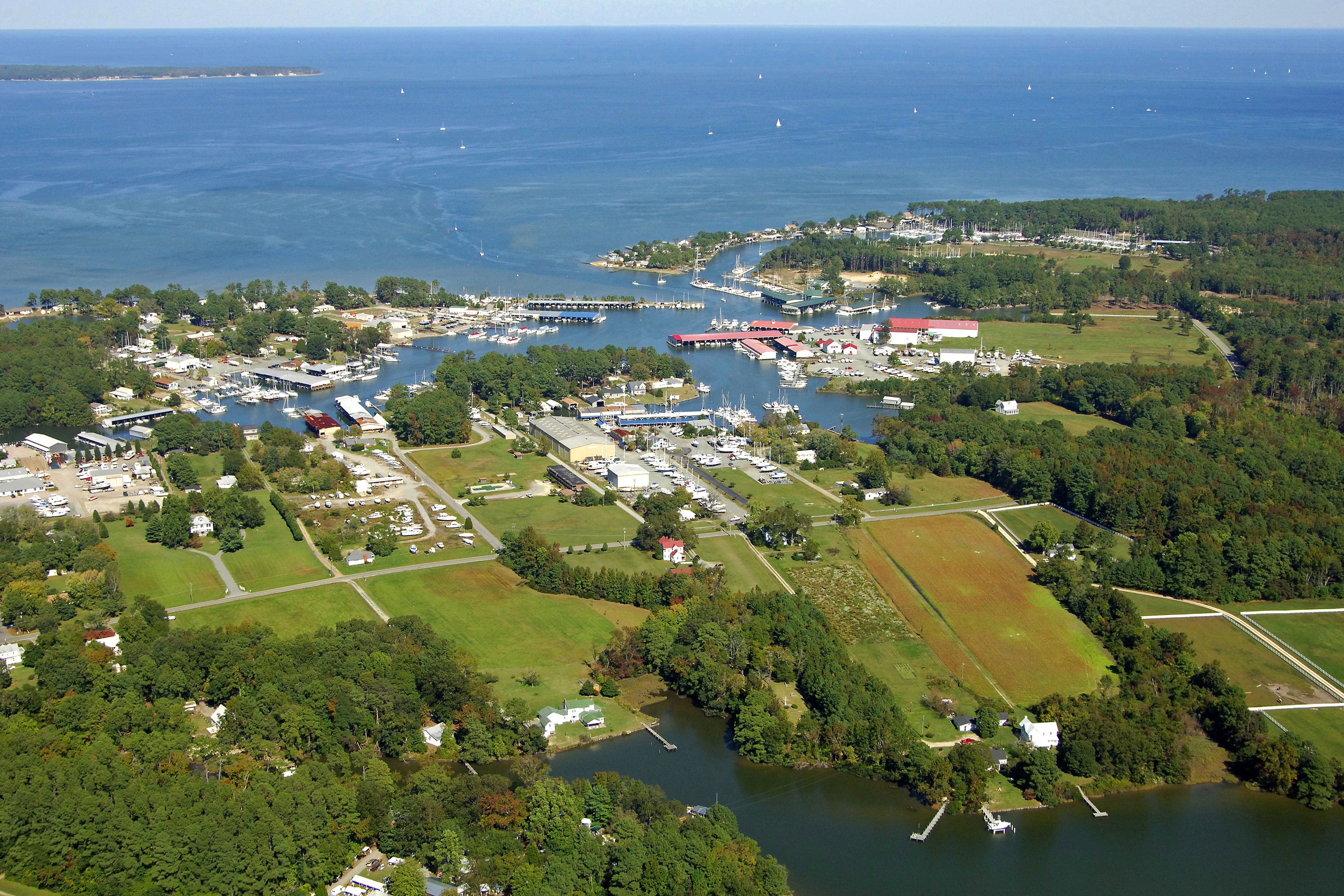
Deltaville is located off of the Rappahannock River near Stingray Point on Virginias Western Shore. Deltaville is an immensely popular stopover point for boaters making the northbound or southbound trek on the Chesapeake Bay because of its location about half way between Solomons Island and Norfolk. Deltavilles Broad Creek has a number of marinas on its shores and a couple of repair yards with full haul-out capabilities.
Use NOAA Chart 12235.
From the Chesapeake Bay, be sure to clear the light at Windmill Point (flashing white every six seconds) as you approach. From here, set a course for Rappahannock River flashing green 3R, and then to flashing green 1 at the mouth of Broad Creek. The entrance to Broad Creek is reported to have five-foot depths, but the wise mariner gives the red daybeacons at the entrance a little bit of room. Hugging them too closely can leave you aground, especially after a couple of days of strong northwest winds.
Once inside, you will find Broad Creek extremely well marked. There are marinas on both ends of the creek, with most of the repair yards located on the west end and most of the resort marinas on the east.
Local Notices to Mariners:
Local Notices to Mariners are available online from the U.S. Coast Guard.