


Esperanza Harbor
Esperanza, Puerto Rico
Marinas near Esperanza Harbor
| Name | Reviews | Max LOA | VHF | Dock Depth | Gas / Diesel | Lift / Crane | Wifi | Amps |
|---|---|---|---|---|---|---|---|---|
| Naval Base Yacht Club | - | - | - | - | - | - | - | - |
| Safe Harbor Puerto Del Rey | 180.0' | 71 | Low 0.0 mHigh 0.0' | G$2.75/galD$2.19/gal | LYes | - | ||
| Coral Dock | - | - | - | - | - | - | - | - |
| Dewey Boatyard | - | 0.0 m | - | Low 0.0 mHigh 0.0 m | - | - | - | - |
| Marina Sardinera | - | - | - | - | - | - | - | - |
| Cayo Obispo Marina | - | 0.0 m | - | Low 0.0 mHigh 0.0' | - | - | - | - |
| Cayo Obispo Yacht Club | - | - | - | - | - | - | - | - |
| Sunbay Marina | 0.0' | - | Low 0.0 mHigh 0.0 m | GYesDYes | - | - | - | |
| Villa Marina | - | - | - | - | - | - | - | - |
| Marina Puerto Chico | 0.0 m | - | Low 0.0 mHigh 0.0 m | - | - | - | - | |
| The Reserve at Marina Puerto Chico | - | - | - | - | - | - | - | - |
| El Conquistador Beach Resort and Marina | - | 0.0' | - | Low 0.0 mHigh 0.0 m | - | - | - | - |
| Veradero Fajardo Boatyard | - | 0.0 m | - | Low 0.0 mHigh 0.0 m | - | - | - | - |
| The Yacht Club Marina at Palmas Del Mar | 175.0' | 11 | Low 10.0'High 400.0' | G$4.42/galDYes | LYes | 50 Amp, 100 Amp Single and 3 Phase | ||
| The Shipyard at Palmas Del Mar | - | - | - | G$4.61/galD$4.24/gal | LYesCYes | 30 |
Introduction:
Esperanza is located on Ceiba Island in a remote southern portion of the island. Although there are a scattering of beach houses and ocean villas here, aside from a local restaurant or two, you will be on your own for provisioning. Ceiba Island is located 46 miles southeast of San Juan and only 12 miles southwest of the island of Culebra.
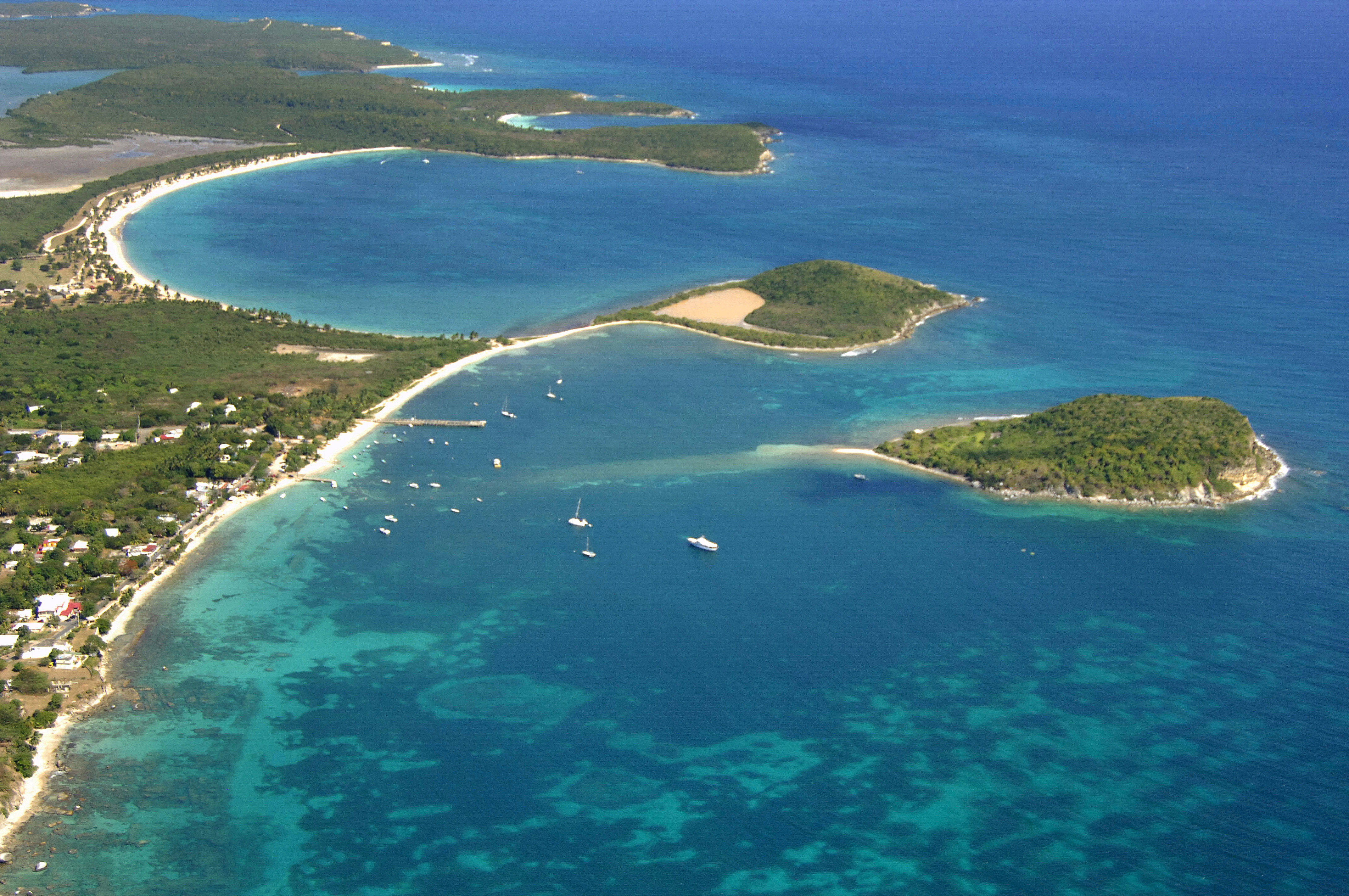
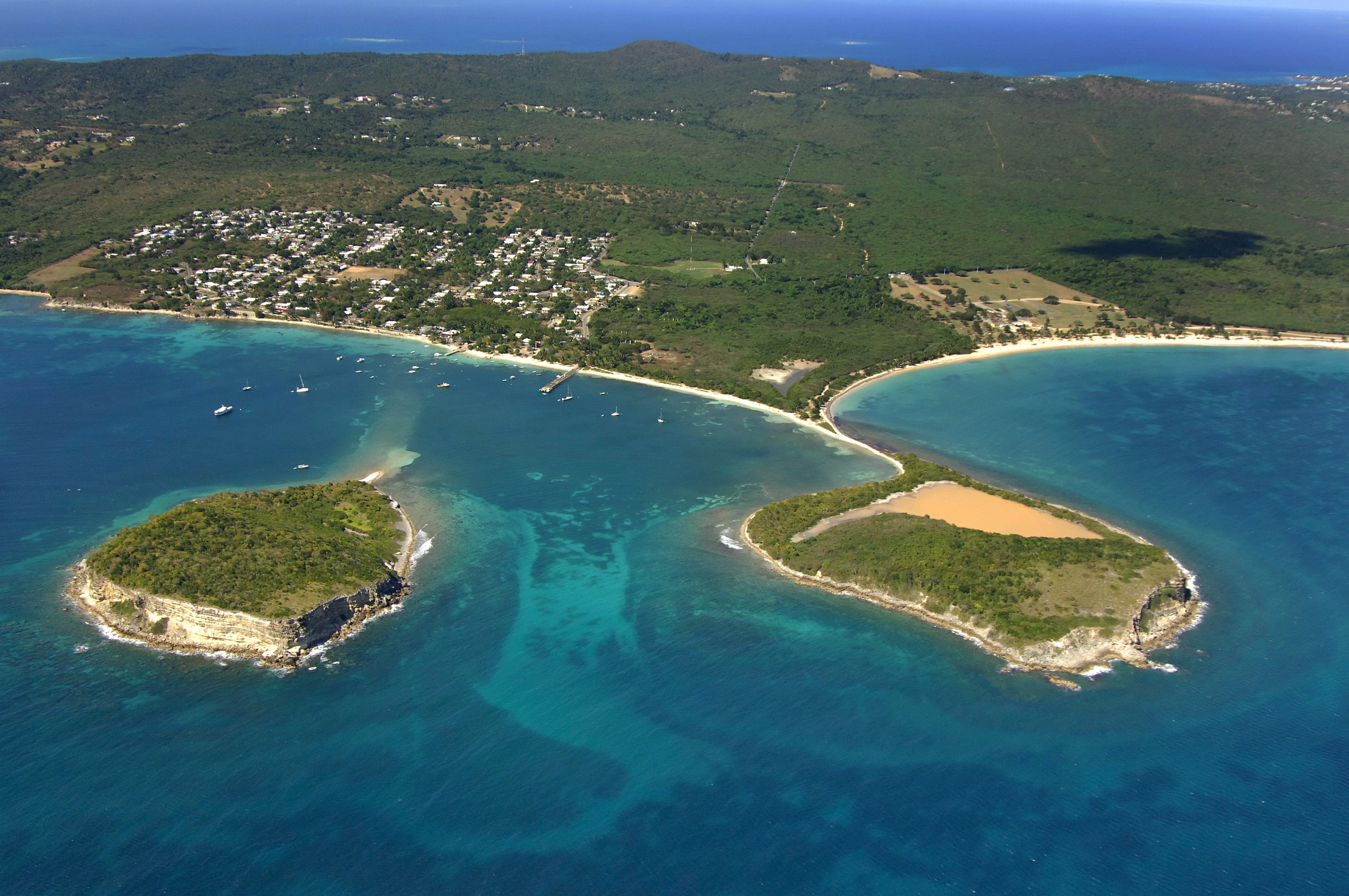
The two islands pictured above are Cayo Real (left) and Cayo de Tierra (right). Between these two is the harbor and anchorage area for Esperanza.
Navigating the Water:
There are three locations for anchoring in the Esperanza area, and they are listed in left to right order, as they appear in the image above. The the left (west) is Puerto Real, in the middle is Esperanza Harbor, and to the right (east) is Ensenada Sun Bay. All are suitable for anchorage, but typical with many coastal locations on the south side of the island, a southerly breeze can make things uncomfortable. Puerto Real is the most protected anchorage, and it is conveniently close to town.
Local Notices to Mariners:
See our Local Notices to Mariners blog for updates on the latest conditions and advisories for this area.