Dundedin-Honeymoon Island Bascule Bridge
| Florida United States | |
| 28° 3' 11.16'', -82° 47' 41.99'' | |
| Palm Harbor |


You might also consider...


Details
| Bridge type | Bascule |
| Closed vertical clearance | 24' |
| Vhf | 9 |
| Schedule | Opens on request. |
About
Introduction:
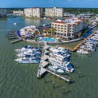
The Dunedin Causeway Bascule Bridge takes vehicular traffic to and from Dunedin to Honeymoon Island across Joseph Sound and the GIWW near mile 140.
Navigating the Bridge:
Use NOAA Chart 11411.
Carrying traffic from Honeymoon Island to the Dunedin mainland, the Dunedin Causeway Bascule Bridge has a 24-foot closed vertical clearance with 91 feet of horizontal clearance in the center span. On the east side of the bridge, depths outside the channel abruptly shoal to two feet in spots, while mid-channel depths are about four to five feet. The channel deepens slightly on the west side, with a bit more leeway in depths outside the channel.
Bridge Schedule:
This bridge opens on demand, 24 hours a day with no restrictions.
Depending on schedule, the bridge can be opened by horn signal (one long, one short) or by hailing the bridge tender on VHF Channel 09. (All bridges in the state of Florida must be hailed on VHF Channel 09.)
Local Notices to Mariners:
Local Notices to Mariners are available online from the U.S. Coast Guard.