Longboat Pass Bascule Bridge
| Florida United States | |
| 27° 26' 38.04'', -82° 41' 12.83'' | |
| Bradenton Beach |


You might also consider...


Details
| Closed vertical clearance | 17 |
About
Introduction:
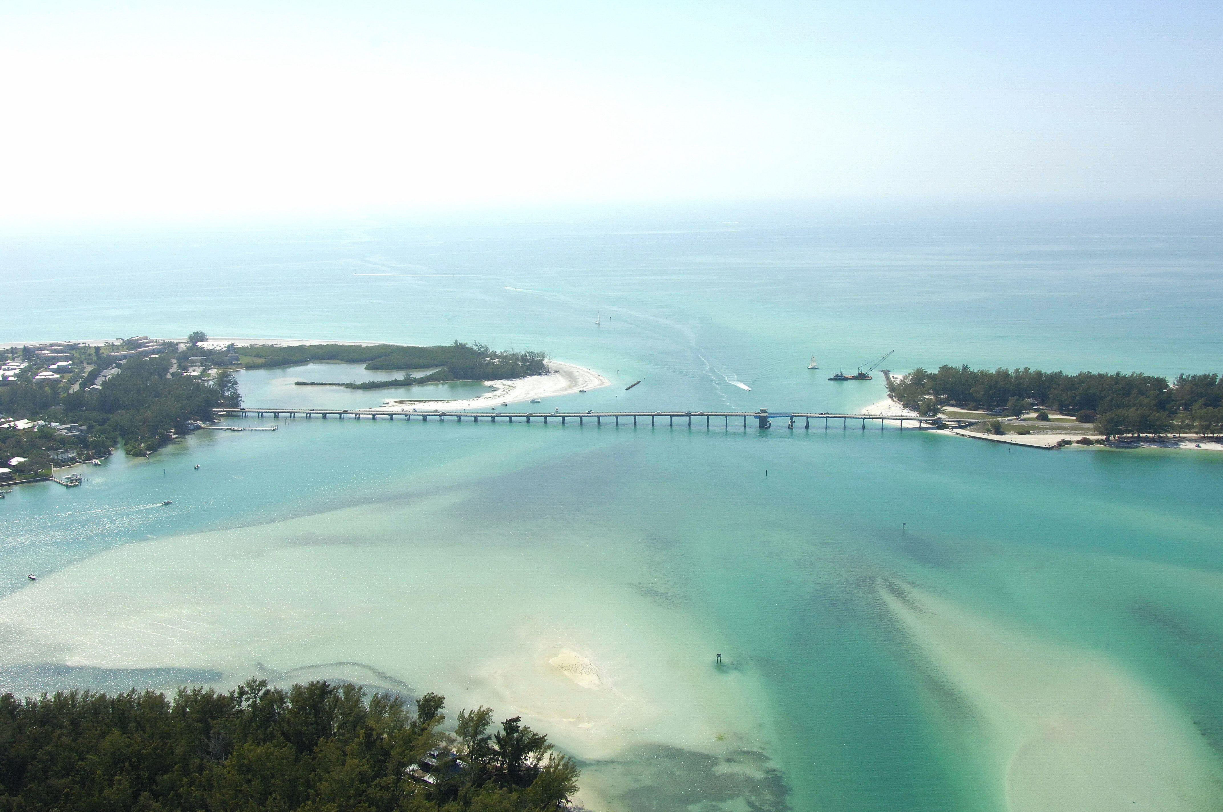
The Longboat Pass Bascule Bridge shuffles traffic to and from Anna Maria Island and Longboat Key near GIWW Mile Marker 85.
Navigating the Bridge:
Use NOAA Chart 11425.
The bridge has a closed vertical clearance of 17 feet with 45 feet of horizontal clearance in the center span. Use Longboat Pass with caution; although 4.5-foot depths are the reported norm, according to the chart, shallower depths may exist and warrant a close watch on the depth sounder.
Bridge Schedule:
The bridge opens on demand 24 hours a day, seven days a week.
The bridge can be opened by horn signal (one long, one short) or by hailing the bridge tender on VHF Channel 09. (All bridges in the state of Florida must be hailed on VHF Channel 09.)
Local Notices to Mariners:
Local Notices to Mariners are available online from the U.S. Coast Guard.