Indian Rocks Beach Causeway Bridge
| Largo, Florida United States | |
| 27° 52' 59.88'', -82° 50' 45.96'' | |
| Indian Rocks Beach |


You might also consider...


Details
| Bridge type | Bascule |
| Closed vertical clearance | 25' |
| Vhf | 9 |
| Schedule | Opens on request. |
About
Introduction:
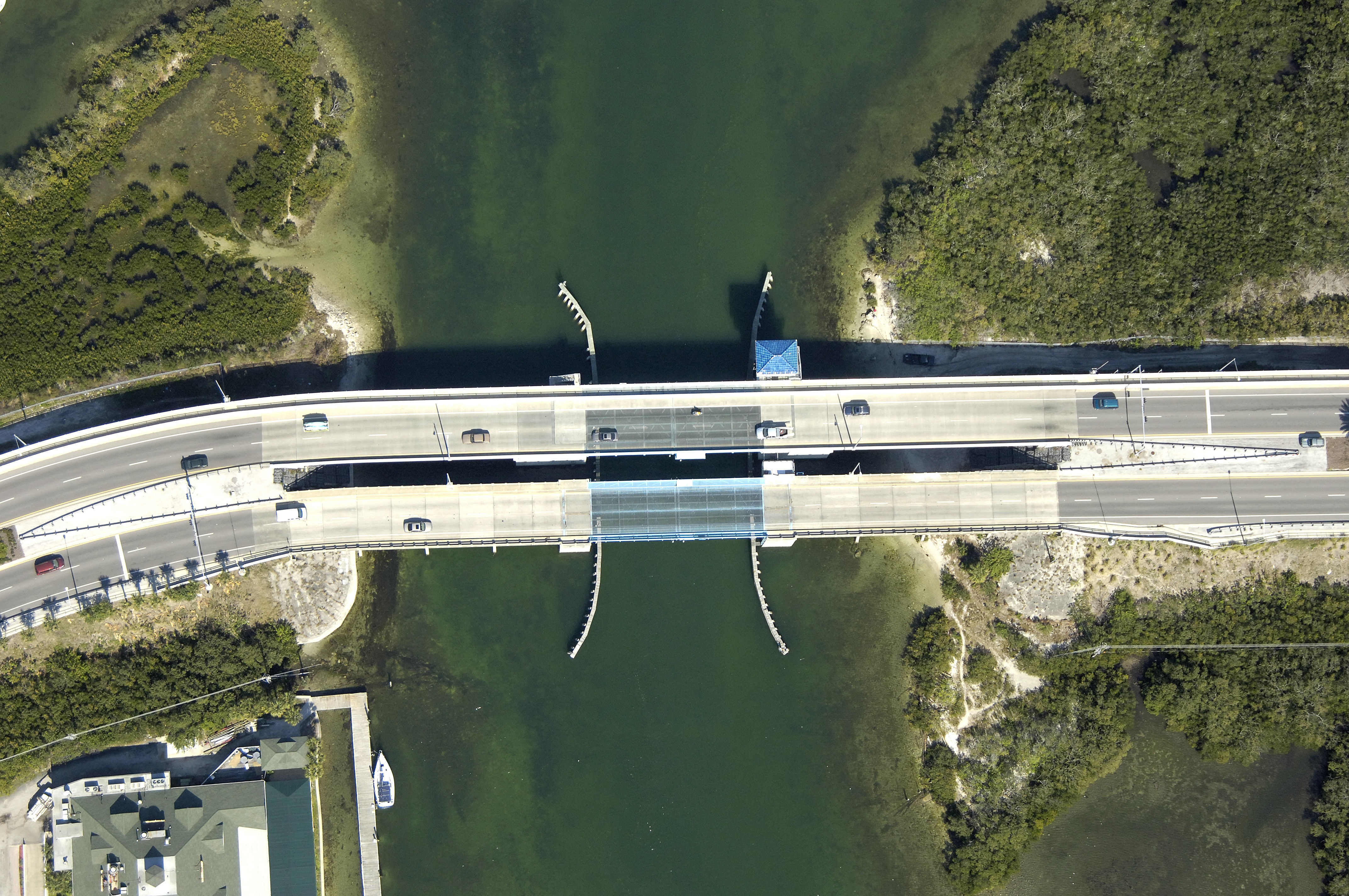
The Indian Rocks Bascule Bridge, located at Mile Marker 128.9 on the GIWW about seven miles south of Clearwater, carries to and from the Florida mainland to Indian Rocks Beach.
Navigating the Bridge:
Use NOAA Chart 11411.
The bridge has a closed vertical clearance of 25 feet with 90 feet of vertical clearance in the center span. The current chart lists the bridge as Under Construction, but the new bridge is complete as of this writing. As is typical with most channel in The Narrows, the depths range from four to six feet.
Bridge Schedule:
This bridge opens on signal at all times.
The bridge can be opened by horn signal (one long, one short) or by hailing the bridge tender on VHF Channel 09. (All bridges in the state of Florida must be hailed on VHF Channel 09.)
Local Notices to Mariners:
Local Notices to Mariners are available online from the U.S. Coast Guard.