Anna Maria Island Bascule Bridge
| Bradenton Beach, Florida United States | |
| 27° 29' 51.0'', -82° 41' 35.87'' | |
| Bradenton Beach |


You might also consider...


Details
| Bridge type | Bascule |
| Closed vertical clearance | 24' |
| Vhf | 9 |
| Schedule | January 15-May 15, 7 AM-6 PM, opens on the hour and half-hour. May 16-January 14, 6 AM-7 PM, on the hour then every 20 minutes. |
About
Introduction:
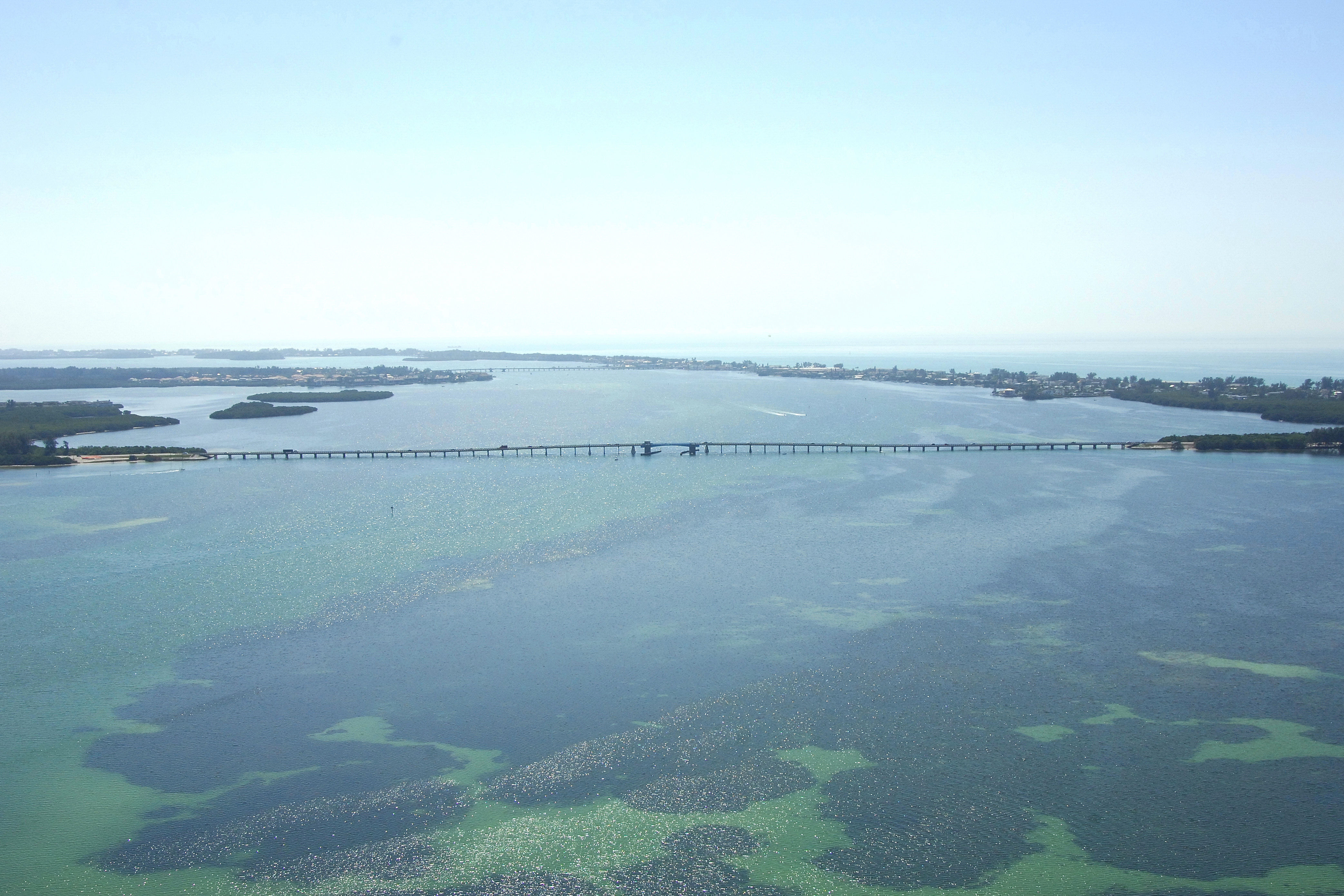
The Anna Maria Bascule Bridge is located about 19 miles south of Saint Petersburg and 15 mile north of Sarasota on Anna Maria Sound at GIWW Mile Marker 89.2. The bridge carries Manatee Avenue traffic to and form Anna Maria Island.
Navigating the Bridge:
Use NOAA Chart 11425.
The Anna Maria Bascule Bridge has a 24-foot closed vertical clearance, with 90 feet of horizontal clearance in the center span. Unlike many GIWW locations, depths in this area are fairly deep (eight-to 16-foot depths) and the channel is relatively wide. There is also plenty of room on either side of the bridge for waiting out an opening.
Bridge Schedule:
The bridge operates on a restricted opening schedule. The bridge opens on the hour, and every 20 minutes thereafter from 7 a.m. to 6 p.m. daily, year-round. The bridge opens on demand at all other times.
Depending on schedule, the bridge can be opened by horn signal (one long, one short) or by hailing the bridge tender on VHF Channel 09. (All bridges in the state of Florida must be hailed on VHF Channel 09.)
Local Notices to Mariners:
Local Notices to Mariners are available online from the U.S. Coast Guard.