KMI Kentucky Military Institute (Hatchett Creek) Bridge


Details
| Bridge type | Bascule |
| Closed vertical clearance | 30' |
| Vhf | 9 |
| Schedule | Weekdays 7 AM-4:20 PM, opens on the hour, 20 minutes past the hour, and 40 minutes past the hour. From 4:25-5:25 PM, there will be no openings. On weekends from 7:30 AM-6 PM, opens on the hour and every 15 minutes. |
About
Introduction:
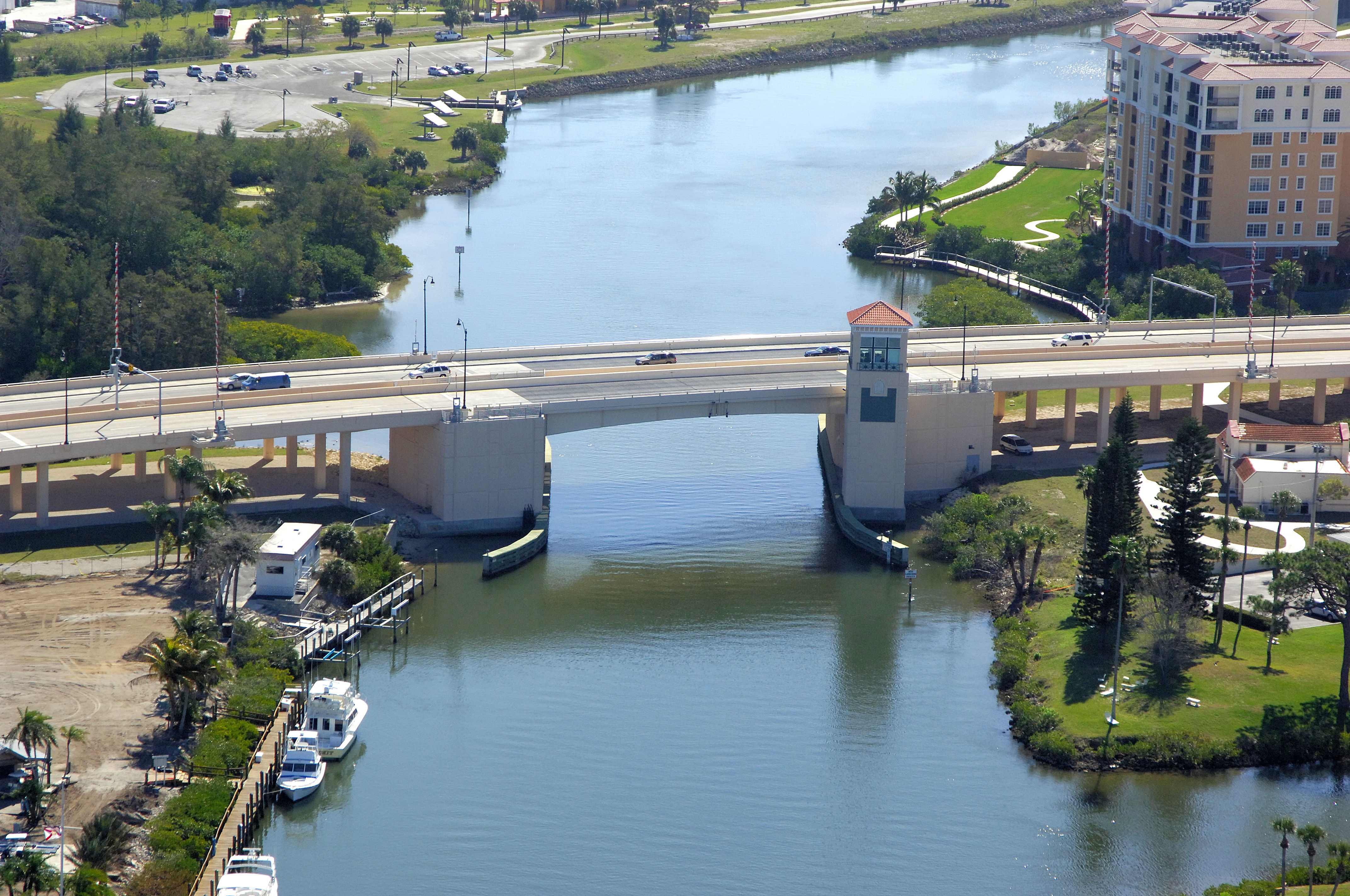
The KMI Kentucky Military Institute Bridge, formerly named the Hatchett Creek Bascule Bridge, carries U.S. Highway 41 across the Gulf Intracoastal Waterway (GIWW) at Mile Marker 56.9 in the middle of Venice.
Bridge Schedule:
This bridge operates with a restricted opening schedule.
Year-round, Monday through Friday, from 7 a.m. to 4:20 p.m., the bridge opens on the hours, and every 20 minutes thereafter with no openings from 4:25 to 5:25 p.m.
On weekends and Federal holidays, from 7:30 a.m. to 6 p.m., the bridge opens on the hour and every 15 minutes thereafter.
Depending on schedule, the bridge can be opened by horn signal (one long, one short) or by hailing the bridge tender on VHF Channel 09. (All bridges in the state of Florida must be hailed on VHF Channel 09.)
Local Notices to Mariners:
Local Notices to Mariners are available online from the U.S. Coast Guard.
Navigating the Bridge:
Use NOAA Chart 11425. 90 feet of horizontal space in the center span.
The bridge, as its name implies, crosses narrow and shallow Hatchett Creek, which brings GIWW boat traffic in from the south into Roberts Bay. Aside from heavy traffic and occasionally strong currents, the bridge is easy to navigate. Red daybeacons 5, 6 and flashing green 5 mark the channel north of the bridge.