Atlantic Boulevard Bascule Bridge
| Florida United States | |
| 26° 13' 54.84'', -80° 5' 35.88'' | |
| Pompano Beach |
You might also consider...
8 Reviews
Now accepting lease applications for slip rentals
Aquamarina Oceanside is ... Read More

31 Reviews
Located in Greater Fort Lauderdale/Broward County, PORT 32 Lighthouse Point M... Read More

28 Reviews
Welcome to Lighthouse Point Yacht Club Marina, a premier destination renowned... Read More
Details
| Closed vertical clearance | 15 |
About
Introduction:
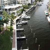
The Atlantic Boulevard Bascule Bridge, at Mile 1056.0 on the Intracoastal Waterway, is approximately two nautical miles south of the Hillsboro Inlet and just north of where the Pompano Canal and Cypress Creek enter the Waterway. The bridge opens on demand.
Navigating the Bridge:
Keep an eye out for entering boat traffic from the Cypress Creek/Pompano Canal entrance just south of the bridge. Otherwise, navigating the bridge is easy and the bridge can be opened by horn signal (one long, one short) or by hailing the bridge tender on VHF Channel 09. (All bridges in the state of Florida must be hailed on VHF Channel 09.)
Local Notices to Mariners:
Local Notices to Mariners are available online from the U.S. Coast Guard.
Reviews
No reviews yet! Be the first to write a review of Atlantic Boulevard Bascule Bridge.