Spanish Wells North Ocean Inlet
| Spanish Wells, Eleuthera Bahamas | |
| 25° 33' 25.2'', -76° 44' 41.65'' | |
| Spanish Wells |


You might also consider...


About
Introduction:
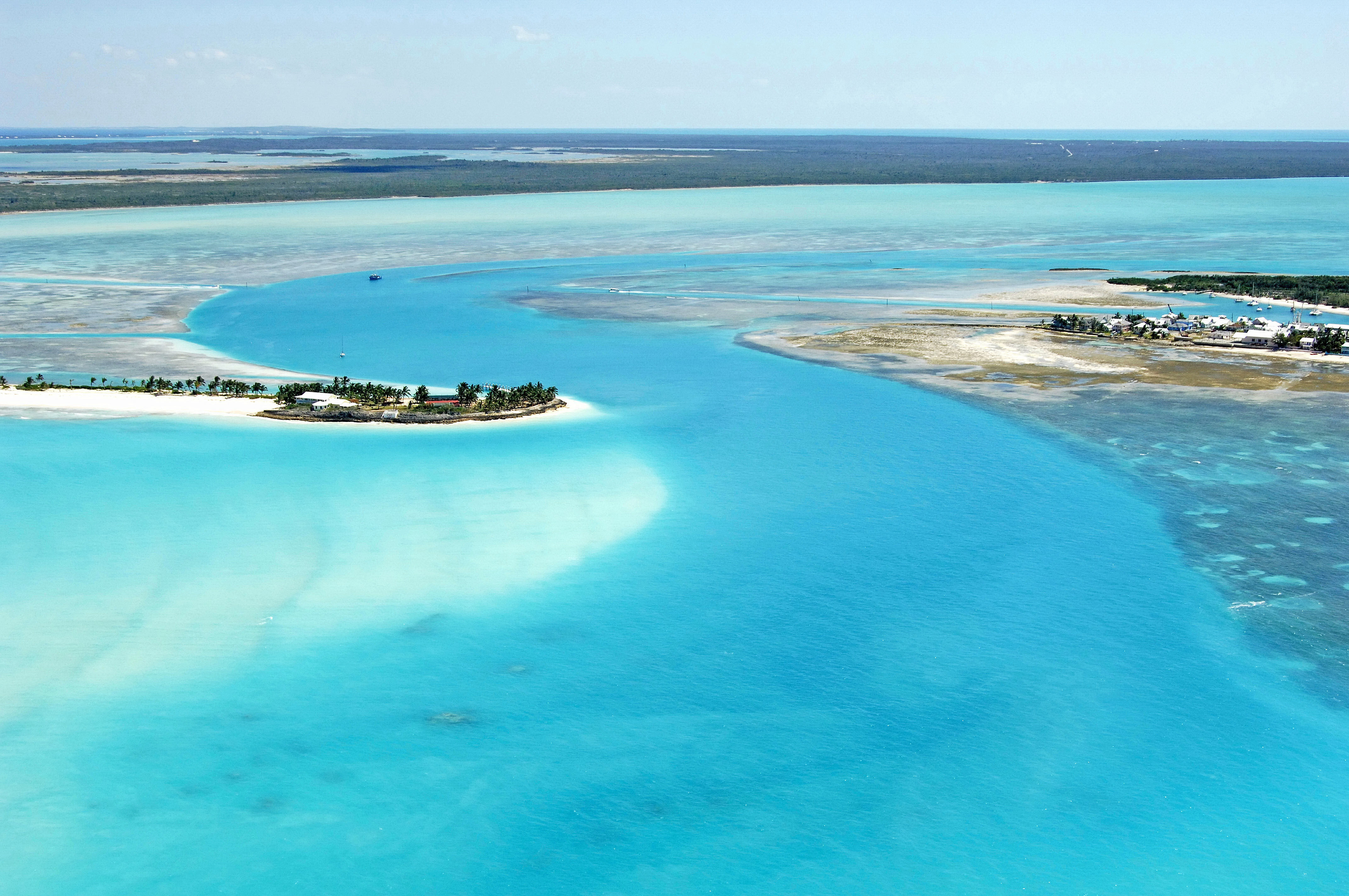
Spanish Wells, named for the Spanish ships that used to fill their water jugs here, is located just west of the north end of Eleuthera Island behind a protective barrier reef that keeps it calm during strong northers. Spanish Wells can be approached form the north or south.
Ashore are a variety of service including markets, stores, repair shops, drug stores, and photo processing, but alas, no liquor store is on the island. A number of small resorts dot the area and there are also several good sit down and take-out restaurants along the waterfront.
Navigating the Water:
Spanish Wells is normally reached from the Atlantic Ocean via a break in the reefs northwest of Salt Kettle Bay. Start your approach to the area from waypoint 25 35.500N 76 44.205W. Once you have picked up this point, set a course of 184 degrees true for a distance of approximately two miles, which will put you just north of the reef break. The next waypoint, 25 33.830N 76 44.306W, will place you farther in toward the inlet. From here, set a course of 171 degrees true for a distance of about .3 mile, and then turn toward the west on a course of 259 degrees true for .2 mile. There is another approach in this area from the east via Ben Bay, but the route requires a longer set of navigation through coral outcrops and shoals.
Clear of the point off the northwest end of Eleuthera, Set a course toward Gun Point (approximately 202 degrees true), making sure to mind the shoals the encroach on the channel from the west. After you have cleared Gun Point, set a course to the southeast to pick up the entrance channel to the back side of Spanish Wells. A ferry channel works across this area and runs from Eleuthera Island to the east westward across a dredged channel to Spanish Wells. The eastern portion of this channel is the entrance into Spanish Wells.
Local Notices to Mariners:
See our Local Notices to Mariners blog for updates on the latest conditions and advisories for this area.