Matanzas Inlet
| Summer Haven, Florida United States | |
| 29° 42' 16.92'', -81° 13' 39.0'' | |
| St. Augustine |


You might also consider...


About
Introduction:
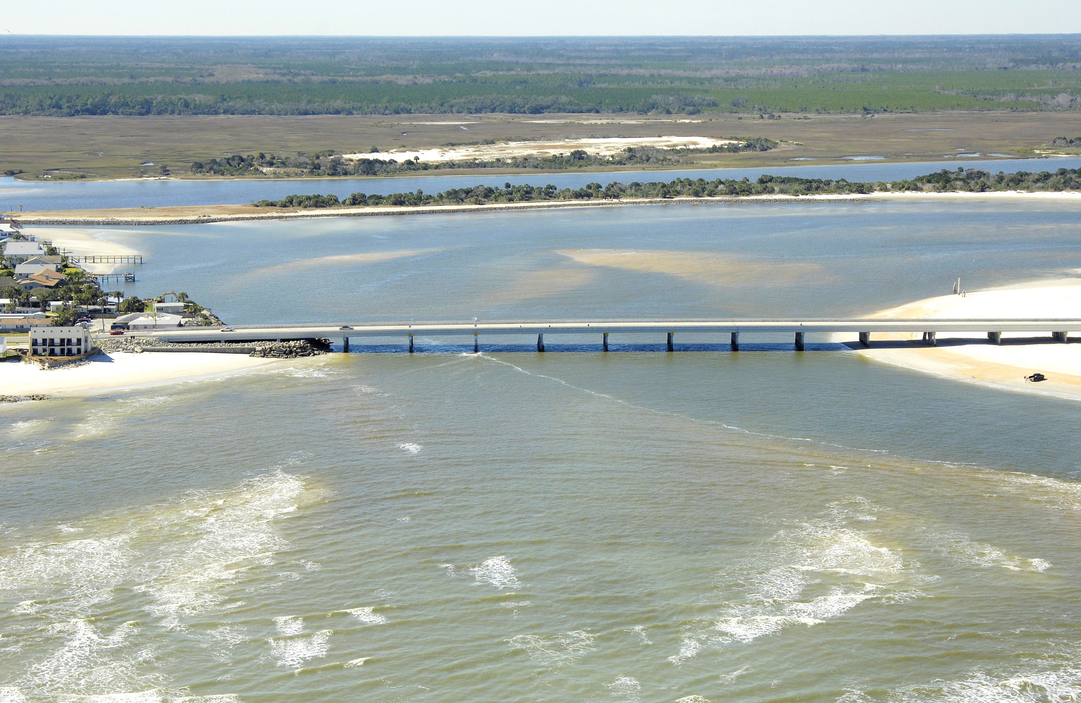
The Matanzas River empties into the Atlantic Ocean about 15 miles south of the city of St. Augustine on Floridas East Coast. Although the inlet is closed to navigation, the Intracoastal Waterway (ICW) runs past the inlet just on the other side of Rattesnake Island, which can be seen in the background of the image above, a view from the east looking west over the inlet from the Atlantic Ocean.
Navigating the Water:
Use NOAA Chart 11485.
Under no circumstance should the Matanzas River Inlet be used by any boat. As visible in the image above, the entire inlet has been allowed to takes its natural course and shoal in. The current edition of NOAA Chart 11485 marks the inlet as Closed to Navigation, and indeed, the current-formed waves and visible shoals above confirm this warning.
The Intracoastal Waterway passes through this area behind For Matanzas and Rattlesnake Island starting at green nun buoy 81A and red nun buoy 80A, just northwest of the inlet. The cut runs for behind the barrier island for about 3.5 miles before meeting up with the Matanzas River again at flashing red 86 and ICW Mile 796.
The closest marine facilities to the marina are the Marineland Marina, about three miles south of the inlet and Devils Elbow at ICW Mile 790.
Local Notices to Mariners:
Local Notices to Mariners are available online from the U.S. Coast Guard.