Cape Fear Inlet
| Southport, North Carolina United States | |
| 33° 52' 9.84'', -78° 3' 8.99'' | |
| Bald Head Island |


You might also consider...


About
Navigating the Water:
Use NOAA Charts 11534 and 11537.
From the Atlantic Ocean, you will first set a course for red and white Morse (A) buoy CF about six miles south of the inlet opening at Bald Head Island. Once you have successfully picked up red and white Morse (A) buoy CF, head north toward the inlet opening. Several lighted buoys and the Cape Fear Entrance Channel Range will assist you all the way in to flashing green buoy 9 and quick flashing red buoy 10 at the Bald Head and Jay Bird shoals, where the channel turns toward the northeast.
After the turn at flashing green buoy 9 and quick flashing red buoy 10,be sure to closely follow the remaining flashing buoys into the twisting channel. There are two additional ranges, the Bald Head Shoal Range and the Smith Island Range, which both help you stay in the deepest water past Fort Caswell. Look for them on the chart, and on your passage up the inlet channel.
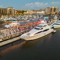
There is an excellent marina on Bald Head Island just at the entrance if you plan on hopping back offshore quickly after your rest, or there are more marinas to the north in Southport where the Intracoastal Waterway breaks off of the Cape Fear River near Battery Island.
Local Notices to Mariners:
Local Notices to Mariners are available online from the U.S. Coast Guard.
Introduction:
Located on the North Carolina coast about 25 miles south of Wilmington and 23 miles southwest of Wrightsville Beach, the Cape Fear River Entrance (Inlet) is a deep and safe all-weather inlet that leads from the Atlantic Ocean to the Cape Fear River's mouth at Bald Head Island. The Intracoastal Waterway crosses the Cape Fear River at the town of Southport near the river's entrance past Battery Island.
Up the Cape Fear River is the city of Wilmington, which has undergone significant change in the last decade and is a pleasant area to visit. There are excellent marina facilities in Wilmington and all but one of them make space available for visiting transient boaters. There are two extensive repair yards above the state Route 117 Bascule Bridge (26-foot closed vertical clearance) that each have high-capacity lifts for haul-outs.