Perkins Cove Inlet
| Ogunquit, Maine United States | |
| 43° 14' 3.85'', -70° 35' 12.84'' | |
| Perkins Cove Harbor |
You might also consider...


About
Introduction:
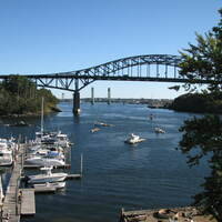
Perkins Cove is a conveniently located refuge about five miles north of Nubble Point off of Bigelow Bight. Perkins Cove has good depths, a reliable entrance and a beautiful, quiet setting to put down for the night. Beautiful summer homes and vacation cottages line the shore and lobstermen come and go at all hours of the day and night harvesting their catch.
Navigating the Water:
Use NOAA Chart 13286.
Red and white Morse (A) buoy PC marks the entrance to Perkins Cove, about one nautical mile north of Bald Head Cliff. Once you have cleared the Morse (A) buoy, set a course for green can 1, and red nun 2 at the mouth to Perkins Cove (These are visible in the aerial above.) A bit farther in to starboard will be red daybeacon 4, a privately maintained aid. Depths of seven to eight feet prevail inside, and a bascule bridge with an 18-foot closed vertical clearance crosses the cove midway along its length.
Local Notices to Mariners:
Local Notices to Mariners are available online from the U.S. Coast Guard.