


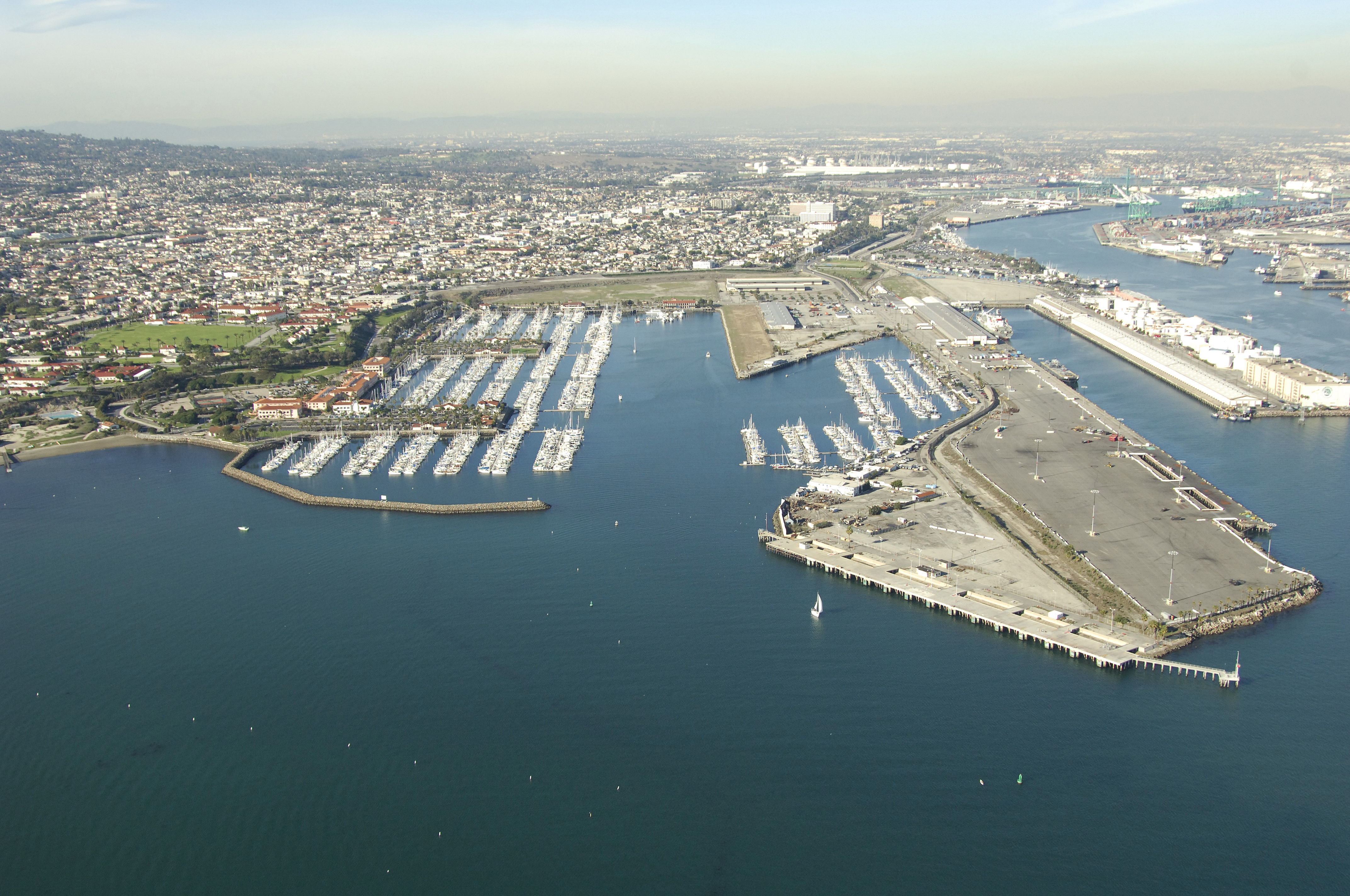
San Pedro Harbor
California United States
Marinas near San Pedro Harbor
| Name | Reviews | Max LOA | VHF | Dock Depth | Gas / Diesel | Lift / Crane | Wifi | Amps |
|---|---|---|---|---|---|---|---|---|
| LA Olympics 2028 | - | - | - | - | - | - | - | - |
| California Yacht Marina - Cabrillo Marina | 120.0' | - | Low 0.0'High 0.0' | GNearbyDNearby | - | - | ||
| Hurricane Gulch Yacht Club | - | - | - | - | - | - | - | - |
| Cabrillo Way Marina | 50.0' | - | Low 0.0 mHigh 0.0' | - | - | - | ||
| Los Angeles Yacht Club | - | - | - | - | GNearby | - | - | - |
| Holiday Harbor Cabrillo Marina | 70.0' | - | Low 0.0'High 0.0' | GNearbyDNearby | - | 30-50 | ||
| Cabrillo Beach Yacht Club | - | 0.0' | - | Low 0.0'High 0.0' | - | - | - | - |
| The Jankovich Company Fuel Dock | - | - | - | - | - | - | - | - |
| Al Larson Boat Shop & Marina | 0.0' | - | Low 0.0 mHigh 0.0 m | - | - | - | - | |
| Euro Sail Charters | - | - | - | - | GNearby | - | - | - |
| General Petroleum Fuel Dock | - | 0.0 m | - | Low 0.0 mHigh 0.0' | - | - | - | - |
| San Pedro Marina | - | - | - | - | GYesDYes | - | - | - |
| Los Angeles Maritime Museum | - | - | - | - | - | - | - | - |
| Newmark's Yacht Centre | 0.0' | - | Low 0.0 mHigh 0.0' | - | - | - | - | |
| Yacht Haven Marina | - | 54.0' | - | - | - | - | - |
Introduction:
San Pedro, along with the port of Los Angeles is among the largest and busiest ports in the United States. With large marina facilities and plenty of resources ashore, San Pedro is a closer alternative for slip space than other marinas in the area, which reside farther up the main Los Angeles Shipping Channel.
There are many things to do ashore, but most of them will require use of public transit (see links below) or the acquisition of a rental car to fully enjoy. A day at the beach, taking in the typical Los Angeles sights or just relaxing in port are all popular activities. The Queen Mary, several museums and an aquarium are nearby. You can also catch ferries serving Catalina Island from this area.
Navigating the Water:
Use NOAA Chart 18746 and 18751.
Approach from the south. San Pedro Harbor is accessed via the main Los Angeles Harbor channel, which passes through the breakwater surrounding the harbor at Los Angeles Light. Pick up Los Angeles Light (flashing green every 15 seconds; horn) at the east end of the San Pedro Breakwater.
Once clear of the entrance, follow the main channel until you sight flashing green buoy 11, where you will make a westerly turn toward San Pedro. Flashing red 4 and flashing green buoy 3 mark the entrance to Western Channel into San Pedro. From here, follow the lighted marks into the marina areas. As always, this is a busy commercial harbor and a close lookout for freighters, tugs and other port traffic is warranted.
Local Notices to Mariners:
Local Notices to Mariners are available online from the U.S. Coast Guard.