


San Luis Obispo Harbor
California United States
Marinas near San Luis Obispo Harbor
| Name | Reviews | Max LOA | VHF | Dock Depth | Gas / Diesel | Lift / Crane | Wifi | Amps |
|---|---|---|---|---|---|---|---|---|
| Port San Luis Pier | - | 0.0' | - | Low 0.0 mHigh 0.0' | - | - | - | - |
| Port Side Marine | - | 0.0 m | - | Low 0.0 mHigh 0.0 m | - | - | - | - |
| Port San Luis Harbor District | - | 0.0' | - | Low 0.0 mHigh 0.0' | - | - | - | - |
| Avila People's Wharf | - | 0.0' | - | Low 0.0 mHigh 0.0' | - | - | - | - |
| Morro Bay State Park | - | 0.0' | - | Low 0.0 mHigh 0.0' | GYesDYes | - | - | - |
| Bay Front Marina | - | - | - | - | - | - | - | - |
| Coastal Boatworks | - | - | - | - | - | - | - | - |
| Morro Bay Tidelands Park | - | - | - | - | - | - | - | - |
| Morro Bay Yacht Club | - | 0.0 m | - | Low 0.0 mHigh 0.0 m | - | - | - | - |
| Morro Bay Marina | - | 0.0' | - | Low 0.0 mHigh 0.0' | - | - | - | - |
| Morro Bay Fuel Dock | - | - | - | - | - | - | - | - |
| Morro Bay Boatyard | - | 0.0 m | - | Low 0.0 mHigh 0.0' | - | - | - | - |
| DeGarimore's Fuel & Ice | - | 0.0' | - | Low 0.0 mHigh 0.0' | GYesDYes | - | - | - |
| Lopez Lake Marina | - | - | - | - | - | - | - | - |
| Lake Nacimiento Resort | - | - | - | - | - | - | - | - |
Introduction:
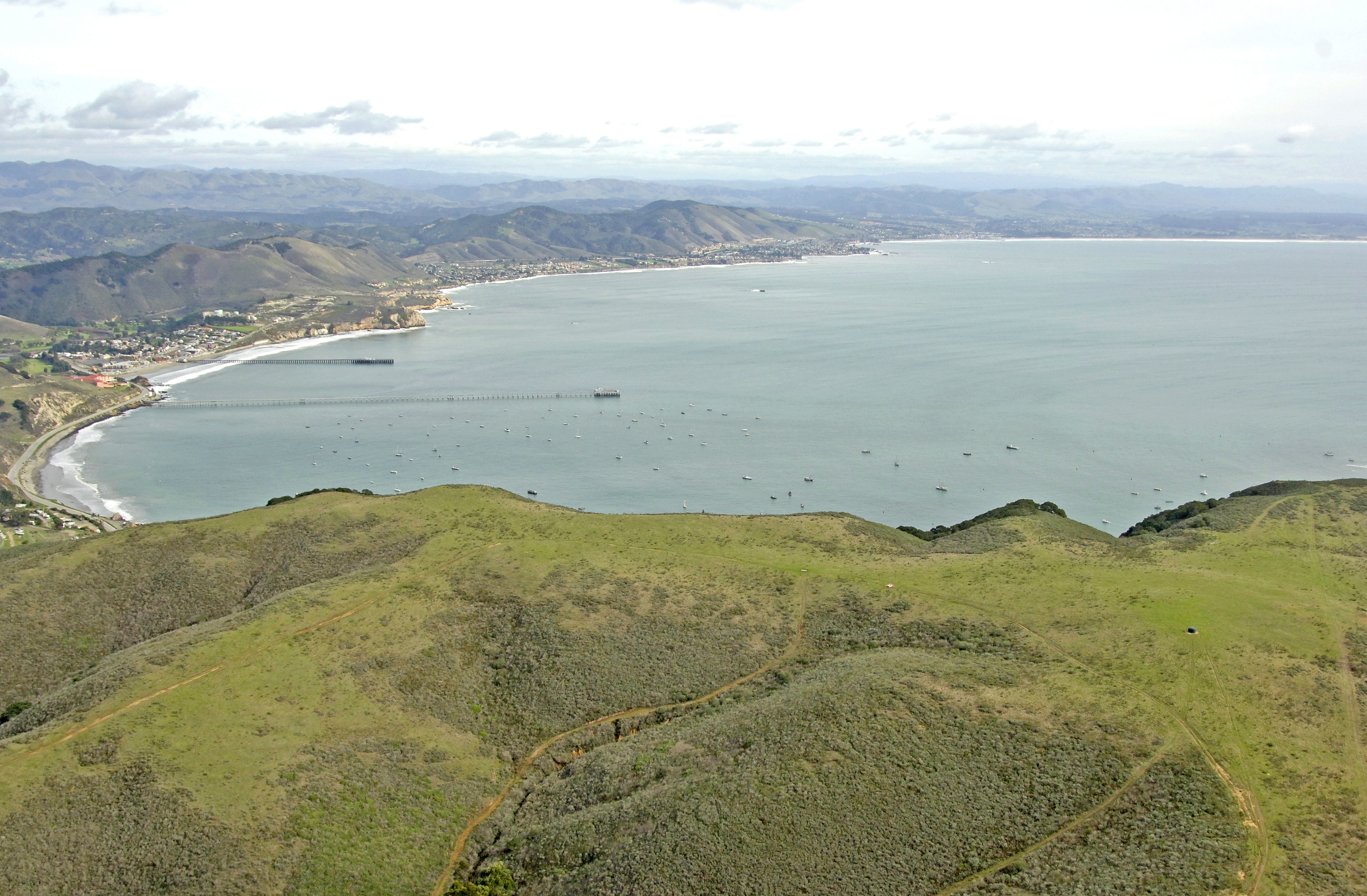
San Luis Obispo, home of the California Polytechnic University (Cal Poly) is a beautiful coastal California town about 150 miles north of the City of Los Angeles with a large anchorage/mooring field and plenty of facilities for the cruising mariner. Hearst Castle and a variety of local attractions await you ashore.
Navigating the Water:
Use Chart Number 18704.
A single pier and a small boatyard are available ashore in San Luis Obispo and can be reached form the partially breakwatered harbor.
Flashing green whistle buoy 3 is located just south of the southern breakwall that protects San Luis Obispo Bay. From here, plot a course north the string of buoys (flashing green 5 and flashing red 4 start the string) in toward the pier and wharf, which should now be visible to you. Depths are 25 to 45 feet in the anchorage area and near the pier until you get farther in toward shore.
Local Notices to Mariners:
Local Notices to Mariners are available online from the U.S. Coast Guard.
Helpful Links:
San Luis Obispo Chamber of Commerce