
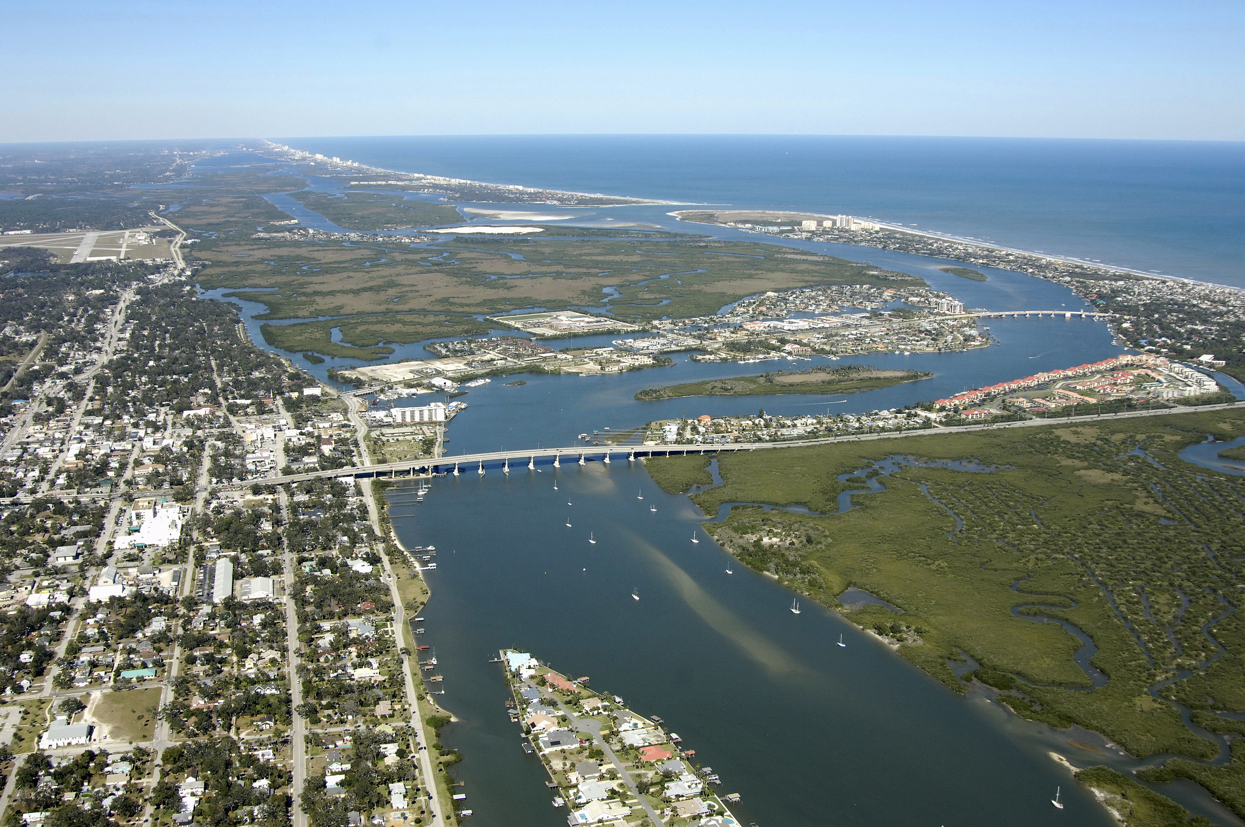


New Smyrna Beach Harbor
New Smyrna Beach, Florida United States
Marinas near New Smyrna Beach Harbor
| Name | Reviews | Max LOA | VHF | Dock Depth | Gas / Diesel | Lift / Crane | Wifi | Amps |
|---|---|---|---|---|---|---|---|---|
| Riverview Hotel | - | - | - | - | - | - | - | - |
| New Smyrna Marina | - | 125.0' | 16 | Low 10.0' | GYesDYes | - | 30, 50, 100 | |
| Bouchelle Island Association Marina | - | - | - | - | - | - | - | - |
| Gerry's Marina | - | - | - | - | - | - | - | - |
| North Causeway Marine | - | 60.0' | 16 | Low 10.0' | G$4.89/galDYes | - | 30, 50 | |
| New Smyrna Beach City Marina | 65.0' | 16 | Low 10.0' | GYes | - | 30, 50 | ||
| River Deck Marina | - | 40.0' | - | Low 8.0' | G$6.67/gal | - | - | 30 |
| Night Swan Intracoastal Bed & Breakfast | 32.0' | - | Low 9.0' | - | - | 30 | ||
| Smyrna Yacht Club | - | 65.0' | 16 | Low 4.0'High 0.0' | - | - | 30, 50 | |
| Lighthouse Boatyard & Marina | - | 0.0' | - | Low 0.0 mHigh 0.0' | - | - | - | - |
| Cay Marine - Ponce | 180.0' | 16 | Low 13.0'High 300.0' | G$6.15/galD$5.85/gal | LYesCYes | 30, 50, 100 | ||
| Inlet Harbor Marina & Restaurant | 0.0' | 6 | Low 14.0'High 0.0' | GYesDYes | LNearby | 30 / 50 / 100 | ||
| Harbour Village Marina | - | - | - | Low 10.0' | - | - | - | |
| Adventure Yacht Harbor | - | - | 16 | Low 5.5'High 65.0' | G$5.149/galD$4.299/gal | - | - | |
| Our Deck Down Under | - | 0.0 m | - | Low 0.0 mHigh 0.0' | - | - | - | - |
Introduction:
New Smyrna Beach is a town along the Intracoastal Waterway south of the Ponce de Leon Inlet and Daytona Beach. Situated at Mile 845 on the Intracoastal Waterway, New Smyrna Beach has an excellent array of marinas and good anchorage space on the town waterfront. Daytona Beach is 12 miles to the north from here.
Navigating the Water:
Use NOAA Chart 11485.
Traveling south from the Ponce de Leon Inlet, you will first need to clear the New Smyrna Coronado Beach Bascule Bridge (24-foot closed vertical clearance; opens on demand 7 a.m. To 7 p.m.) at ICW Mile 845. Once you have cleared the bridge, continue south to pick up flashing red 30 and red daybeacon 32 at the turn toward New Smyrna Beach.
From the south, you will first need to clear a 65-foot fixed vertical clearance bridge to the south of Sheephead Cut, and then you will set a course to pick up flashing red 38 and green daybeacon 39, which lead on to the east toward Ponce de Leon Inlet.
The first marina you will encounter is just south of the New Smyrna Coronado Beach Bascule Bridge on the east shore of the ICW route. After you have made the turn to the west at flashing green 33, there will be marinas scattered along the north shore of the Waterway. Anchorage is available farther to the south past the 65-foot fixed vertical clearance bridge.
Local Notices to Mariners:
Local Notices to Mariners are available online from the U.S. Coast Guard.