


Eureka Harbor
California United States
Marinas near Eureka Harbor
| Name | Reviews | Max LOA | VHF | Dock Depth | Gas / Diesel | Lift / Crane | Wifi | Amps |
|---|---|---|---|---|---|---|---|---|
| Eureka Public Marina | - | 200.0' | - | Low 12.0'High 0.0' | GYesDYes | - | - | 30/50 |
| Englund Marine Supply Co | - | - | - | - | - | - | - | - |
| Woodley Island Marina | - | - | 14 | - | - | - | - | - |
| Johnny’s At The Beach | - | - | - | - | - | - | - | |
| E-Z Landing RV Park & Marina | - | - | - | - | - | - | - | |
| Gills by the Bay | - | - | - | - | - | - | - | - |
| Ruth Lake Marina | - | - | - | - | - | - | - | |
| Chart Room Marina and Restaurant | - | - | - | - | - | - | - | - |
| Crescent City Harbor | 150.0' | 16 | - | GYes | - | 30, 50 | ||
| Pinewood Cove Resort and Marina | - | - | - | - | - | - | - | - |
| Trinity Lake Marinas | - | - | - | G$8.399/gal | - | - | ||
| Pine Cove Marina | - | - | - | - | - | - | - | - |
| Trinity Alps Marina | - | - | - | - | - | - | - | - |
| Wiskeytown Marina | - | - | - | - | GYes | - | - | - |
| Port of Brookings Harbor | - | - | - | - | - | - | - |
Introduction:
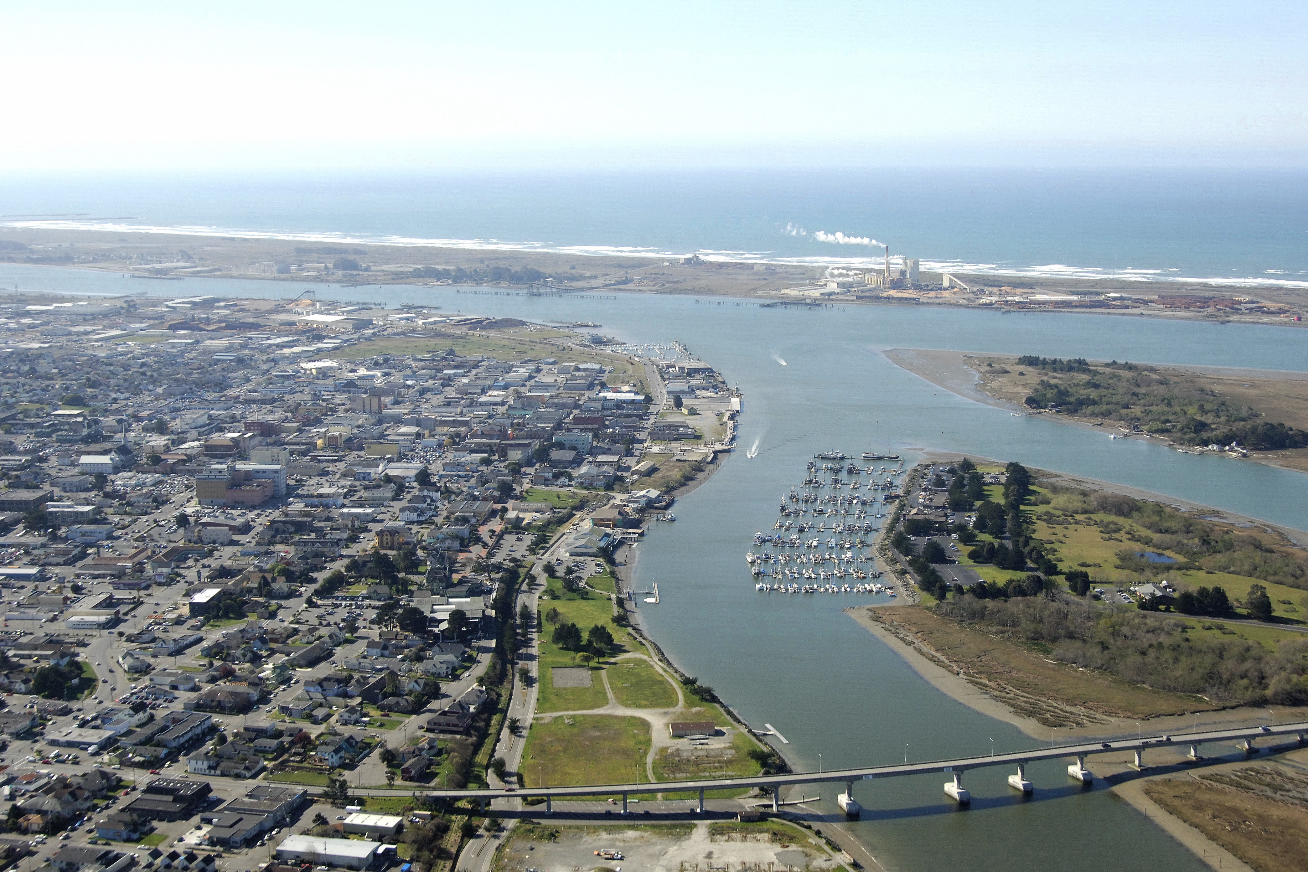
Eureka, once home to the booming California gold trade, a thriving logging industry, and some of the largest salmon runs on the West Coast, is now a town based around recreation, adventure, gambling and marine activities. About 233 miles north of San Francisco (as the crow flies), Eureka is among the last major harbors on the northern California coast before reaching the Oregon border, some 85 miles to the north.
Eureka has a safe and reliable entrance from the Pacific, good marinas and marine facilities and an interesting town and local economy to support it all.
Navigating the Water:
Use NOAA Chart 18622.
From the Pacific Ocean, pick up red and white Morse (A) buoy HB just west of Bar Channel, which leads to the inlet to Humboldt Bay. Flashing green 3 and flashing red 4 mark the north and south breakwaters of the entrance channel, respectively.
Once inside, the waterway makes a sharp turn toward the north, eventually turning into North Bay Channel just east of North Spit. Following the well-marked approach, North Bay Channel splits into Samoa Channel and Eureka Channel Inner Reach at flashing red 2. Marinas should be visible to the east and west.
Things to do in Eureka, CA
Eureka, California is a picturesque coastal town located on Humboldt Bay, making it a popular destination for boaters. Here are some of the top things to do in Eureka from the perspective of a visiting boater:
Visit Old Town Eureka: Old Town Eureka is a charming historic district with Victorian architecture, boutique shops, galleries, and restaurants. Dock your boat at the nearby marina and take a leisurely stroll through the town.
Explore Humboldt Bay: Humboldt Bay offers plenty of opportunities for boaters to explore the local scenery. Take a leisurely cruise around the bay, try your luck at fishing, or visit one of the nearby islands, like Indian Island or Woodley Island.
Tour the historic ships: Eureka is home to several historic ships that offer guided tours. Visit the SS Jeremiah O'Brien, a World War II Liberty Ship, or the MV Madaket, a historic ferry boat that has been in operation for over 100 years.
Visit the Sequoia Park Zoo: The Sequoia Park Zoo is a small but charming zoo located in the heart of Eureka. The zoo features over 100 animals and several exhibits, including a red panda exhibit, a parrot aviary, and a reptile house.
Explore the Redwood National and State Parks: The Redwood National and State Parks are located just a short drive from Eureka and offer stunning views of the giant redwood trees. Visitors can hike, camp, and take scenic drives through the parks.
Sample local cuisine: Eureka is known for its fresh seafood and local cuisine. Visit one of the many seafood restaurants in town, like the historic Woodley Island Restaurant, or try some of the local brews at one of the craft breweries.
Attend a local event: Eureka hosts several annual events and festivals, like the Redwood Coast Music Festival and the Eureka Street Art Festival. Check the local events calendar to see what's happening during your visit.
In summary, Eureka offers plenty of activities and sights for boaters to enjoy, from exploring the historic town to cruising around the bay. Be sure to also take some time to visit nearby attractions like the Redwood National and State Parks and sample the local cuisine.
Local Notices to Mariners:
Local Notices to Mariners are available online from the U.S. Coast Guard.