


Isla Caja de Muertos Harbor
Puerto Rico
Marinas near Isla Caja de Muertos Harbor
| Name | Reviews | Max LOA | VHF | Dock Depth | Gas / Diesel | Lift / Crane | Wifi | Amps |
|---|---|---|---|---|---|---|---|---|
| Ponce Yacht and Fishing Club | 200.0' | - | Low 15.0'High 0.0' | GYesDYes | LYes | 30, 50, 100 | ||
| Caribbean Images Marina | - | 0.0' | - | Low 10.0 mHigh 11.0' | - | - | - | |
| Villa Pesquera Restaurant & Marina | - | - | - | - | - | - | - | - |
| La Bahia Marina | - | - | - | - | - | - | - | - |
| Marina de Salinas | 65.0' | 72 | Low 10.0' | G$1.29/galD$1.45/gal | - | 30/50 | ||
| Playita Salinas | - | - | - | - | - | - | - | - |
| Cana Gorda State Park | - | - | - | - | - | - | - | - |
| Club Nauticos De Guayama | - | - | - | - | - | - | - | - |
| Jobos Yacht Club | - | - | - | - | - | - | - | - |
| Jobos Bay Marine & Fishing Club | - | - | - | - | - | - | - | |
| Boqueron Yacht Club | 0.0 m | - | Low 0.0 mHigh 0.0' | - | - | - | - | |
| Club Nautico Arecibo | - | - | - | - | - | - | - | - |
| Salinas Bay Dock | - | - | - | - | - | - | - | - |
| Boqueron Bay Marina | - | 0.0 m | - | Low 0.0 mHigh 0.0 m | - | - | - | - |
| Puerto Arecibo Wharf | - | - | - | - | - | - | - | - |
Introduction:
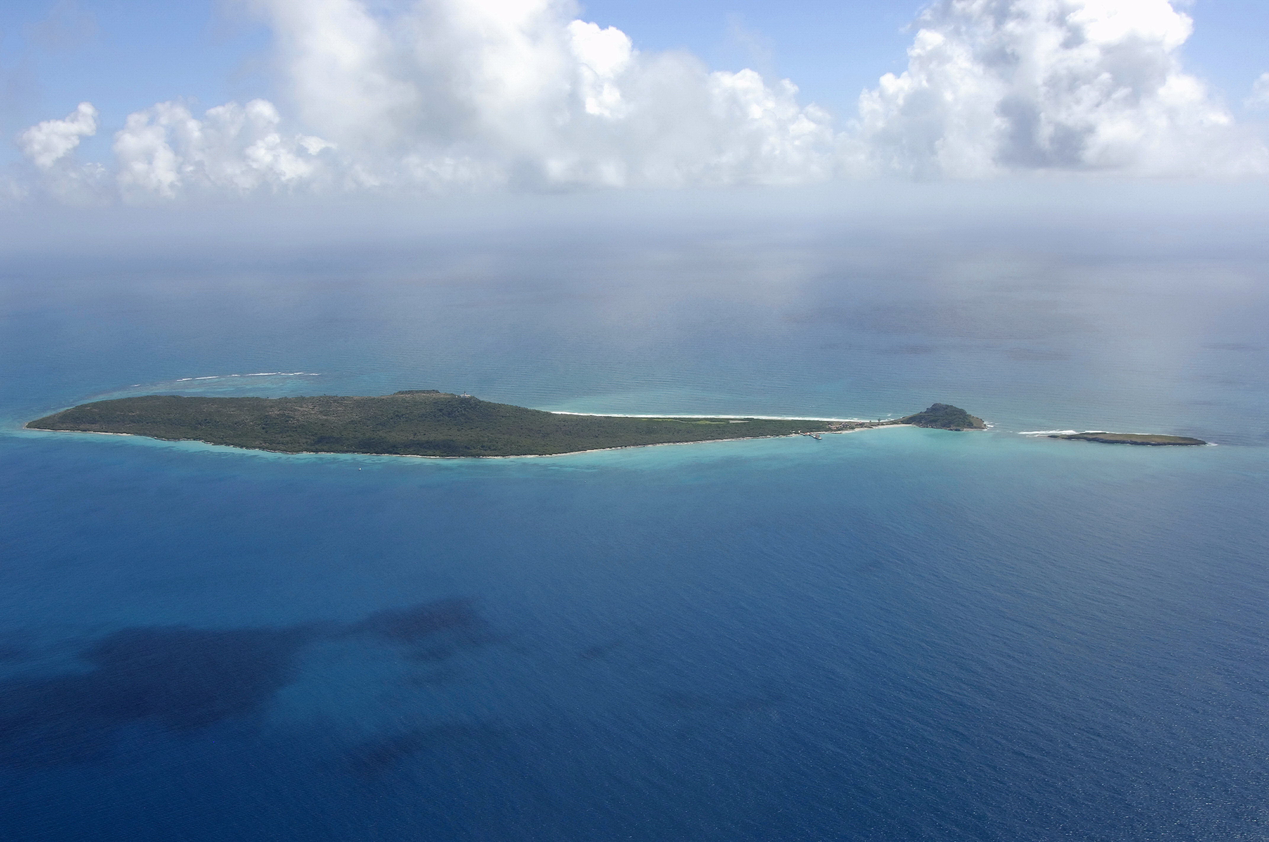
Isla Caja de Muertos is locally known as Coffin Island due to the islands coffin-like profile, as visible in the image above. Other locals say that a love story between a pirate and his lover, who he supposedly buried here, was involved in the naming.
Isla Caja de Muertos lies about 6 miles to the south of the popular marina anchorage in Ponce, and is generally used as a staging area for cruisers making extended journeys to other islands. Isla Caja de Muertos is 30 miles to the southeast of Guanica and 49 miles southwest of San Juan.
Navigating the Water:
Approaching from the ocean, the 244-foot-high top of Isla Caja de Muertos is visible at least 10 to 12 miles away depending on visibility. To further aid navigation, a gray lighthouse (flashing white every 30 seconds) stands 297 feet above the highest point on the island.
There are two anchorages on Isla Caja de Muertos. The first is located on the northern end of the island on its west side and it is fairly open and rough at most times. A better choice is to pick the anchorage on the southwest end of the island where you can tuck in a small cove for protection, although any west or northwest wind will make conditions rough here.
Local Notices to Mariners:
See our Local Notices to Mariners blog for updates on the latest conditions and advisories for this area.