


St. Pete Beach Harbor
St. Pete Beach, Florida United States
Marinas near St. Pete Beach Harbor
| Name | Reviews | Max LOA | VHF | Dock Depth | Gas / Diesel | Lift / Crane | Wifi | Amps |
|---|---|---|---|---|---|---|---|---|
| Bay Palms Waterfront Resort & Marina - St Pete Beach | - | - | - | - | - | - | ||
| Isla Del-Sol Yacht Club Marina | - | 0.0' | - | Low 0.0 mHigh 0.0' | - | - | - | - |
| Pelican Bay Marina | - | - | - | - | - | - | - | - |
| Bay Winds Sports Motel | - | 0.0 m | - | Low 0.0 mHigh 0.0 m | - | - | - | - |
| Pasadena Yacht & Country Club | - | - | 16 | Low 8.0' | - | - | - | - |
| Bay Street Villas and Resort Marina | - | 0.0 m | - | Low 0.0 mHigh 0.0 m | - | - | - | - |
| Johnny Leverocks Seafood House | - | 0.0 m | - | Low 0.0 mHigh 0.0' | - | - | - | - |
| Pasadena Marina Inc | - | 55.0' | 16 | Low 6.0'High 9.0' | GNearbyDNearby | LNearby | 30 and 50 Amp | |
| Mariner's Cove Marina | - | - | - | GYes | - | - | - | |
| Great American Marine | - | - | - | - | - | - | - | - |
| MarineMax St Petersburg | - | 100.0' | - | Low 0.0 mHigh 0.0' | GYesDYes | CYes | 30/50/100 | |
| The BoardWalk Grill | - | - | - | - | - | - | - | - |
| Gulfport Yacht Club | - | 0.0' | - | Low 0.0 mHigh 0.0' | GYes | - | - | - |
| St Petersburg Yacht Club Pass-A-Grille Yacht Club | - | 0.0' | - | Low 0.0 mHigh 0.0' | - | - | - | - |
| Boca Ciega Yacht Club BCYC | - | 0.0' | - | Low 0.0 mHigh 0.0' | - | - | - | - |
Introduction:
At one time, the string of islands that made up the Saint Pete Beaches were known as four different keys: Long Key, Treasure Island, Sand Key and Clearwater Beach Key. Long Key, the most southern island, was originally made up of four areas: Pass-A-Grille Beach, Don CeSar Place, Belle Vista Beach and St. Petersburg Beach. In 1957 the four communities merged and formed the City of St. Petersburg Beach. Later, in efforts to achieve their own identity, the City voted to shortens its name to St. Pete Beach.
[i]Information Courtesy of Saint Petersburg Clearwater Chamber of Commerce[/i]
History:
St. Pete Beach is filled with an enormous amount of history. Pass-A-Grille, the most southern tip of St. Pete Beach is thought to have gotten its name from the Cuban fisherman, known as "Grillers", who camped along the waters edge of the island and would smoke their fish before returning home. Traveling thru the pass, you could see the fires on the beaches . hence Pass-A-Grille.
[i]Information Courtesy of Saint Petersburg Clearwater Chamber of Commerce[/i]
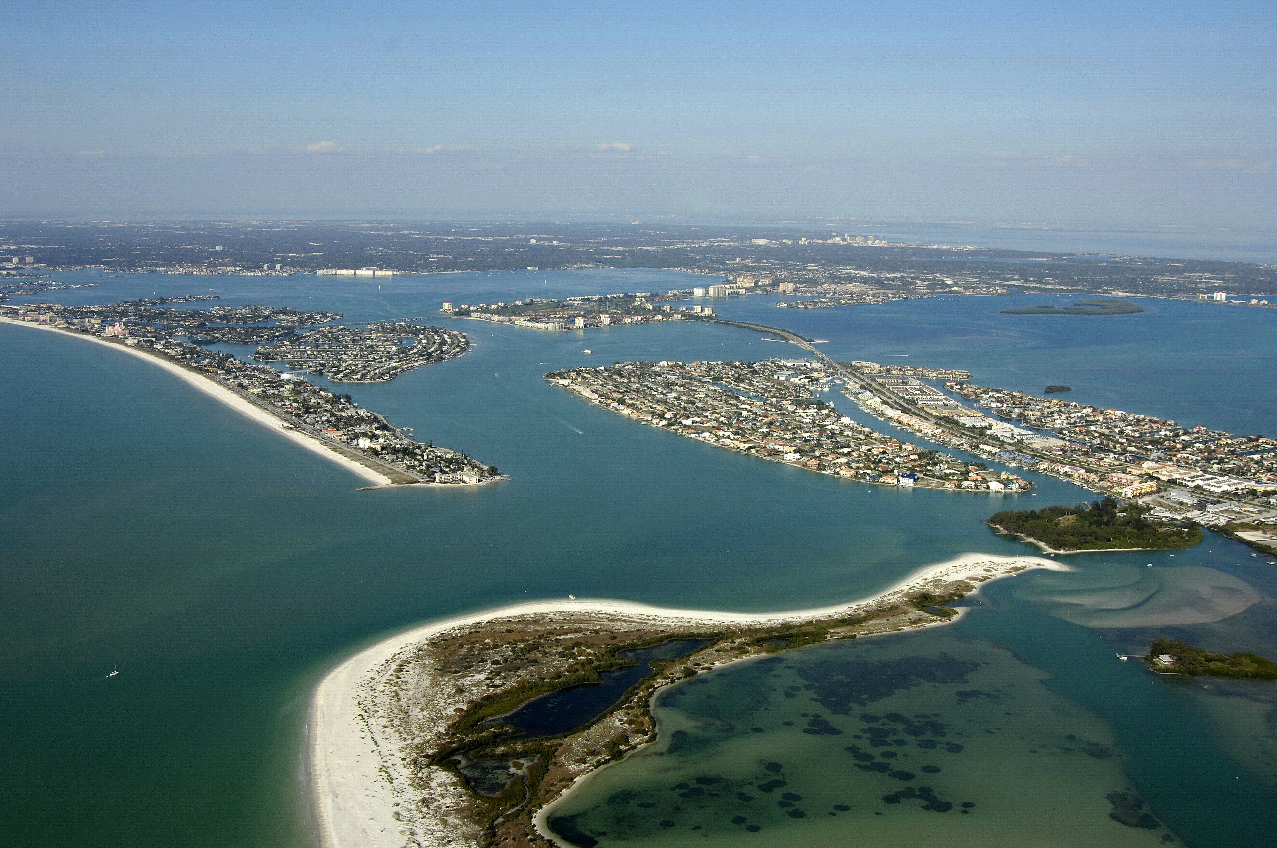
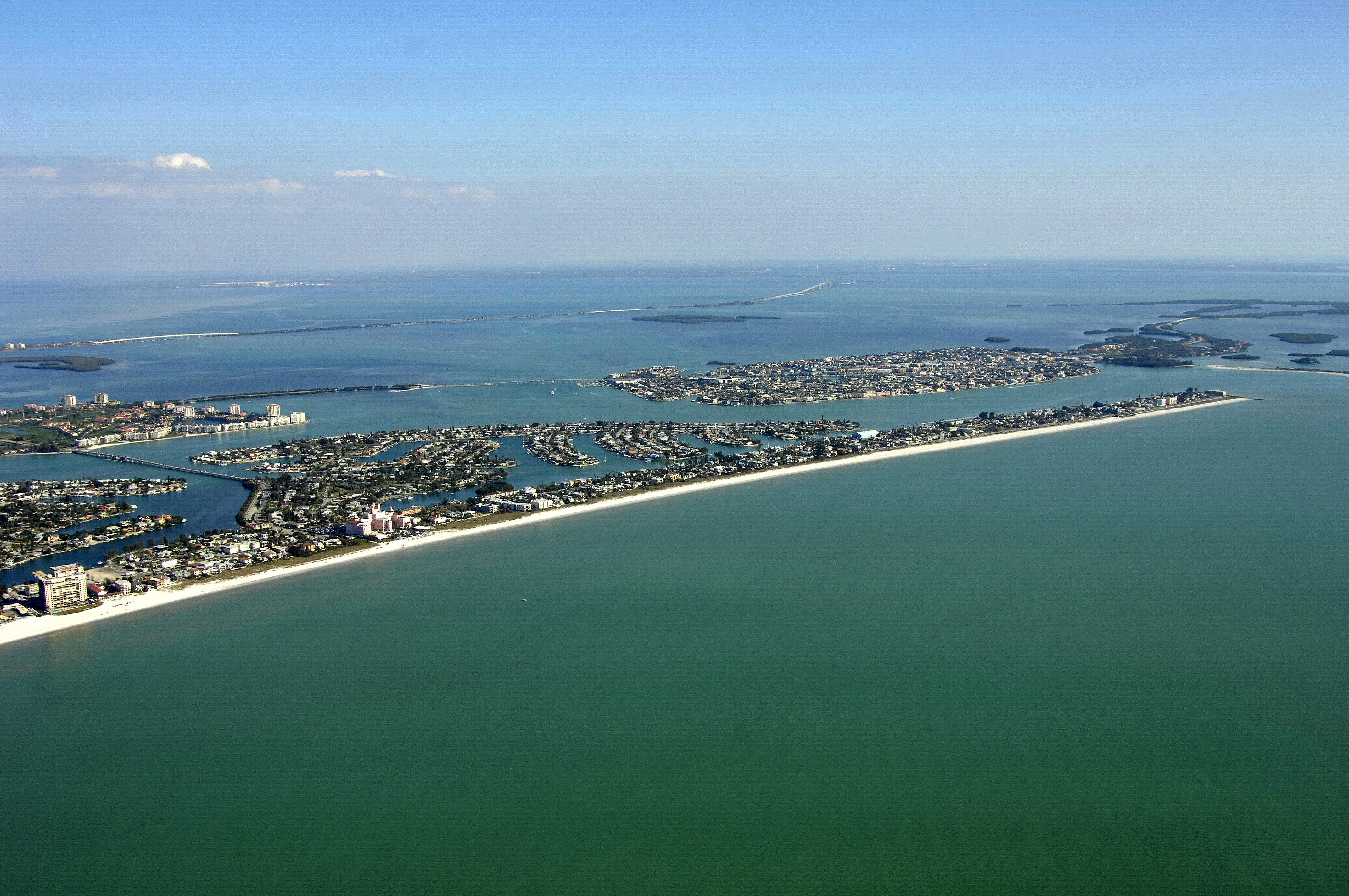
Navigating the Water:
Use NOAA Chart 11411.
Transiting the Gulf Intracoastal Waterway through Boca Ciega Bay is easy if you arm yourself with the proper charts, bridge schedules and keep an eye on the depth sounder and your relative position in the channel (strong currents).
Several bridges crisscross Boca Ciega Bay between Saint Petersburg and Saint Pete Beach - some fixed, some bascule - and they all require care to navigate and advance awareness of their opening scheuldes, if applicable. You can find images and opening schedules of the Boca Ciega Bay bridges by browsing the interactive Marinas.com map to the right (click on Go To Full Map).
Pass-a-Grille Channel allows to-and-from access to Saint Pete Beach and is one of the most reliable passes on the Gulf Coast with 10- to 20-foot depths and stable channels that rarely shift. Several marinas and boating facilities dot the landscape throughout the bay. Check our marinas guide for locations and more information on facilities.
Local Notices to Mariners:
Local Notices to Mariners are available online from the U.S. Coast Guard.
Things To Do/Local Events:
Along with boating, fishing and beach going, there are a multitude of cultural and historical attractions in Saint Pete Beach and Saint Petersburg. Check the Helpful Links section below for a detailed calendar of events for the area.
Transportation:
The Pinellas Suncoast Transportation Authority operates 180 buses and trolleys on 43 different routes throughout the Saint Pete Beach area. See the Helpful Links section below for detailed information and route schedules. There is also a Looper trolley that serves the Saint Petersburg downtown area (schedules available in the links below).
The Tampa International Airport provides service with major carriers on a regular basis and is only 20 mile to the northeast of Saint Pete Beach.. Shuttle service is available to and from the airport; check the links below for flight schedules and shuttle routes.
Helpful Links:
Saint Petersburg/Clearwater Chamber of Commerce ?Saint Petersburg Calendar of Events? Tampa Bay Beaches Chamber of Commerce? Tampa International Airport
Pinellas Suncoast Transit Authority