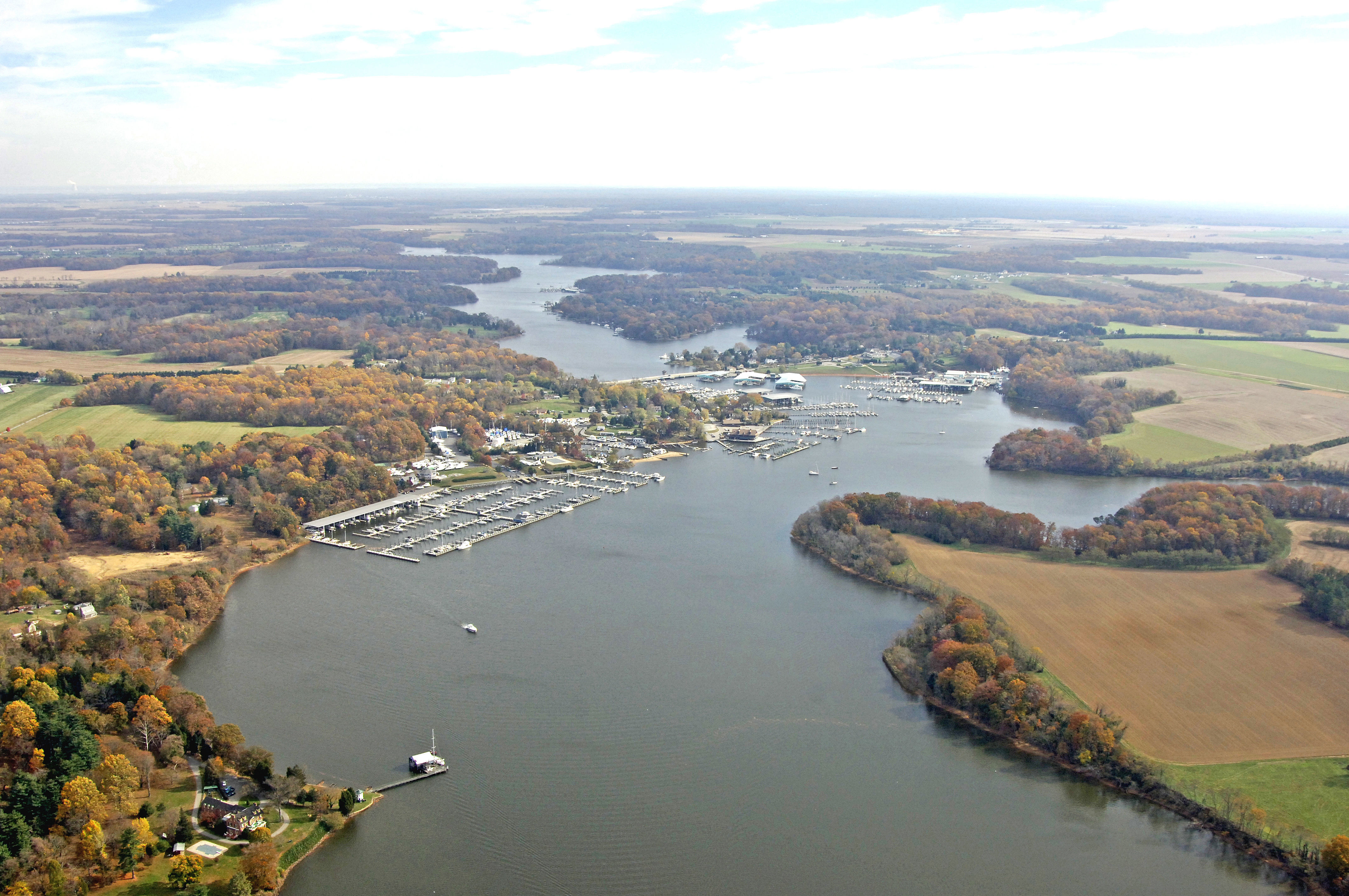


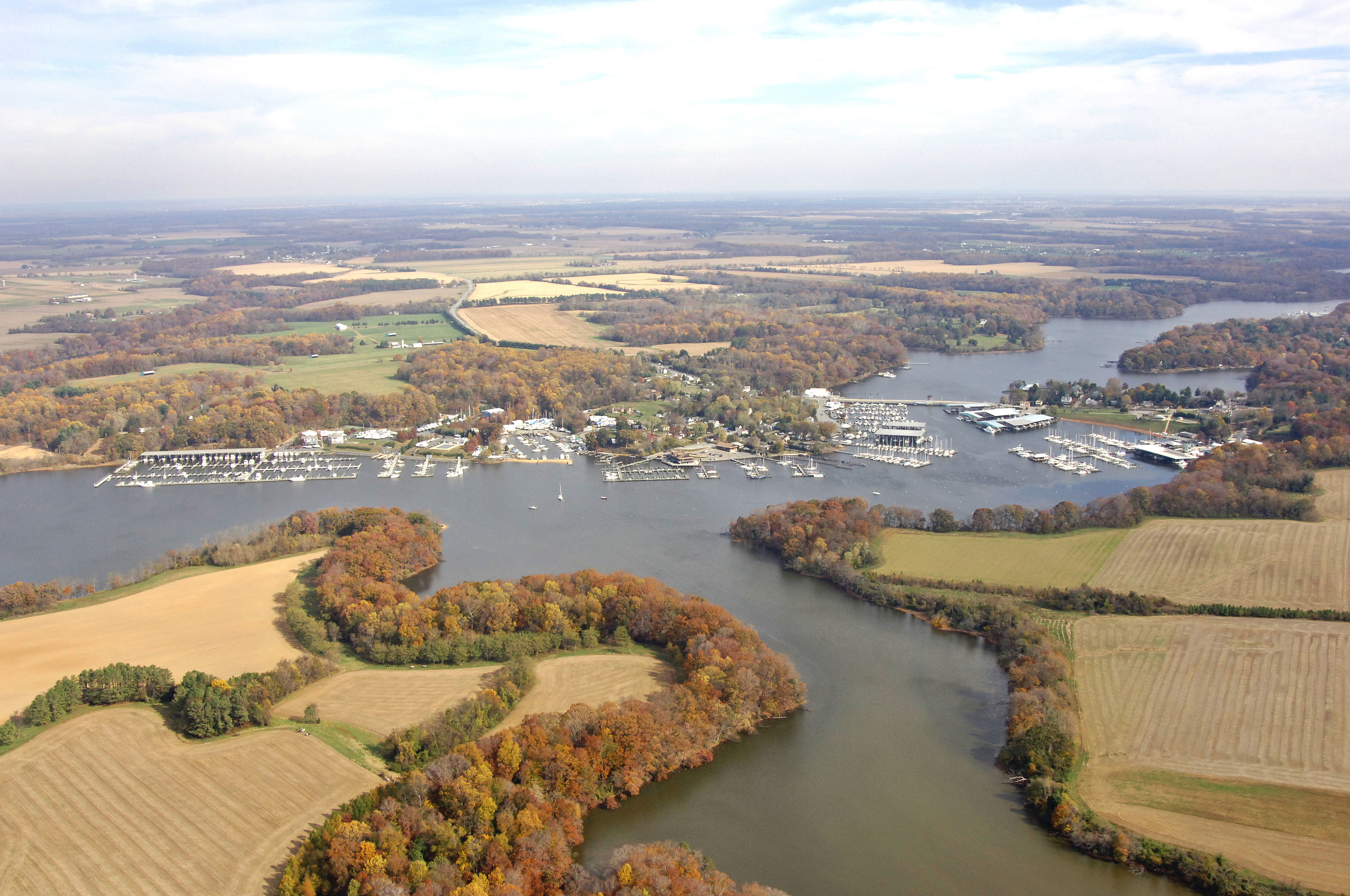
Georgetown Harbor
Georgetown, Maryland United States
Marinas near Georgetown Harbor
| Name | Reviews | Max LOA | VHF | Dock Depth | Gas / Diesel | Lift / Crane | Wifi | Amps |
|---|---|---|---|---|---|---|---|---|
| Sassafras Harbor Marina | 120.0' | 16 | Low 7.0' | - | LYes | 30/50/100 | ||
| Georgetown Yacht Haven | - | 200.0' | 71 | Low 3.0' | G$4.99/galD$3.75/gal | LYes | - | |
| Sailing Associates Inc | 60.0' | 68 | Low 12.0' | - | LYes | 30, 50 | ||
| The Granary Marina | - | 120.0' | 71 | - | GNearbyDNearby | - | 30AM, 50AMP | |
| Duffy Creek Marina | 0.0' | - | Low 6.0'High 0.0' | GNearbyDNearby | - | - | - | |
| Skipjack Cove Marina | 0.0' | 16 | Low 15.0'High 0.0' | GNearbyDNearby | LNearby | - | ||
| Gregg Neck Boat Yard | 50.0' | - | Low 10.0'High 0.0' | - | LYes | - | ||
| Bohemia Anchorage | - | 0.0' | - | Low 0.0'High 0.0' | GNearby | - | - | - |
| Safe Harbor Hack's Point | 40.0' | 16 | Low 6.0'High 0.0' | - | - | 30 | ||
| Richmond's Marina | - | 0.0 m | - | Low 0.0 mHigh 0.0' | - | - | - | - |
| Long Point Marina | 0.0' | - | Low 0.0 mHigh 0.0' | GYesDYes | - | - | - | |
| Safe Harbor Bohemia Vista | 50.0' | 16 | Low 6.0'High 0.0' | - | LYes | 30, 50 | ||
| Bohemia Bay Yacht Harbour | 65.0' | 9 | Low 0.0 mHigh 0.0' | G$4.79/galDYes | LYes | 30, 50 | ||
| Two Rivers Yacht Basin | - | 0.0' | - | Low 0.0 mHigh 0.0' | GYes | LYes | - | - |
| Duck Neck Campground | - | - | - | - | - | - | - | - |
Introduction:
Georgetown is one of the last major yachting centers on the upper Eastern Shore of Maryland before you reach the C&D Canal. Situated up the Sassafras River, Georgetown is not only a convenient stopover point for cruisers, but a pleasant area for exploration or an extended stay.
There are a good handful of marinas in Georgetown, and a couple of them are among the largest and best equipped on the Chesapeake Bay.
Navigating the Water:
Use NOAA Chart 12274.
Georgetown is reached via the Sassafras River. From the Chesapeake Bay, exit the main bay shipping channel at flashing red buoy 5. From here, set a course to the east toward flashing red buoy 2, making sure to leave it well to starboard as you move farther on to flashing green buoy 5 at Ordinary Point. The rest of the journey up to Georgetown is simple and straightforward, as long as you make sure to honor all of the well placed marks.
The Route 213 Bascule Bridge crosses the Sassafras River at Georgetown. The bridge has a close vertical clearance of five feet with 40 feet of horizontal clearance in the center span. There is a large wor
Local Notices to Mariners:
Local Notices to Mariners are available online from the U.S. Coast Guard.