


Crisfield Harbor
Crisfield, Maryland United States
Marinas near Crisfield Harbor
| Name | Reviews | Max LOA | VHF | Dock Depth | Gas / Diesel | Lift / Crane | Wifi | Amps |
|---|---|---|---|---|---|---|---|---|
| Seamark Marine | - | - | - | - | - | - | - | - |
| Somers Cove Marina | 150.0' | 16 | Low 9.0'High 0.0' | G$5.99/galD$5.45/gal | - | 30, 50, 100 | ||
| Janes Island State Park Marina | - | - | - | - | - | - | - | - |
| Smith Island Marina | 0.0' | - | Low 0.0 mHigh 0.0 m | GNearby | - | - | - | |
| Park's Marina | 100.0' | - | Low 0.0 mHigh 0.0' | - | - | - | - | |
| Windsor's Marina, Inc. | - | - | - | - | - | - | - | - |
| Scott's Cove Marina | - | 0.0 m | - | Low 0.0 mHigh 0.0 m | - | - | - | - |
| Deep Creek Marine Service | - | - | - | - | - | - | - | - |
| Pocomoke City Municipal Dock | - | 0.0' | - | Low 0.0 mHigh 0.0' | - | - | - | - |
| Onancock Wharf and Marina | - | 16 | Low 6.0' | G$6.479/galD$5.829/gal | - | 30, 50 | ||
| Nanticoke Harbor Marina | - | - | - | - | - | - | - | - |
| Whitehaven Marina | - | 0.0 m | - | Low 0.0 mHigh 0.0' | - | - | - | - |
| Smith Point Marina | 45.0' | 16 | Low 4.5' | G$4.79/galD$4.79/gal | LYes | 30 amp & 50 amp | ||
| Gaps Marina | - | 0.0 m | - | Low 0.0'High 0.0 m | - | - | - | - |
| Wicomico Yacht Club | - | 0.0 m | - | Low 0.0 mHigh 0.0 m | - | - | - | - |
Introduction:
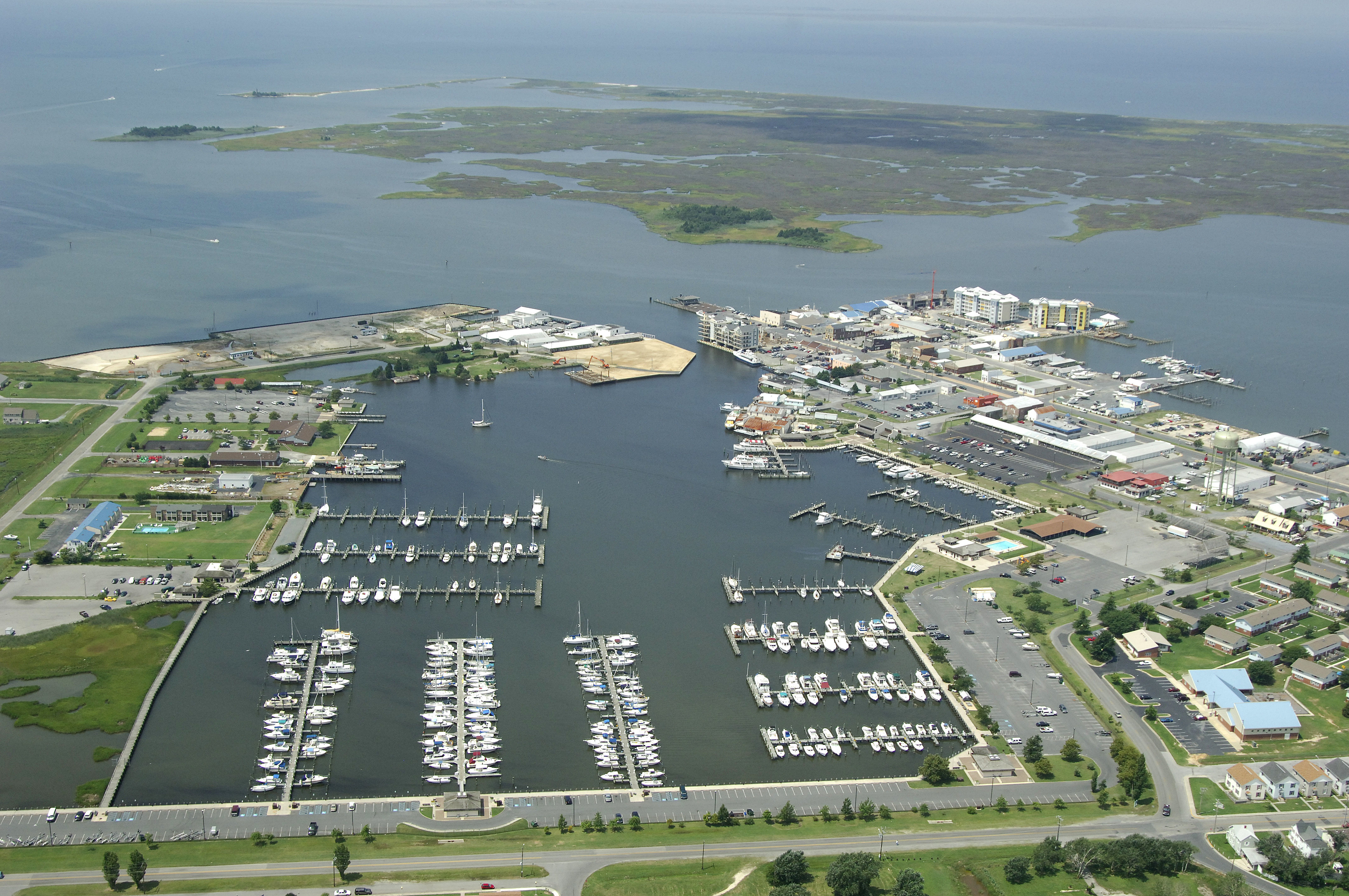
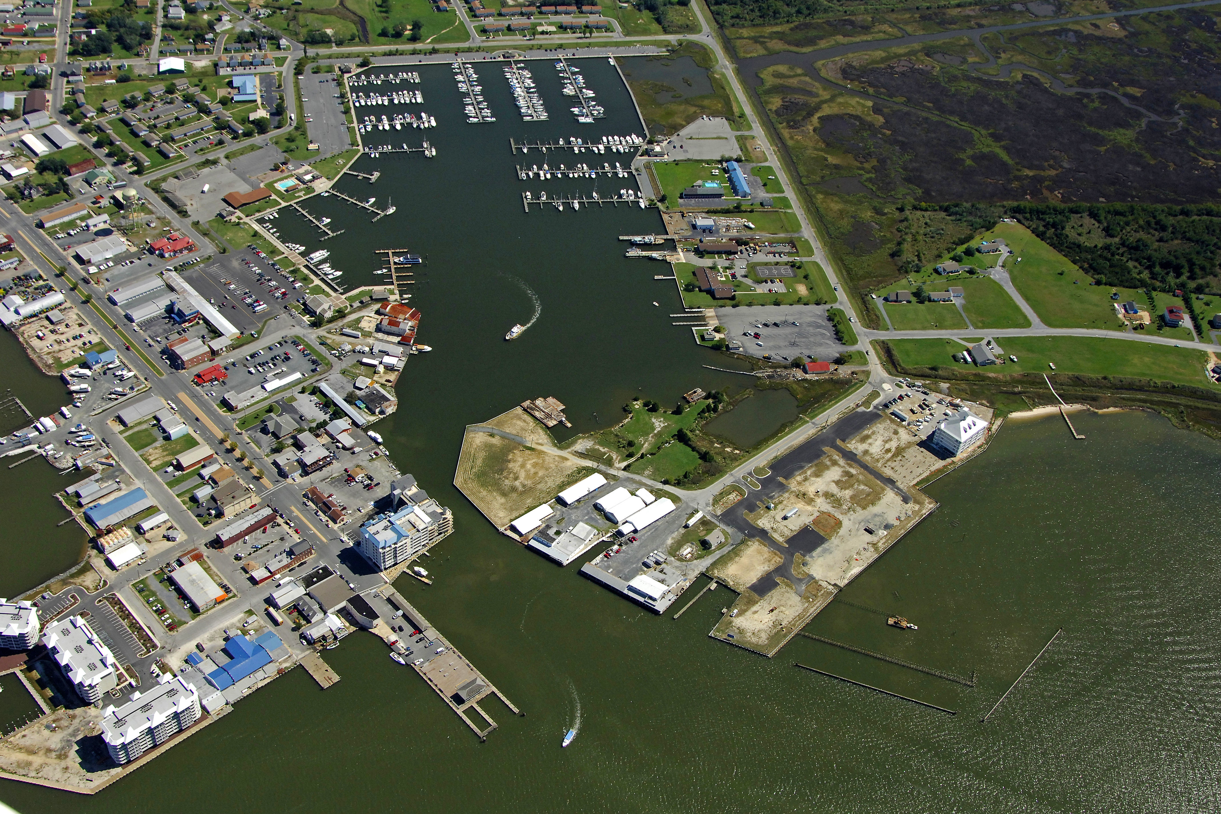
Located on the Chesapeake Bay off Tangier Sound near the mouth of the Annemessex River, and bordered to the south by the Pocomoke River, Crisfield has long been referred to as "The Crab Capital of the World."
 Crisfield is a historic waterfront town nearly surrounded by the waters of the Chesapeake Bay and is famous for its fishing, sailing and boating.  In addition, Tangier Sound offers one of the finest courses for sailing yachts and motor boats in the world.  Along with that, Somers Cove Marina with its 515 boat slips is considered by some to be the best marina in the state, if not on the East Coast. The restaurants and shops of the town are an easy walk or bike ride from the marina. Ferries from Smith and Tangier Island travel to and from Crisfield, making a great day's outing, and if you enjoy kayaking,  nearby Janes Island State Park offers 2,900 acres of beautiful salt marsh and over 30 miles of marked water trails along with miles of pristine sandy beaches.   A haven for birds, fish, crabs and other salt marsh dwellers, the beaches are among the very few left where you'll still find shells and sand dollars near the waters edge.
A full calendar of events provides something for everyone nearly every weekend throughout the season, starting with the May Strawberry Festival.  For more information, contact the Crisfield Chamber of Commerce at 410 968 2500 or [email protected] <a rel='nofollow' href=http://www.crisfield.com/>City of Crisfield</a>
History:
Founder Benjamin Somers (Summers) originally settled in the Annemessex area in the year 1663. He was granted a patent by the Calverts of Maryland on February 10, 1663. His tract of land was called Emessex and contained 300 acres. His home was near the center of the tract on a small gut leading out of a cove which was later called Somers Cove. The upper part of this tract became the town of Crisfield, and the Cove still bears the name. Crisfield would probably have retained the name Somers Cove or Annemessex but for a trifling accident which befell the Honorable John Woodland Crisfield, a leader of the Somerset Bar and Member of Congress from the District. Mr. Crisfield was also involved with the railroad, and during an inspection tour of the docks, he was walking along a shaky old footway which led to the Steamboat landing. The story goes that one of those old boards gave way, and the distinguished lawyer and statesman landed in the cold waters of the Annemessex River. With much difficulty he was fished out, not much the worse for his ducking, but his clients sought to mollify his wrath, and on the spot christened the future City of Crisfield. (thank you to local historian Phil Goldsborough)
Crisfield received its Charter from the Maryland Legislature forming the town in 1872. Most of the first houses built were placed on piles over marsh or water. To fill the swamp land, oyster shells were used. Today from the center of the town to the City Dock is man made land of billions of oyster shells crushed compactly together forming the foundation of the larger part of the business section of the city. The ground is as firm as the Rock of Gibraltar.
The late 1800s was the era of the steamboat, and Crisfield had regular steamer service sailing from Norfolk to Crisfield and from Crisfield to Baltimore. By 1910, the Custom House at Crisfield had the largest list of sailing vessels of any port in the United States, and became a formal 'port of entry'.
Navigating the Water:
Use NOAA Chart 12231.
Crisfield and Somers Cove Inlet can be reached on a north or southbound approach from Tangier Sound. On either approach, Janes Island Light (flashing white every four seconds) is the light you first pick up to clear into the Annemessex River (green can 1 is a secondary unlit aid in the area).
Once clear of the long shoal extending from Janes Island, pick up quick flashing red 2, flashing red 4, and then flashing green 7 at Long Point (making sure to follow the intermediate aids as well). After you have passed Long Point, flashing red 10, and then flashing red 11 guide you into Somers Cove. Depths in the cove, and along the approach route bottom out at about 8 feet at mean low water.
Local Notices to Mariners:
Local Notices to Mariners are available online from the U.S. Coast Guard.
Transportation:
Crisfield, while the centerpiece of the the most unspoiled area of Chesapeake Bay is easily accessible by boat, car or airplane. It's a 40 minute scenic drive from Salisbury, home to the Salisbury Regional Airport, and 3 miles to Crisfield Municipal Airport. Most of the town is within walking distance, and bicycles are available for loan or rent. Boats and kayaks are also available to rent, and there is a local taxi service. Transport to and from Smith and Tangier Islands is by regularly scheduled ferry. Janes Island State Park is a 5 minute boat ride from Somers Cove Marina or a couple of miles by road.