


Plattsburgh Harbor
Plattsburgh, New York United States
Marinas near Plattsburgh Harbor
| Name | Reviews | Max LOA | VHF | Dock Depth | Gas / Diesel | Lift / Crane | Wifi | Amps |
|---|---|---|---|---|---|---|---|---|
| Plattsburgh Boat Basin | 48.0' | 6 | - | G$4.70/galD$4.33/gal | LYes | - | ||
| Plattsburgh City Marina | - | 0.0 m | - | Low 0.0 mHigh 0.0' | - | - | - | - |
| Treadwell Bay Marina | 50.0' | 68 | - | G$5.75/galD$5.99/gal | LYesCYes | 30, 50 | ||
| Valcour Island Marina | 55.0' | - | Low 12.0'High 100.0' | G$5.75/galD$5.58/gal | - | - | ||
| Keeler Bay Campground and Marina | - | - | - | - | - | - | - | |
| Point Au Roche State Park | - | 0.0 m | - | Low 0.0 mHigh 0.0' | - | - | - | - |
| Mooney Bay Marina | 0.0' | - | Low 0.0 mHigh 0.0' | GYesDYes | - | - | - | |
| Ladd's Landing Marina | - | - | - | G$4.40/galDYes | - | - | ||
| Apple Island Marina | 30.0' | - | - | G$4.99/gal | - | - | ||
| Montys Bay Marina | - | 0.0 m | 16 | Low 3.0 mHigh 0.0 m | GYesDYes | LYesCNearby | - | |
| Gilbert Brook Marina | - | - | - | - | - | - | ||
| Rocky Cove Marina | - | 0.0 m | - | Low 0.0 mHigh 0.0 m | - | - | - | - |
| The North Hero House | - | 0.0 m | - | Low 0.0 mHigh 0.0 m | - | - | - | - |
| Hero's Welcome | - | 0.0 m | - | Low 0.0 mHigh 0.0 m | - | - | - | - |
| Lakehurst Campground and Marina | - | - | - | - | - | - | - |
Helpful Links:
Plattsburgh Chamber of Commerce
Introduction:
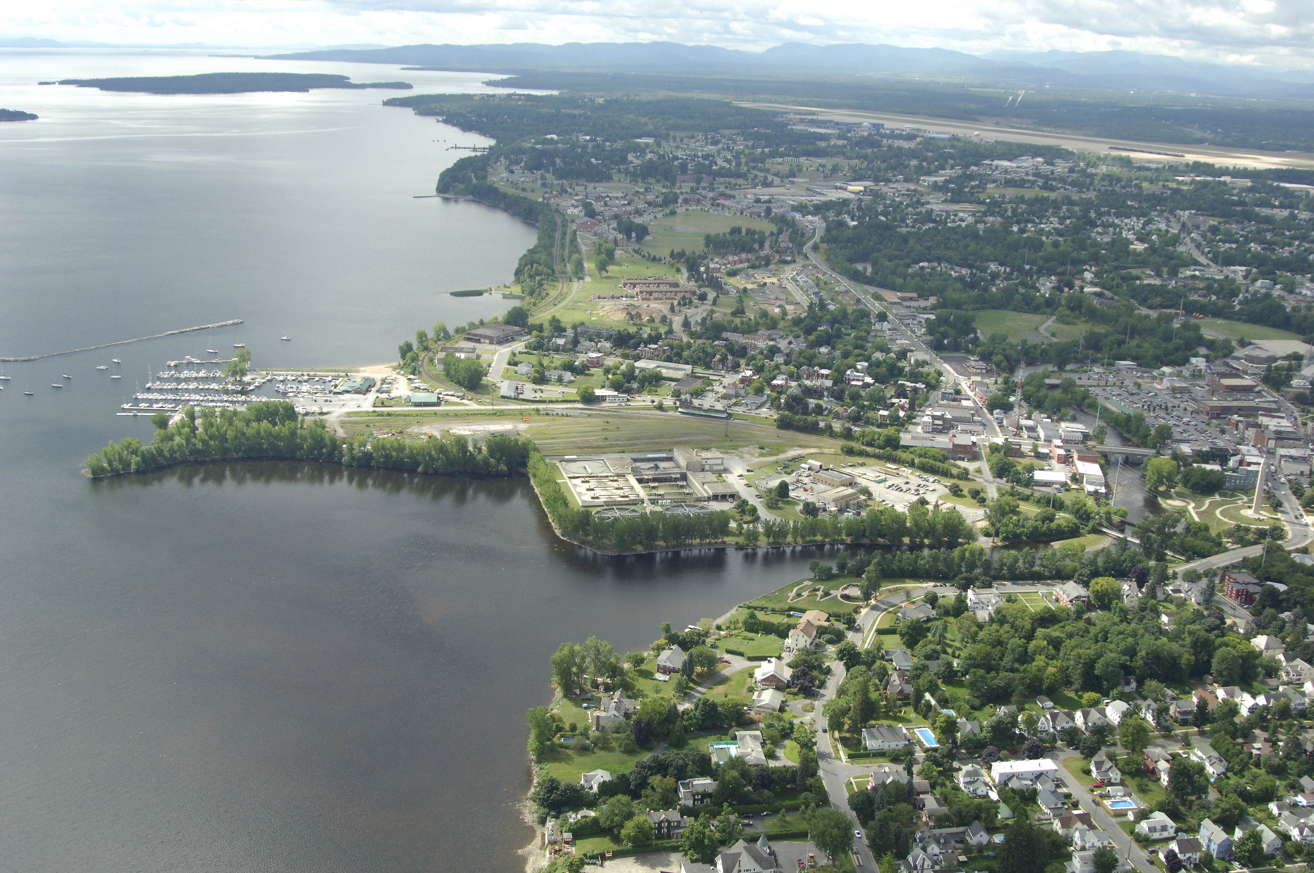
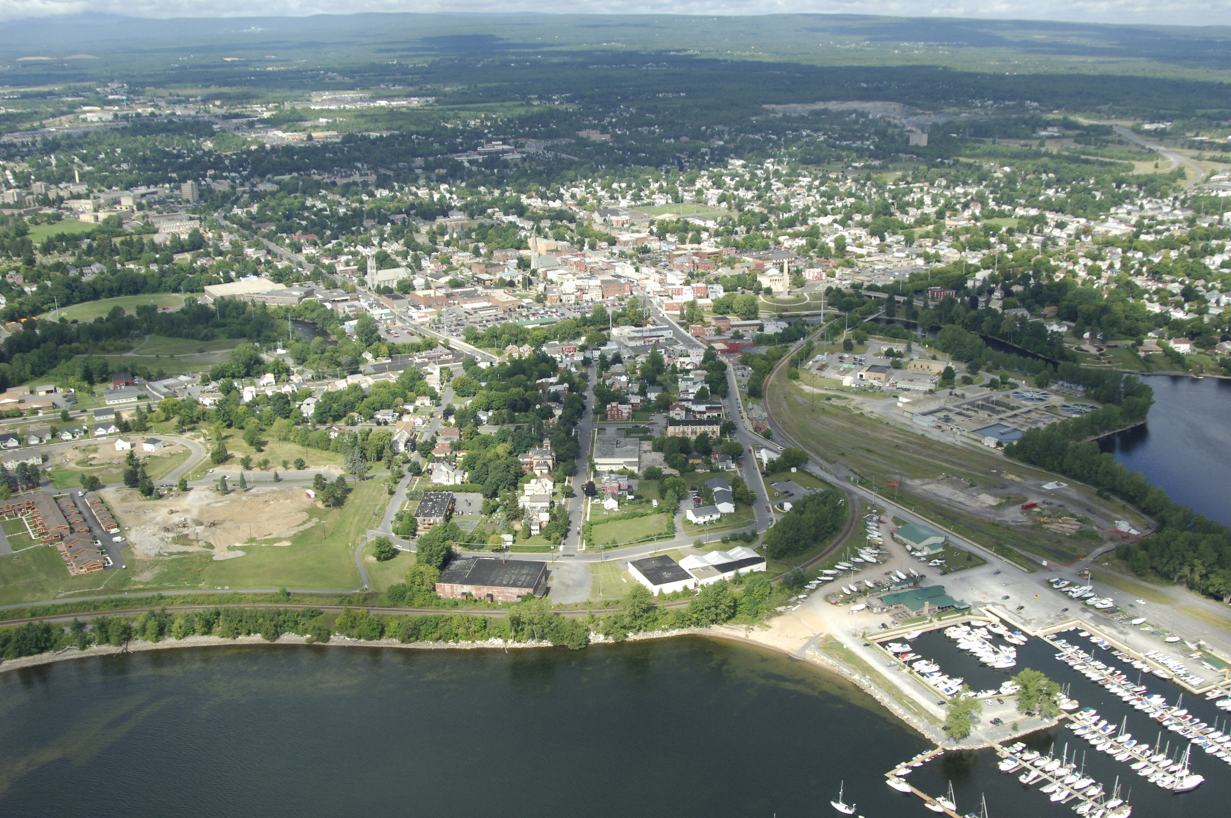
Plattsburgh is a major boating stopover on Lake Champlain for cruisers traveling north and south along the Lake Champlain Waterway, which leads north to the Saint Lawrence Seaway or south to the Hudson River. Ashore in Plattsburgh you will find a wide variety of facilities for provisioning and an excellent marina with repair facilities.
Navigating the Water:
Use NOAA Chart 14782.
From Lake Champlain, Cumberland Head Light (flashing white every four seconds) and red nun 24 mark the north and south boundaries of the entrance into Cumberland Bay, respectively. From either of these points, or anywhere in between, set a course for the Plattsburgh water front at green can 1. There is a breakwall to the south near the Plattsburgh Boat Basin that is marked with two flashing white lights. This breakwater serves as the target for nighttime approaches as it is the only lighted navigational structure in Cumberland Bay.
The single marina in town is very well equipped, and has plenty of transient space available. The marina also has a 35-ton lift for haul-outs and repairs, gas and diesel fuel, pump-out and laundry facilities. The marina also maintains a field of mooring buoys in Cumberland Bay. About a 15-minute walk ashore are some excellent shops for provisioning including a market, liquor store and pharmacy.
Local Notices to Mariners:
Local Notices to Mariners are available online from the U.S. Coast Guard.