


Eastern Harbor
Maine United States
Marinas near Eastern Harbor
| Name | Reviews | Max LOA | VHF | Dock Depth | Gas / Diesel | Lift / Crane | Wifi | Amps |
|---|---|---|---|---|---|---|---|---|
| North Atlantic Lobster Sales, Inc. | - | - | - | - | - | - | - | - |
| Eastern Harbor Public Dock | - | 0.0 m | - | Low 0.0'High 0.0' | - | - | - | - |
| Smith's Lobster | - | - | - | - | - | - | - | - |
| Barney's Cove Lobster Company | - | 0.0 m | - | Low 0.0 mHigh 0.0' | - | - | - | - |
| Beals-Jonesport Co-Op Inc. | - | - | - | - | - | - | - | - |
| OW Look & Son | - | 0.0 m | - | Low 0.0 mHigh 0.0 m | - | - | - | - |
| Moosabec Mussels | - | 0.0 m | - | Low 0.0 mHigh 0.0 m | - | - | - | - |
| OW & BS Look Co. | - | - | - | - | - | - | - | - |
| Jonesport Municipal Marina | - | 0.0 m | - | Low 0.0'High 0.0' | - | - | - | - |
| Great Wass Island Public Dock | - | 0.0 m | - | Low 0.0'High 0.0' | - | - | - | - |
| Jonesport Shipyard | 40.0' | 9 | Low 6.0' | - | CYes | - | ||
| Mooseneck General Store | - | - | - | - | - | - | - | - |
| Millbridge Marina | - | - | - | - | - | - | - | - |
| Corea Lobster Co-op | - | - | - | - | - | - | - | - |
| Young Brothers Moorings | - | - | - | - | - | - | - | - |
Introduction:
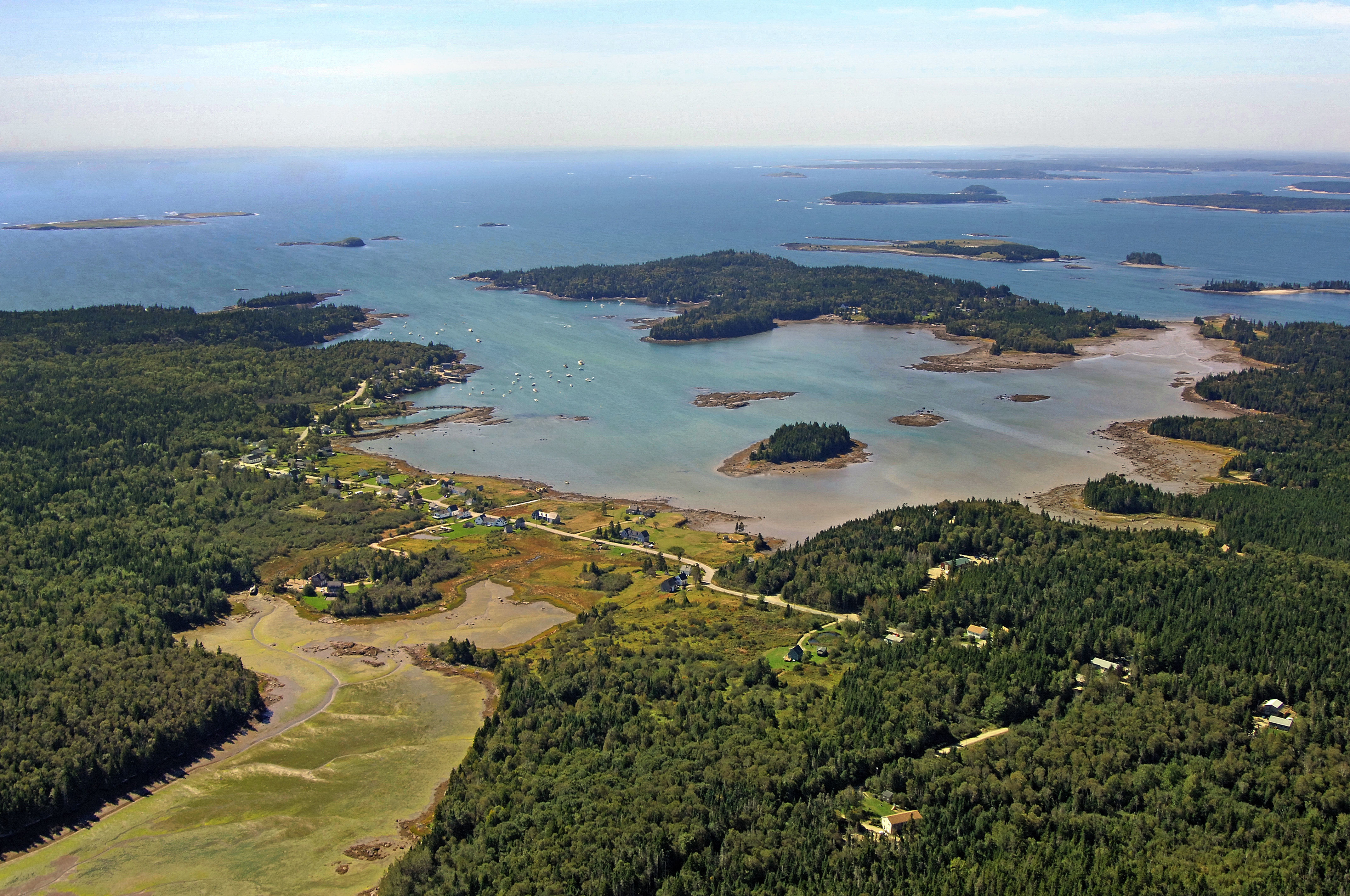
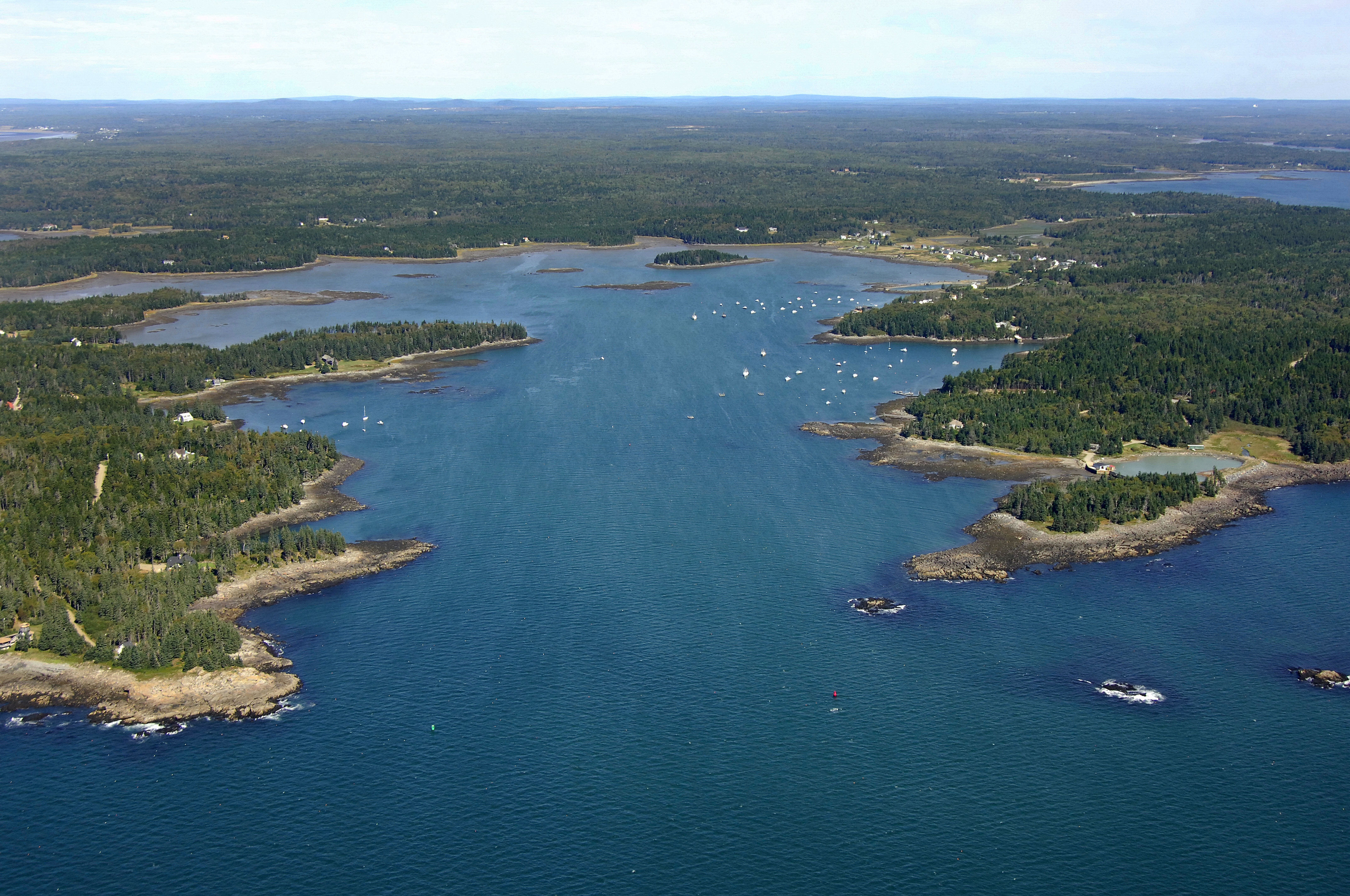
Eastern Harbor is located on the Atlantic Ocean south of the town of Addison, Maine in Washington County. South Addison borders the harbor to the east, and is particularly know as a remote vacation getaway spot with several bed and breakfasts dotting the shoreline.
Navigating the Water:
Use NOAA Chart 13324.
Eastern harbor is approached from the south, and the entrance between Eastern Pitch and Marsh Island is marked with two unlit nun buoys. Approach at night with radar is possible, but not recommended in rough weather.
Inside, depths range from seven to 19 feet, shoaling quickly at the northern end of the harbor. Two additional aids to navigation guide mariners once inside the harbors entrance, but a close eye on the depth sounder will be required beyond this point. Staying close to the middle guarantees the best depths, with a deeper channel bending off to the east.
Local Notices to Mariners:
Local Notices to Mariners are available online from the U.S. Coast Guard.
Things To Do/Local Events:
See the Helpful Links section at the bottom of this page for detailed information.
Transportation:
The town of South Addison lies on the east shore of East Harbor, but transportation here is limited to foot and bicycle travels.
Drisko, Narragus and Machias Valley airports are close by, but more suited for general aviation purposes.