


Providence Harbor
Providence, Rhode Island United States
Marinas near Providence Harbor
| Name | Reviews | Max LOA | VHF | Dock Depth | Gas / Diesel | Lift / Crane | Wifi | Amps |
|---|---|---|---|---|---|---|---|---|
| India Point Park | - | 0.0 m | - | Low 0.0 mHigh 0.0 m | - | - | - | - |
| Providence Marina - RI | 70.0' | - | Low 8.0'High 21.0' | - | - | - | 30/50 | |
| East Providence Yacht Club | - | 0.0' | - | Low 5.0'High 0.0' | - | - | - | - |
| Oyster House Marina | - | 0.0 m | - | Low 0.0 mHigh 0.0 m | - | - | - | - |
| Ocean State Boat Basin | - | 50.0' | - | - | - | - | - | - |
| Narragansett Boat Club | - | - | - | - | - | - | - | - |
| Edgewood Yacht Club | - | 14 | Low 5.0' | - | - | 30 | ||
| Rhode Island Yacht Club | 0.0' | 78 | Low 0.0 mHigh 0.0' | - | - | - | ||
| Pawtuxet Cove Marina | 0.0' | - | Low 5.0'High 0.0' | - | - | - | 30 | |
| Frank C Pettis III Boat Yard | - | - | - | - | - | - | - | - |
| TPG Marinas (Corporate Office) | - | - | - | - | - | - | - | - |
| Safe Harbor Cove Haven | 100.0' | 9 | Low 12.0'High 0.0' | G$5.32/galD$5.79/gal | LYesCYes | 30, 50 | ||
| East Providence Harbor Master | - | 0.0' | 9 | Low 0.0'High 0.0' | - | - | - | - |
| Bullock's Cove Marina | - | 0.0' | - | Low 0.0 mHigh 0.0' | - | LYes | - | - |
| Lighthouse Marina | 0.0 m | - | Low 0.0 mHigh 0.0' | - | - | - | - |
Introduction:
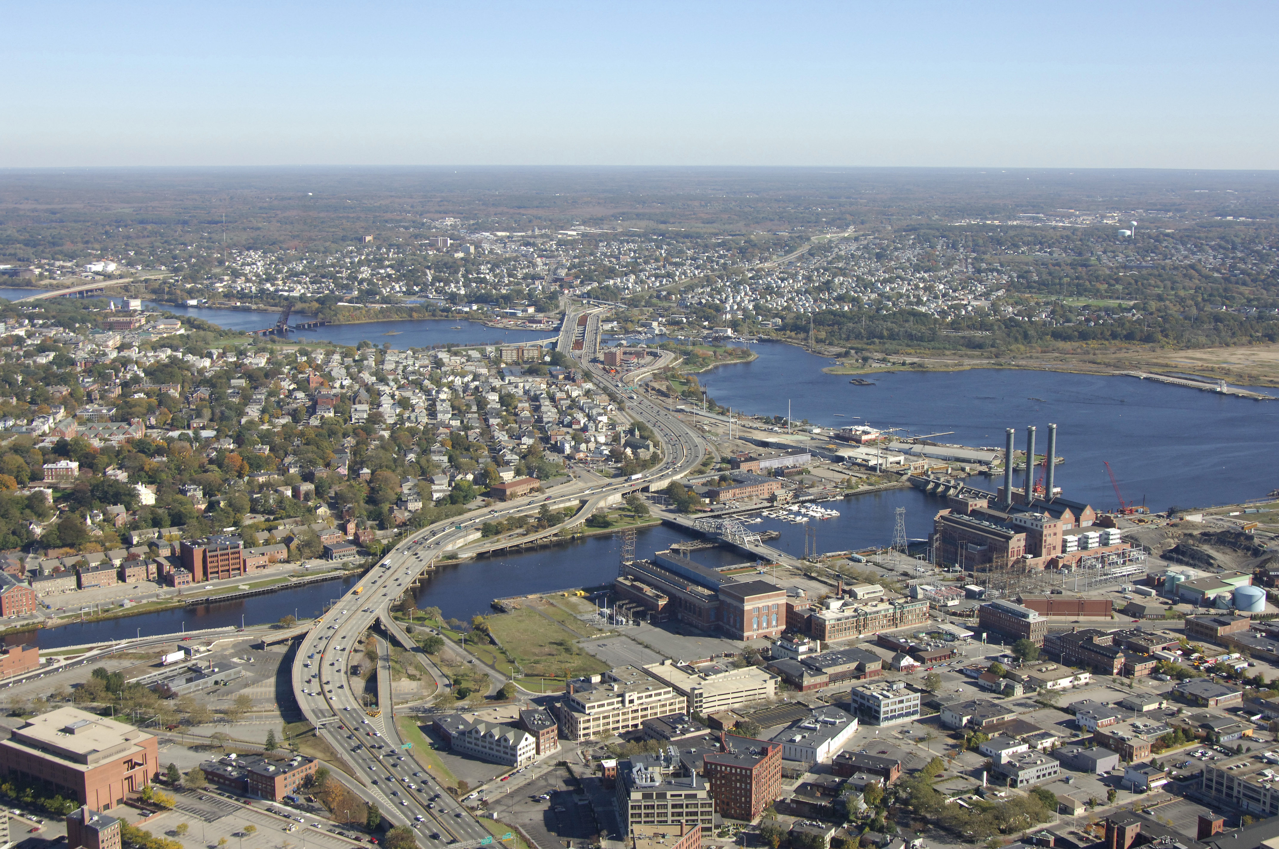
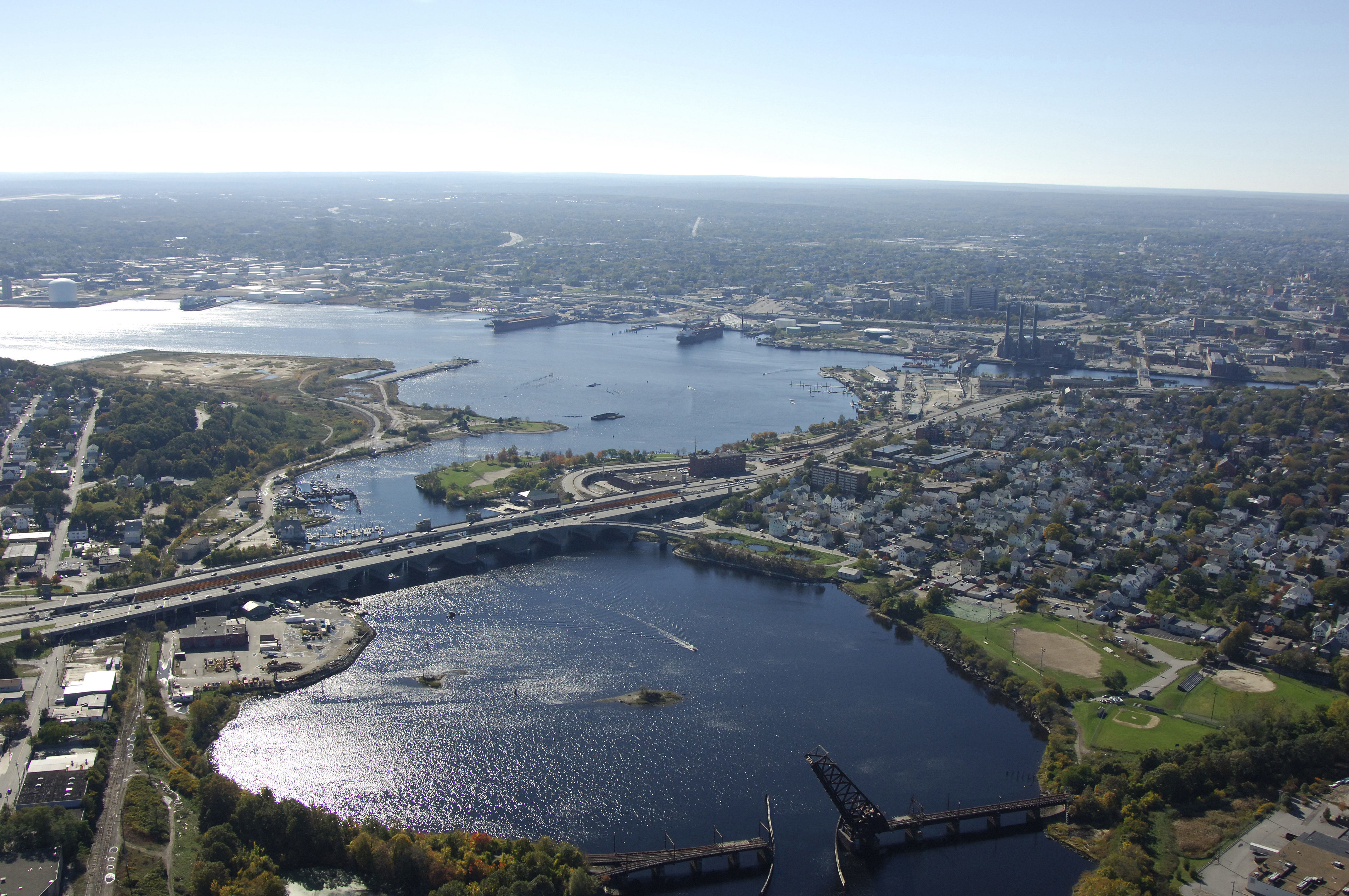
The largest city in the state of Rhode Island and home to prestigious Brown University, Providence is located in the northern portion of Narragansett Bay on the Providence River. Providence is about 25 miles northwest of Newport and 40 miles southwest of Boston (across land).
Leading up to Providence is the Providence River - home to dozens of marine facilities and popular coves and rivers like the Warren, Bullock Cove and the Pawtuxet River. Once you are in Providence, a wide array of facilities become available from which to base your shoreside exploration from.
Navigating the Water:
Use NOAA Chart 13221.
The mouth of the Providence River is sandwiched between Conimicut and Nayatt points near quick flashing green buoy 15 and quick flashing red 16. This is also the beginning of the Conimicut Point Reach, which will turn into the Bullock Point Reach at quick flashing green 19. To starboard at quick flashing green 19 is Bullock Cove, which has a large mooring field and a few marinas for tie ups.
Once you have entered Bullock Point Reach. You will set a course toward quick flashing green 29 and quick flashing red 30 at Sabin Point. West of Sabin Point is a creek with three marinas. Past Sabin Point, the Sabin Point Reach turns into the Fuller Rock Reach, and then the Fox Point Reach, which leads you into the Providence waterfront. Most of the marinas in town are scattered around the the turn at Fox Point.
Click here to see a map of Providence Harbor
Local Notices to Mariners:
Local Notices to Mariners are available online from the U.S. Coast Guard.
History:
The area surrounding Providence Harbor was first settled in 1636 by Roger Williams. Providence was one of the original Thirteen Colonies as persecuted religious dissenters seeked refuge from The Massachusetts Bay Colony.
The Providence Colony was the first to take action against the British in the Revolutionary War and declared independence on May 4th 1776. They were also the last to sign the U.S. Constitution after demanding the Bill of Rights and individual freedom.
Providence was at the forefront of the American Revolution. Industrial growth began in the late 1700s and both Newport Harbor and Providence Harbor became some of the busiest ports in the United States.
Today Providence is home to 170,000 people and has many great restaurants, shopping, and historical attractions for both locals and tourists to enjoy!
Places to Visit:
Providence Harbor and the surrounding waters of Narragansett Bay provide visitors with a multitude of activities to enjoy (fishing, boating, sailing, kayaking), but there are also hundred of activities related to art, history, and culture ashore.
Here are a few of our favorites nearby Providence Harbor:
Rhode Island School of Design Museum of Art - 224 Benefit Street
Providence Performing Arts Center - 220 Weybosset Street
Roger Williams Park Zoo - 1000 Elmwood Avenue
Historic Federal Hill - Depasquale Avenue
Rhode Island State House - 82 Smith Street
Providence Children's Museum - 100 State Street
Where to Eat, Drink, and Shop in Providence:
Providence is the heart of Rhode Island and filled with great restaurants and shopping. Federal Hill is just a short walk from downtown and home to some of the best Italian restaurants in the northeast. All of the downtown shopping, dining, and nightlife are all just steps away from Providence Harbor.
Here are some of the best places to eat, drink, and shop nearby Providence Harbor:
Los Andes (Food & Drink) - 903 Chalkstone Avenue
The Capital Grille (Fine Dining) - 10 Memorial Boulevard
Hemenways (Fine Dining) - 121 South Main Street
Siena (Fine Dining) - 238 Atwells Avenue
The Eddy (Drinks) - 95 Eddy Street
Trinity Brewhouse (Drinks) - 186 Fountain Street
Providence Place Mall (Shopping) - 1 Providence Place
Downtown Shops (Shopping) - Westminster Street & Eddy Street
Test
Test
Annual Events:
April:
Eat Drink RI Festival - Highlights Rhode Islands food, farm, and restaurant scene
June:
Federal Hill Stroll - Experience Federal Hills best cuisine and vote for your favorites!
Festival of Historic Houses - Providence Preservation Societys historic house tours.
July:
Independence Day Celebration - Parade, street performers, food trucks, and fireworks.
August:
Flickers RI International Film Festival - Largest public film festival in New England.
Transportation:
Transportation in and around Providence is provided by the Rhode Island Public Transportation Authority. Busses and rail run on regular schedules inside the city, and also to outlying areas like Newport and Jamestown. The T.F. Green International Airport is located about eight miles south of the downtown area and is accessible via the RIPTA bus, or you can arrange a shuttle by contacting the airport. For detailed transportation schedules, see the Helpful Links section below.
Helpful Links:
Providence Chamber of Commerce