


Belhaven Harbor
Belhaven, North Carolina United States
Marinas near Belhaven Harbor
| Name | Reviews | Max LOA | VHF | Dock Depth | Gas / Diesel | Lift / Crane | Wifi | Amps |
|---|---|---|---|---|---|---|---|---|
| Belhaven Marina | 140.0' | 16 | Low 7.0' | G$5.599/galD$5.649/gal | - | 30, 50 | ||
| Belhaven Town Docks at Wynne's Gut | - | - | 16 | - | - | - | - | - |
| River Forest Manor and Marina | 140.0' | 16 | Low 8.0' | G$5.75/galD$5.45/gal | LYes | 30/50/100 | ||
| TJ's Marina & Boatyard | - | - | - | G$5.95/galD$5.95/gal | LYesCYes | 30,50 | ||
| River Forest Shipyard | - | - | - | - | - | - | - | - |
| Blackbeard’s Cove Marina & Pub | 0.0' | - | Low 0.0 mHigh 0.0' | - | - | - | - | |
| Cee Bee Marina | - | - | - | - | - | - | - | - |
| Dowry Creek Marina | 200.0' | 16 | Low 8.0'High 90.0' | G$5.89/galD$3.85/gal | - | 30, 50, 100 amp | ||
| River Rat Yacht Club | - | - | - | - | GYes | - | - | - |
| Potters Marine | - | - | - | - | - | - | - | |
| Ocean Limo Marina | - | - | - | - | - | - | - | - |
| Quarterdeck Marina | - | 0.0' | - | Low 0.0 mHigh 0.0' | - | - | - | - |
| Bath State Dock | - | - | - | - | - | - | - | - |
| Bath Harbor Marina and Motel | 60.0' | 16 | Low 7.0'High 120.0' | - | - | 30 / 50 | ||
| Germantown Bayside Marina NC | - | 30.0' | - | Low 2.5'High 2.5' | - | - | - | - |
Introduction:
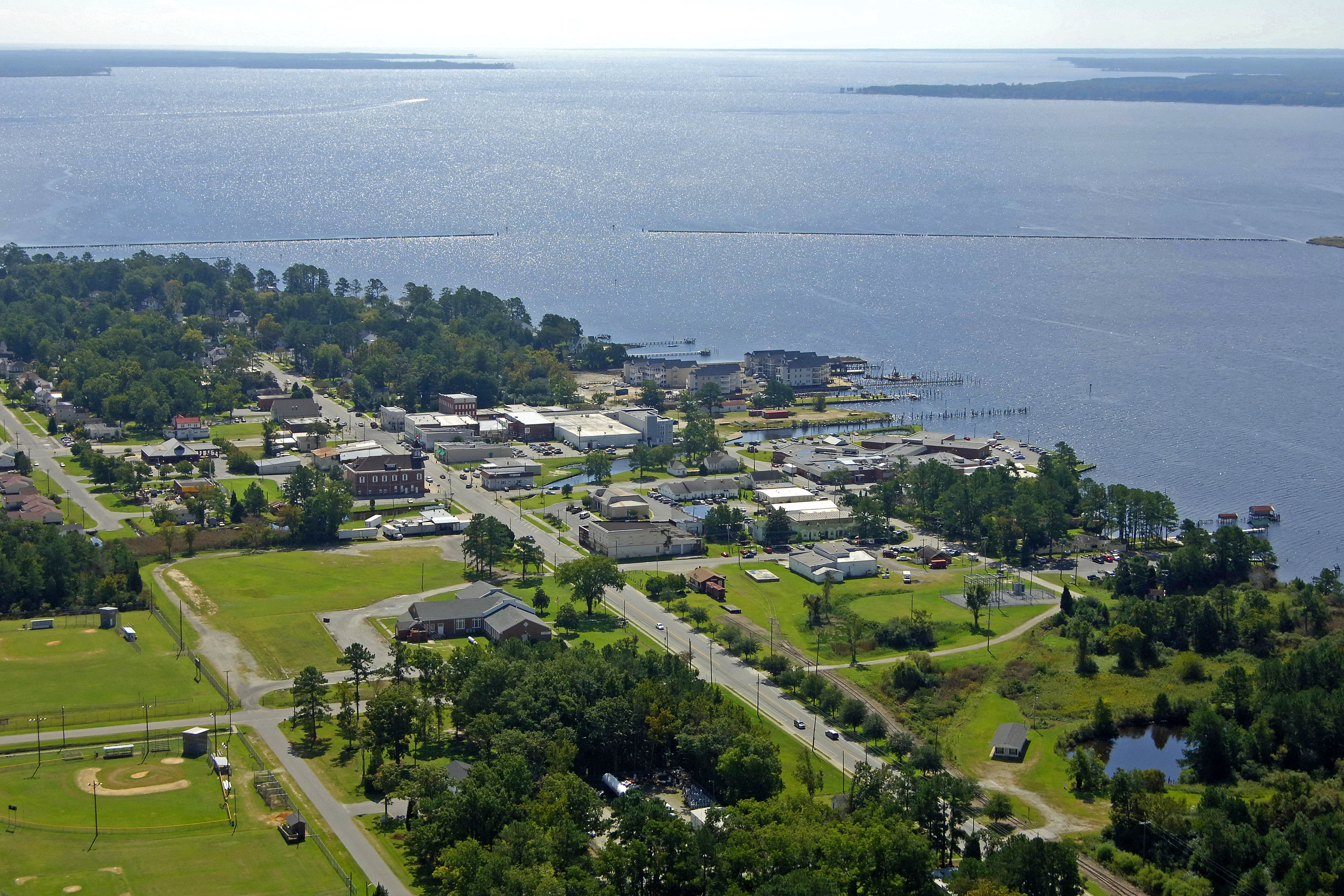
Belhaven is located off the Pungo River south of the Alligator River-Pungo River Canal at Intracoastal Waterway Mile Marker 135 about 55 miles south of Coinjock and 60 miles north of Beaufort (as the bird flies). Belhaven is an important stop on the Intracoastal Waterway, as it is located at a spot that is in the middle of a days run from Beaufort to the south and the Alligator River entrance to the north (five-knot boat).
With that in mind, Belhaven has set itself up well to deal with transient boaters. There are two primary marinas here and each is dedicated to taking care of visiting boaters. In addition to transient facilities, both marinas have 40-ton lifts and extensive repair facilities for haul-outs and refits. If you need to stock up the galley, you will need to arrange for a courtesy car or golf cart with one of the marinas; the nearest grocery is two miles away.
Local Notices to Mariners:
Local Notices to Mariners are available online from the U.S. Coast Guard.
Helpful Links:
Belhaven Community Chamber of Commerce
Navigating the Water:
Use NOAA Chart 11553.
From the Pungo River heading south, be sure to first honor quick flashing red 10, which marks a shoal extending northward from Durants Point. Once you have cleared the shoal, set a course for flashing green 1BC about one mile east of the twin jetties at the opening to Pantego Creek at Belhaven. From here, follow in red daybeacon 2BC, green daybeacon 3, red daybeacon 4, and then flashing green 5 and flashing red 6 at the south and north jetties to Pantego Creek, respectively. The entrance channel has a controlling depth of nine feet.
Inside the harbor, the channel hugs the shoreline up to the 13-foot fixed vertical clearance bridge. Anchorage is available just to the west of the channel when you enter and the holding here is good, but do expect wave and wake traffic from the Pungo River to mix things up a bit.
Harbor Reviews
Belhaven is a charming little town. Enhanced by the welcoming committee “The Chamber of Commerce”. We arrived with our Boat Club of 5 boats and were greeted by the Dockmaster Greg who helped us get docked and took us around his facility to get us all familiarized with the marina. The bathrooms/Showers were clean and well stocked including towels for taking showers which was a nice touch. On our first night stay the Belhaven Chamber of Commerce put on a lovely mixer to welcome us all to their quaint little town. We can’t thank Mark and his staff enough for their genuine hospitality and would highly recommend stopping at Belhaven Marina to experience this truly Southern Hospitality first hand. Belhaven is enjoying a rejuvenation with new shops and eateries being added so add this stop to your boating adventure for sure!!!!