

Oak Bluffs Harbor
Oak Bluffs, Massachusetts United States
Marinas near Oak Bluffs Harbor
| Name | Reviews | Max LOA | VHF | Dock Depth | Gas / Diesel | Lift / Crane | Wifi | Amps |
|---|---|---|---|---|---|---|---|---|
| Oak Bluffs Marina | 115.0' | 71 | Low 8.0' | G$5.39/galD$6.69/gal | - | 30 and 50 amp | ||
| Dockside Marina | 0.0' | - | Low 0.0 mHigh 0.0' | - | - | - | - | |
| Churchs Pier | - | 0.0' | - | Low 0.0 mHigh 0.0' | - | - | - | - |
| East Chop Yacht Club | 0.0' | - | Low 0.0 mHigh 0.0' | - | - | - | - | |
| Vineyard Haven Harbor Mooring | - | - | - | - | - | - | - | |
| Vineyard Haven Moorings | - | 71 | - | - | - | - | - | |
| Vineyard Haven Yacht Club | - | 0.0' | - | Low 0.0 mHigh 0.0' | - | - | - | - |
| Tisbury Harbormaster | - | 69 | - | - | - | - | - | |
| Gannon & Benjamin Marine Railway | - | - | - | - | DYes | - | - | - |
| Safe Harbor Vineyard Haven | 38.0' | 68 | Low 6.0'High 18.0' | G$2.99/gal | - | - | 30 | |
| Tisbury Town Dock | - | 0.0' | - | Low 0.0 mHigh 0.0' | - | - | - | - |
| Tashmoo Boat Yard | - | 0.0 m | - | Low 0.0 mHigh 0.0' | - | - | - | - |
| Edgartown Harbormaster | 65.0' | 74 | Low 15.0' | G$5.299/galD$6.599/gal | LYes | - | 30 / Dual 30 / 50 / Dual 50 | |
| The Harborside Inn Docks | 135.0' | 10 | Low 6.5' | - | - | - | ||
| Safe Harbor Edgartown | 0.0' | - | Low 0.0 mHigh 0.0' | - | - | - | - |
Introduction:
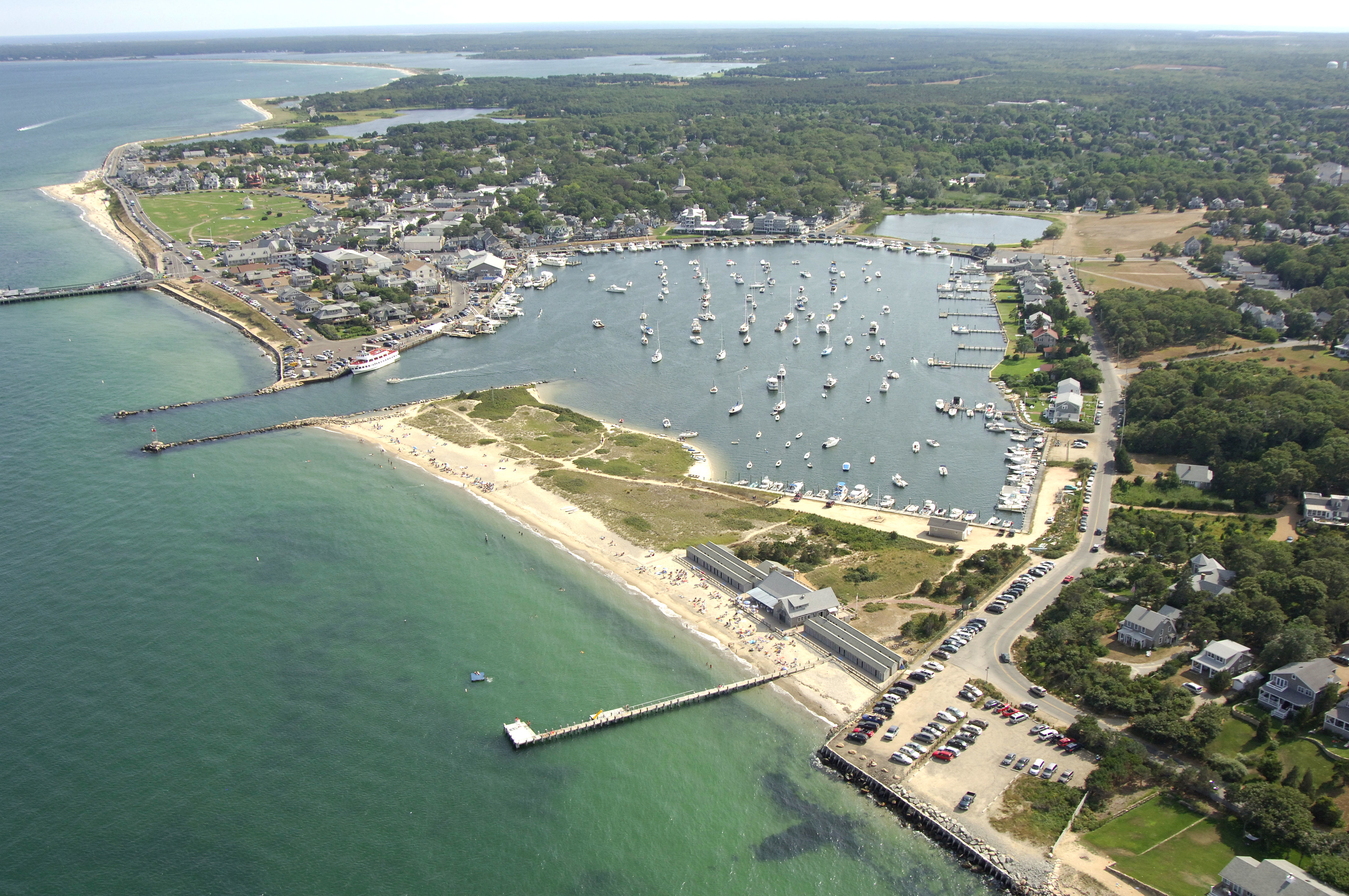
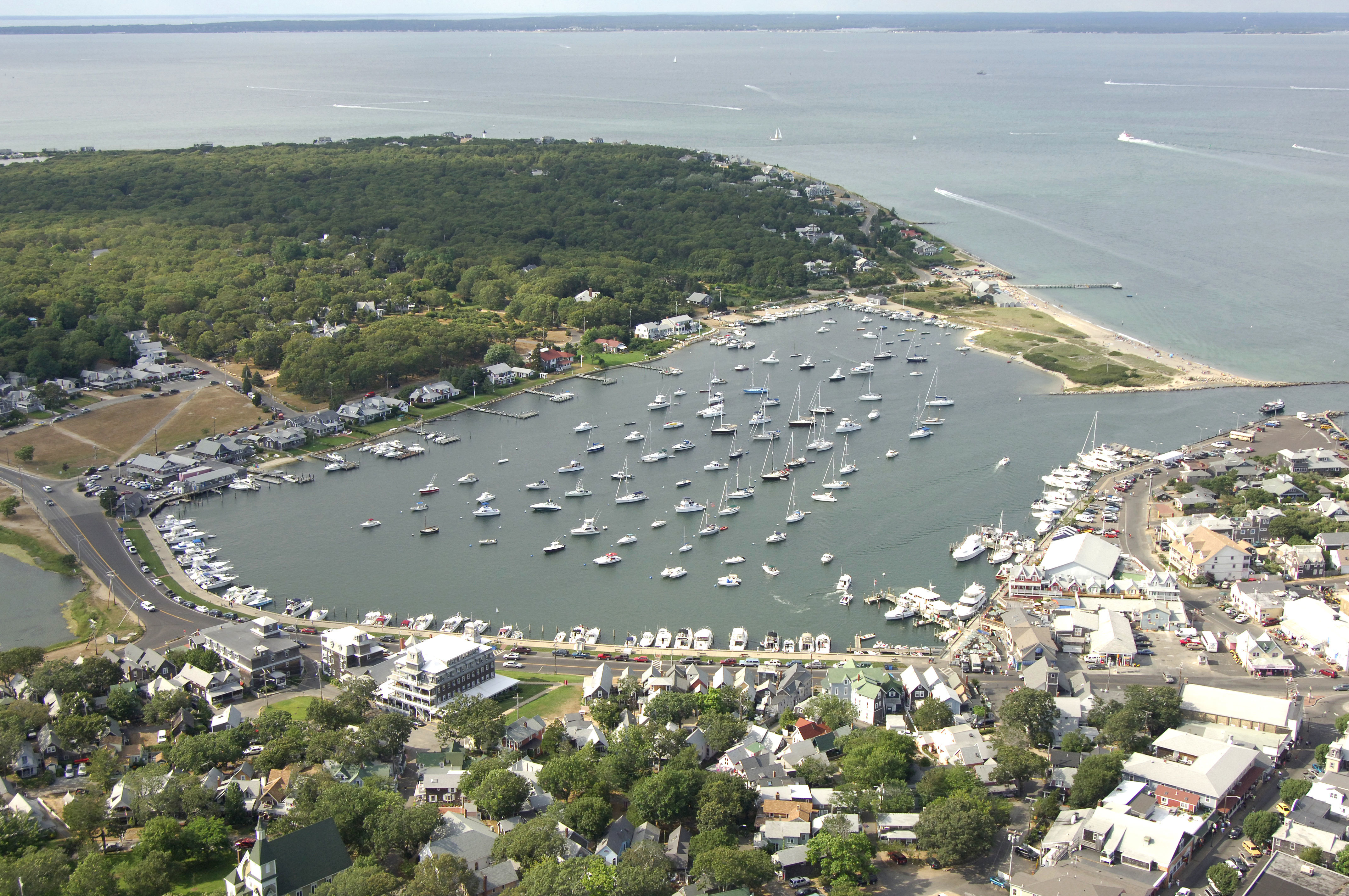
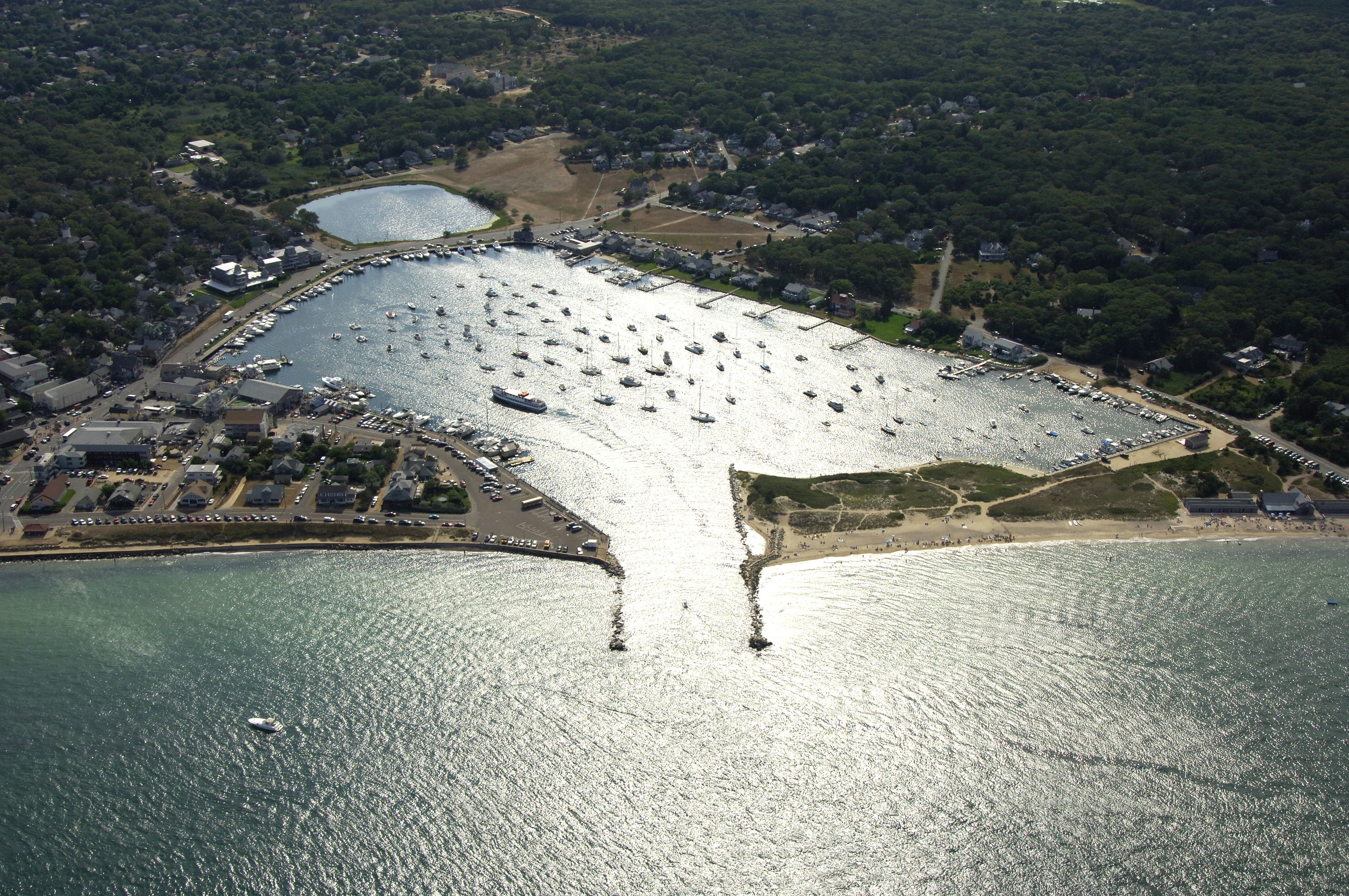
Oak Bluffs Harbor is located 17 nautical miles southwest of Hyannis, MA and about three miles across Marthas Vineyard from Vineyard Haven. The harbor offers a well protected mooring field and excellent marinas around its border. Fairly remote compared to Vineyard Haven, Oak Bluffs Harbor is a popular stop with local fisherman and recreational boaters who would rather stay out of the hustle and bustle of Vineyard Haven, but still be within reach of all the facilities that the larger town has to offer. Beach Road crosses over Lagoon Pond and links the two communities.
From Oak Bluffs Harbor, Vineyard Haven is only a short bike ride (two miles) or about a half-hour walk. Since established, Oak Bluffs has been a hub for tourism in New England. Downtown shops and restaurants are just steps away from Oak Bluffs Harbor on Circuit Avenue.
Navigating the Water:
Use NOAA Chart 13233.
Oak Bluffs Harbor is reached via Vineyard Sound just southwest of East Chop and the Vineyard Highlands. From Vineyard Sound, a green and red can buoy first serves to keep mariners off of a rock pile southeast of the inlet. Oak Bluffs Harbor itself is announced by flashing red "2," which is prominently placed on the north breakwater to the harbor.
Depths in the inlet are at least seven feet, and aside from some heavy recreational traffic at times, the passage is easy to follow and normally fairly calm. Inside there are four marine facilities, and and extensive and well protected mooring field.
Local Notices to Mariners:
Local Notices to Mariners are available online from the U.S. Coast Guard.
History:
Originally called Ogkeshkuppe, The Oak Bluffs Harbor area was originally inhabited by the Wampanoag people thousands of years ago. The city was settled in 1682 by Europeans and later incorporated as Cottage City in 1880. In 1907 the town was renamed Oak Bluffs because of an oak grove nestled along the towns ocean bluffs. It was the only town in Marthas Vineyard developed specifically for tourism.
Many of the early travelers to visit Oak Bluffs Harbor were Methodists in town for religious camp meetings. The annual camp meetings became quite popular and the Methodists built unique cottages known as Gingerbread Cottages. The Gingerbread Cottages are a popular tourist destination and designated as a National Historic Landmark.
Oak Bluffs Harbor is also home to The Flying Horses Carousel, the oldest operating platform carousel in America. The carousel was built in 1876 and brought to Oak Bluffs from Coney Island, NY in 1884. It is also designated as a National Historic Landmark.
Places to Visit:
Oak Bluffs Harbor has many great attractions and activities for all travelers. The center of Oak Bluffs downtown area is Circuit Avenue including many restaurants, bars, and great shopping. Just behind Circuit Avenue are the historic Gingerbread Cottages. The beautiful homes are a very popular tourist destination. For the summer months, Oak Bluffs Harbor is nearby Inkwell Beach and Joseph Sylvia State Beach.
Here are a few of our favorites nearby Oak Bluffs Harbor:
Inkwell Beach - 83 Seaview Avenue, Oak Bluffs
Joseph Sylvia State Beach - Beach Road, Oak Bluffs
Mocha Motts - 10 Circuit Avenue, Oak Bluffs
Flying Horses Carousel - 15 Oak Bluffs Avenue, Oak Bluffs
Circuit Avenue Shops - Circuit Avenue, Oak Bluffs
Gingerbread Cottages - Trinity Park, Oak Bluffs
East Chop Lighthouse - 229 East Chop Ave, Oak Bluffs
Marthas Vineyard Sharks Baseball - 100 EdgartownVineyard Haven Road, Oak Bluffs
Farm Neck Golf Club - Oak Bluffs Avenue, Oak Bluffs
Annual Events:
June:
Oak Bluffs Harbor Festival - Live music, foods, arts & crafts on the harborfront
July:
4th of July Parade and Barbecue - Entertainment, parade, hot dogs, burgers, and ice cream
September:
Marthas Vineyard Ukulele Festival - Live music, vendor area, luau dinner
Tivoli Day Festival - Live entertainment, food, arts, and music
October:
Annual Art of Chocolate Festival - Chocolate lovers festival! Chocolate tasting, art, and more!
Helpful Links:
Marthas Vineyard Transportation
Marthas Vineyard Calendar of Events
Harbor Reviews
Great Dockhands, especially that young man kert! Overall amazing expierence.