


Nanny Cay Harbor
Tortola, British Virgin Islands
Marinas near Nanny Cay Harbor
| Name | Reviews | Max LOA | VHF | Dock Depth | Gas / Diesel | Lift / Crane | Wifi | Amps |
|---|---|---|---|---|---|---|---|---|
| Nanny Cay Resort and Marina | 0.0' | - | Low 0.0 mHigh 0.0' | - | - | - | ||
| Nanny Cay Boatyard | - | 160.0' | 16 | Low 12.0'High 0.0' | GYesDYes | LYes | - | |
| Hannah Bay Marina | - | 0.0' | - | Low 0.0 mHigh 0.0' | - | - | - | - |
| Manuel Reef Marina | - | 0.0' | - | Low 0.0 mHigh 0.0' | - | - | - | - |
| Road Reef Marina | 0.0' | - | Low 0.0 mHigh 0.0' | - | - | - | - | |
| Prospect Reef Marina | - | 0.0 m | - | Low 0.0 mHigh 0.0' | - | - | - | - |
| Fort Burt Marina | - | - | - | - | GYesDYes | - | - | |
| Village Cay Marina | - | 190.0' | - | Low 0.0 mHigh 0.0' | GYesDYes | - | - | 30, 50, 100 |
| Tortola Yacht Club | - | 0.0 m | - | Low 0.0 mHigh 0.0' | - | - | - | - |
| Moorings Marina | - | 0.0' | - | Low 0.0 mHigh 0.0' | - | - | - | - |
| Footloose Marina | - | 0.0' | - | Low 0.0 mHigh 0.0' | - | - | - | - |
| Tortola Yacht Services | - | - | - | - | - | LYes | - | - |
| Mega Surface Marina | - | 0.0 m | - | Low 0.0 mHigh 0.0' | - | - | - | - |
| Clipper Marina | - | - | - | - | - | - | - | - |
| Hodge's Creek Marina | - | 0.0' | - | Low 0.0 mHigh 0.0' | - | - | - |
Introduction:
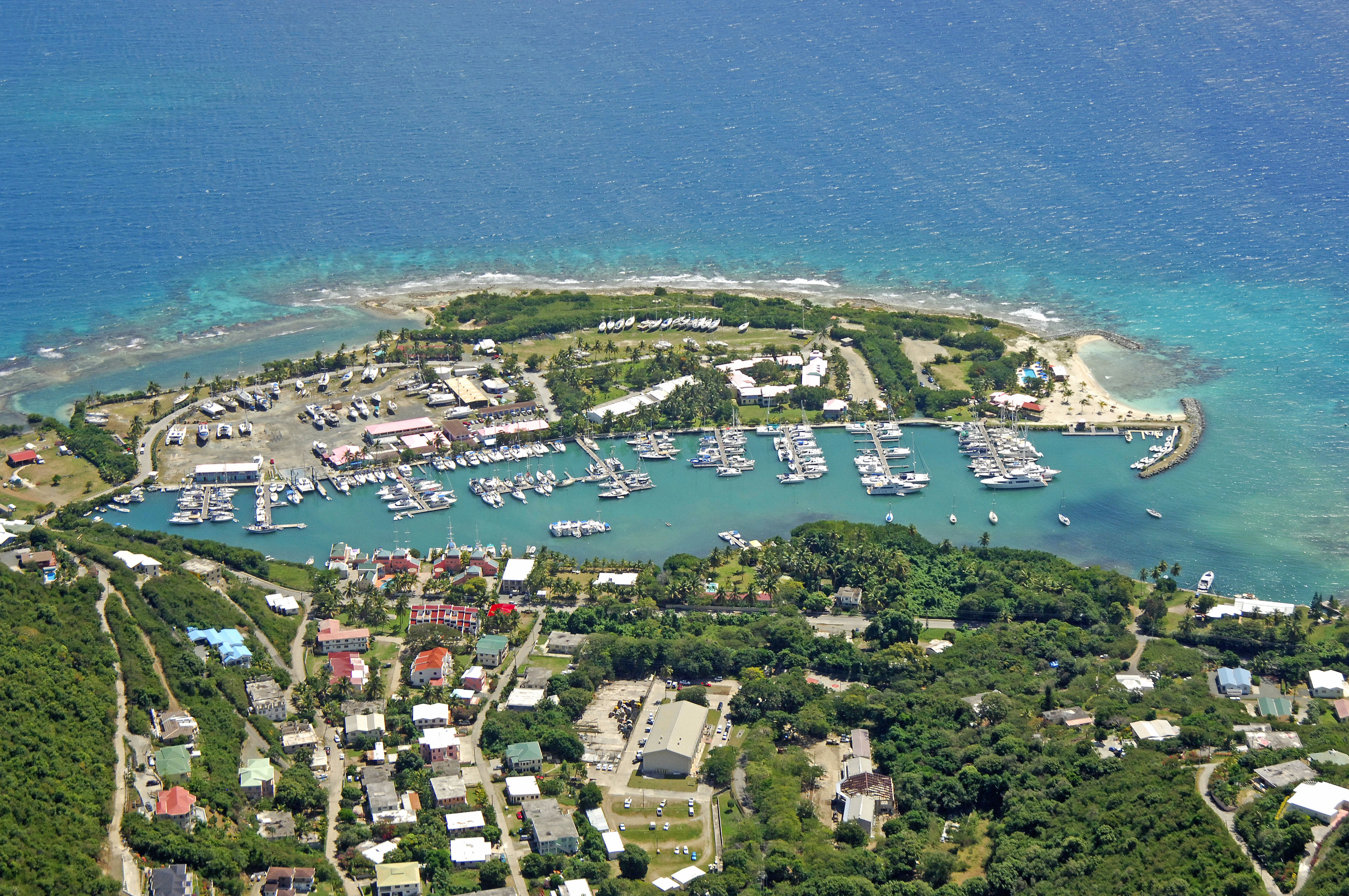
Nanny Cay is a small protected body of water on the southeast end of Tortola. Nanny Cay is 3 miles southwest of Road Town and 4 miles northeast of Sopers Hole. Though there is only one marina ashore, it is very well equipped, and there are a gathering of other marine repair facilities surrounding the marina if you need engine, electronics or other service.
Navigating the Water:
Nanny Cay is approached from the south via via the Sir Francis Drake Passage. From the south, set a course for the southern opening of Nanny Cay, and then be on the lookout for the series of red and green buoys that lead into the cay past the stone breakwall.
Nanny Cay Marina is inside, and due to the tight and restricted quarters, no anchoring is permitted here. You may be able to tie up at one of the marinas mooring buoys, but plan on tying up for the night when you arrive (calling ahead for reservations recommended).
Ashore are a variety of marine and non-marine services including electronics repair shops, varnish restoration, Internet cafe, and several good restaurants.
Local Notices to Mariners:
See our Local Notices to Mariners blog for updates on the latest conditions and advisories for this area.