


North Sound Harbor
Cayman Islands
Marinas near North Sound Harbor
| Name | Reviews | Max LOA | VHF | Dock Depth | Gas / Diesel | Lift / Crane | Wifi | Amps |
|---|---|---|---|---|---|---|---|---|
| Morgans Boat Service | - | - | - | - | - | - | - | - |
| Barcadere Marina | - | 130.0' | - | Low 0.0 mHigh 0.0' | GYesDYes | LYes | 30, 50, 100 | |
| Scotts Marine | - | - | - | - | - | - | - | - |
| Sailing Club | - | 0.0 m | - | Low 0.0 mHigh 0.0 m | - | - | - | - |
| Harbour House Marina | - | - | - | - | - | - | - | - |
| Paradise Villas Resort | - | - | - | - | - | - | - | - |
| Marlin Marina Cayo Largo | - | 16 | - | GYesDYes | - | - | - | |
| Marlin Marina Jardines de la Reina | - | - | - | - | - | - | - | - |
| Marlin Marina Trinidad | - | - | - | - | GYesDYes | - | - | - |
| Marlin Marina El Colony | - | - | 19 | - | - | - | - | - |
| Marlin Marina Cienfuegos | - | - | 19 | - | GYesDYes | - | - | - |
| Montego Bay Yacht Club | - | - | 16 | Low 6.0' | GYesDYes | - | - | - |
| Montego Bay Marine Park | - | - | - | - | - | - | - | - |
| Trelawny Marine Service | - | - | - | - | - | - | - | - |
| Lagoon Hotel & Marina | - | 0.0 m | - | Low 0.0 mHigh 0.0 m | - | - | - | - |
Introduction:
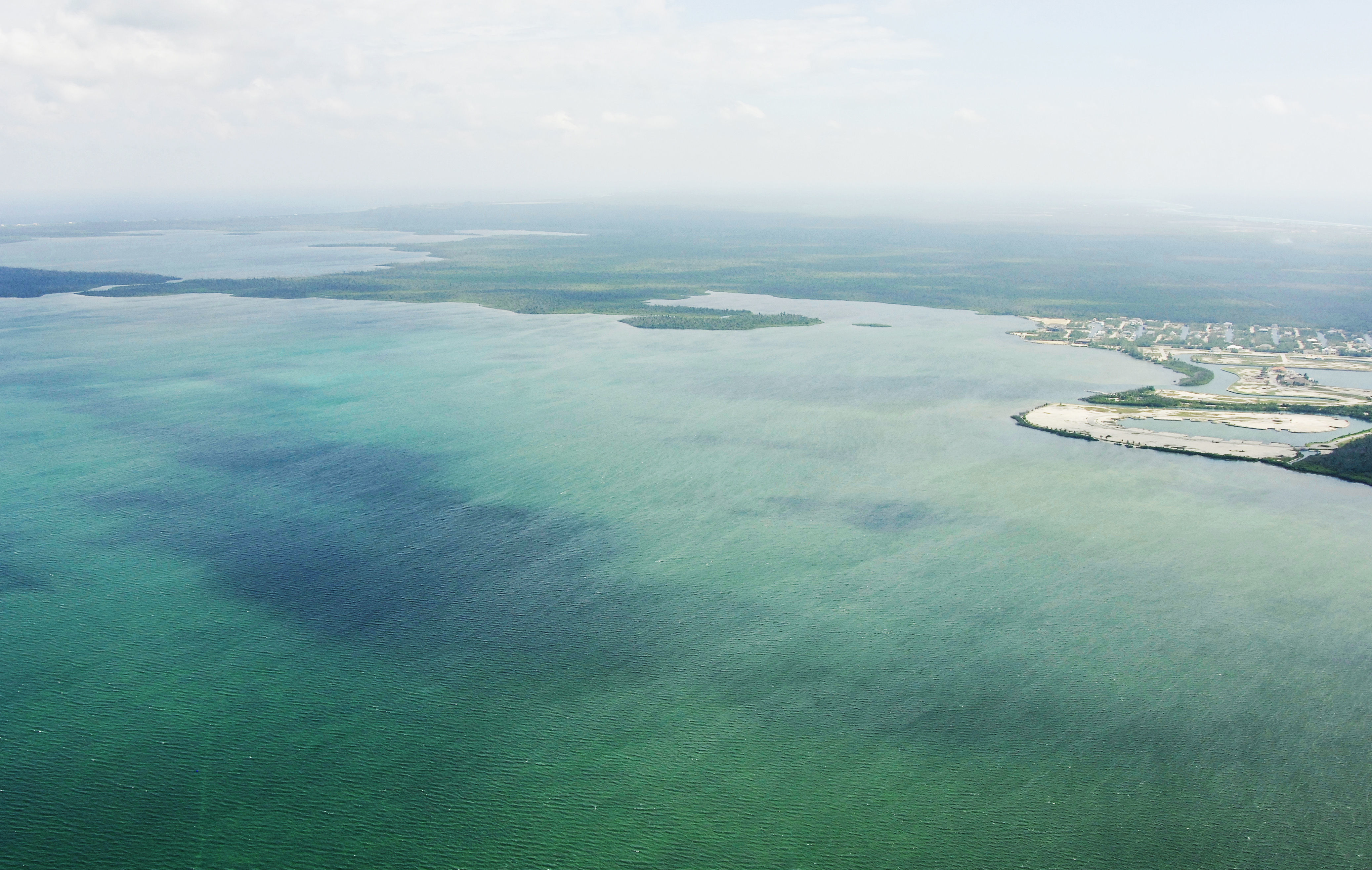
North Sound is the largest protected bay on Grand Cayman Island. While large, fairly well-protected and easy to navigate, many boaters never even enter the area when visiting Grand Cayman. The anchorage at Marine Park off Georgetown is more popular, though this ares can be rough when winds clock out of the wrong direction.
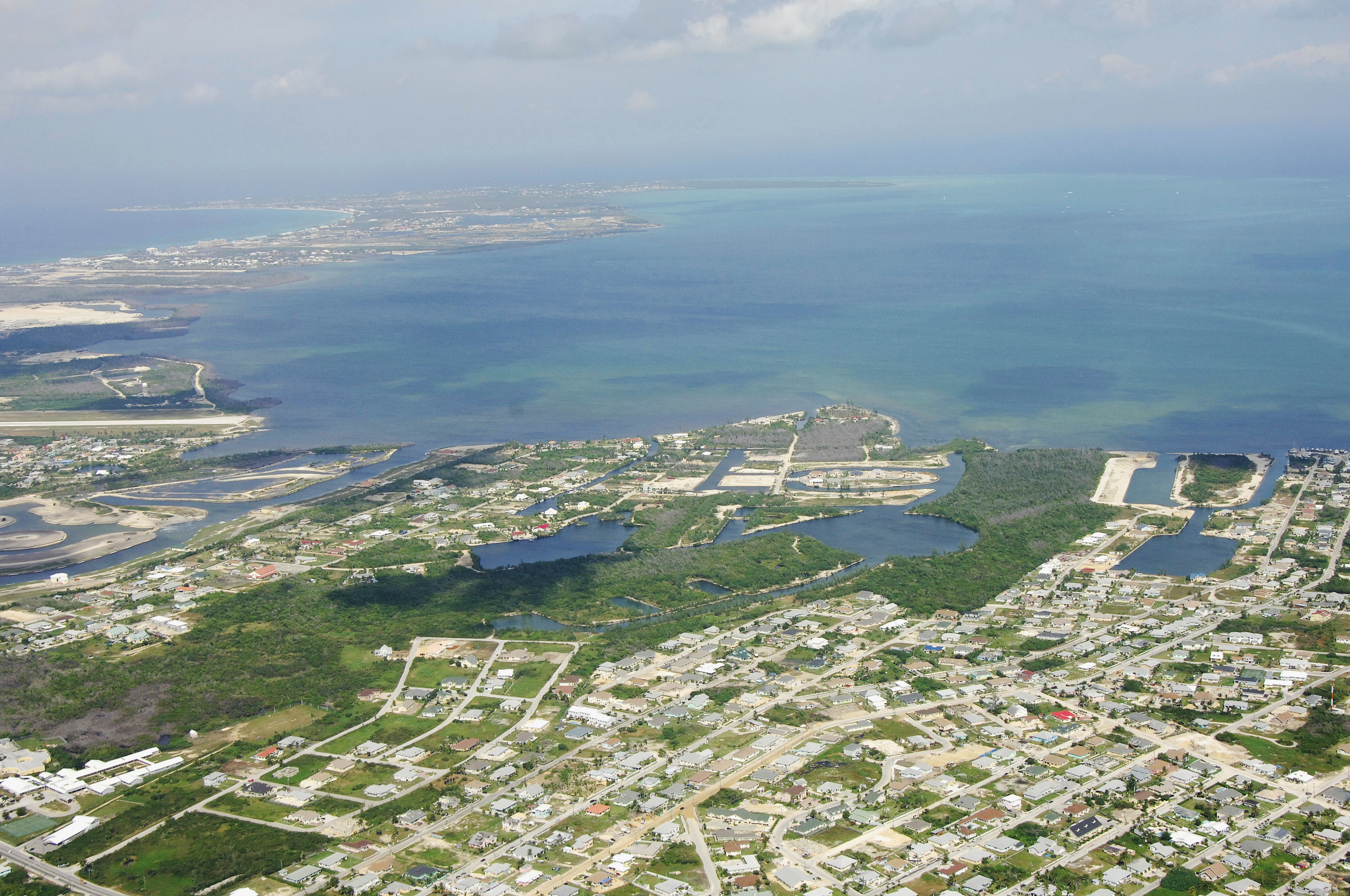
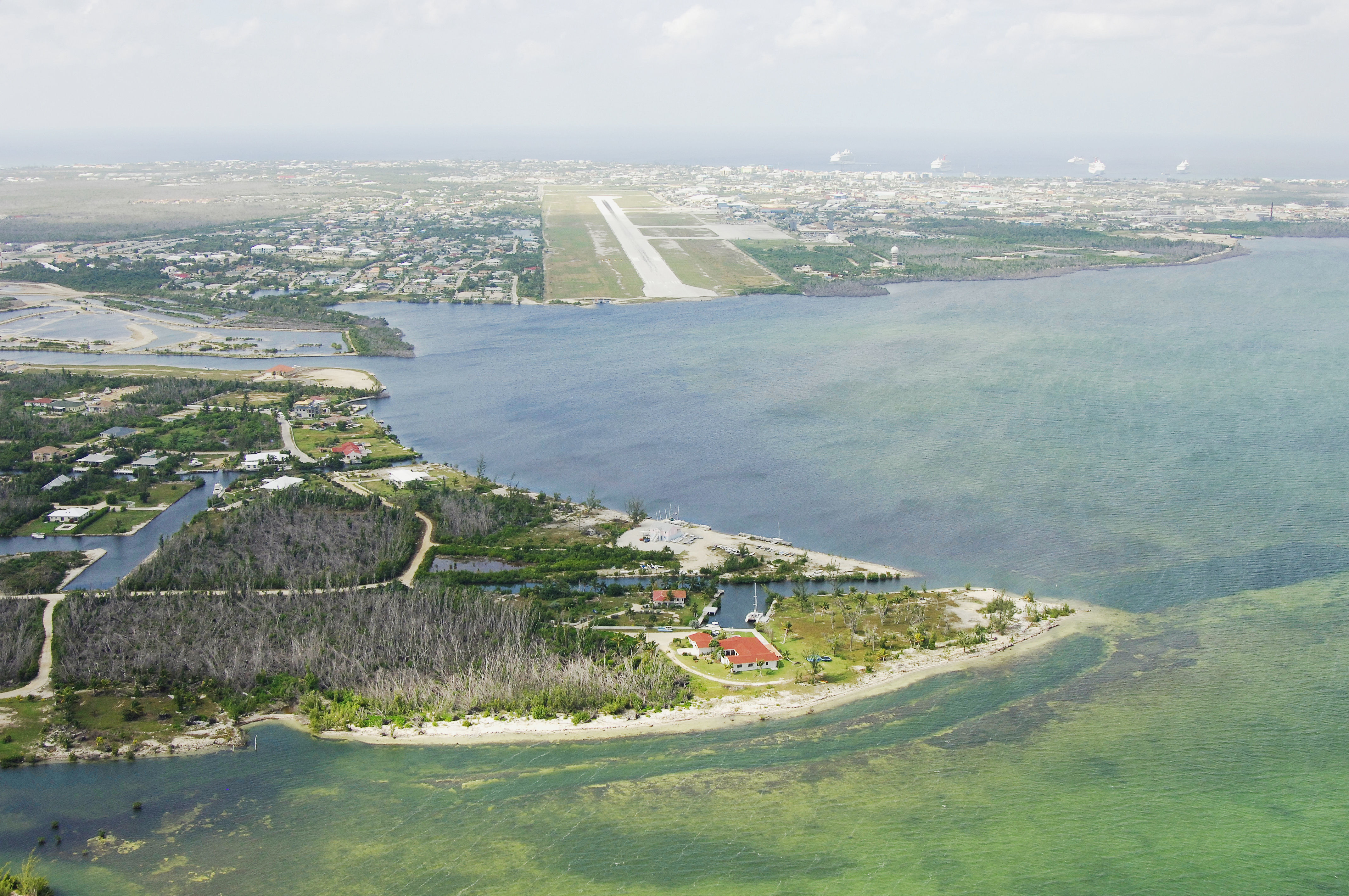
Inside North Sound are a variety of marinas and side creeks that afford protection and facilities. In the northwestern side of the sound, there is Morgans Bay, which has a couple of marinas, one with repairs. Farther south on the west side of the sound is Governors Creek, which is home to the Cayman Islands Yacht Club, a full service facility, and an anchorage that is the best protected on the island. Red Bay, in the southern section of the sound, rounds off the facilities.
The main runway of the Owen Roberts International Airport is visible in the image above, and off to the right, the cruise ship anchorage for Marine Park off Georgetown is visible.
Navigating the Water:
Approaching from offshore, you may have a hard time sighting Grand Cayman Island due to its relatively low height above water (maximum elevation 60 feet). Most radars will catch the island about 18 to 20 miles out, and you should be able to see fringes of the island by eye within 10 miles or so, depending on weather and wave height. Boatswain Point Light is located just east of Boatswain Bay (northwest corner of the island - located out on the far point in the image above) and has a 15-mile visible beam offshore.
Once you have picked up the island and are within 10 miles, you must announce your arrival on VHF Channel 16 to Port Security. The entrance into North Sound can be problematic in strong northerly winds, but the small gap just east of Barkers Cay (about 2 miles east of Head of Barkers Point) carries consistent 7- to 10-foot depths. The only warning offered about this entrance is that it is in constant flux, with coral reefs growing in different directions each year, storms moving sand across channels and current charts being unreliable.
Clear of the entrance to North Sound, you can proceed through North Sound itself, keeping a lookout for shallow areas and coral outcroppings. The current chart for this area is quite inaccurate, sources report, so if you are in doubt as to what course to take at anytime, give the port authority or one of the local are dredged for entry. Remember, too, that you must first clear customs in Georgetown before stepping ashore on Grand Cayman (see our Georgetown Overview for more information on checking in).
Local Notices to Mariners:
See our Local Notices to Mariners blog for updates on the latest conditions and advisories for this area.
Transportation:
Owen Roberts International Airport is located about 2 miles southeast of the center of Georgetown on the southern side of North Sound. The airport has regularly scheduled commercial jet service from carriers like United, US Airways, American and Cayman Airways. Taxi cab service is available across much of the island and shuttle service can be arranged to/from by contacting the airport directly.
Helpful Links:
Cayman Islands Department of Tourism