

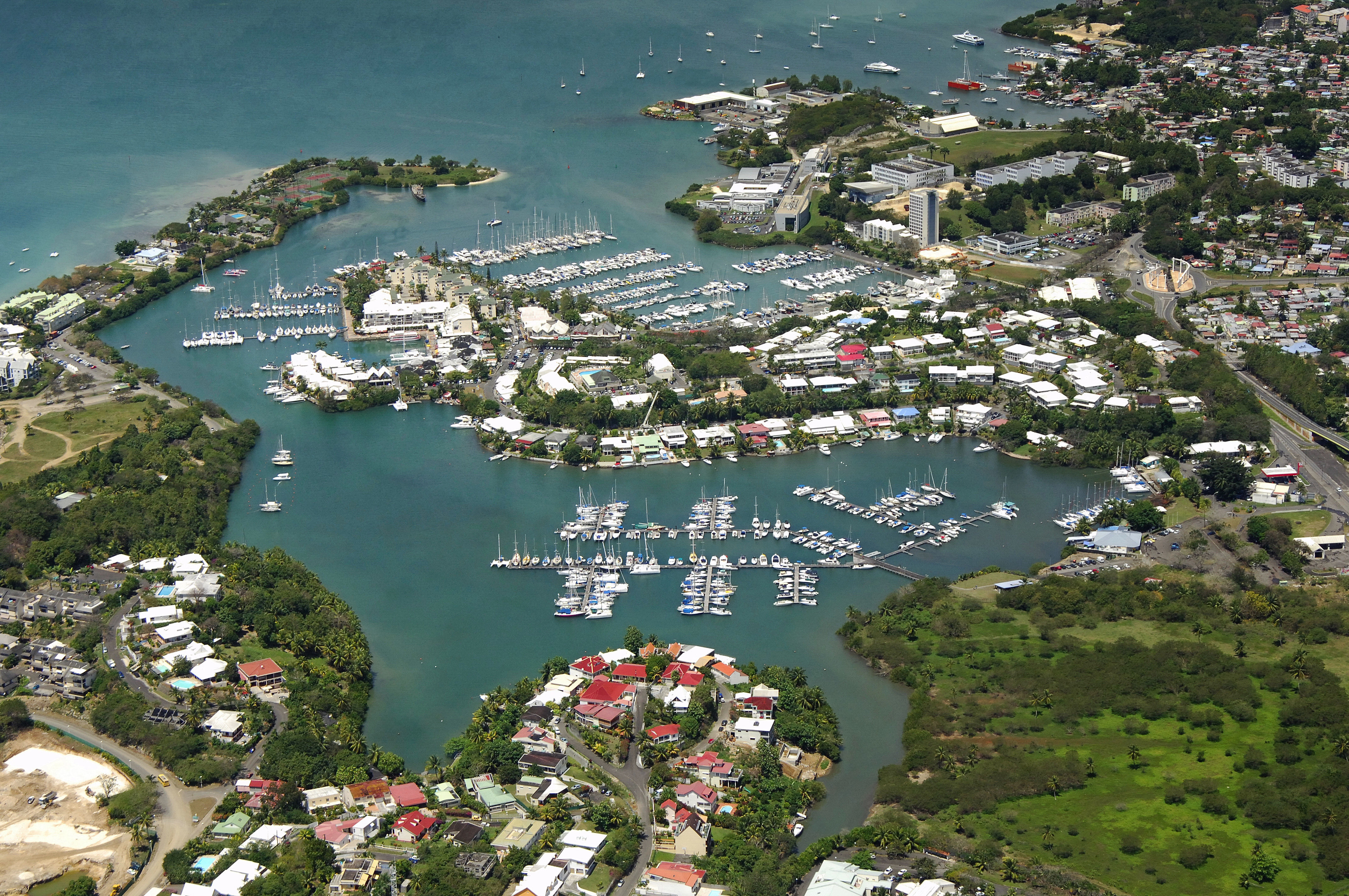


Pointe a Pitre Harbor
Pointe a Pitre, Guadeloupe
Marinas near Pointe a Pitre Harbor
| Name | Reviews | Max LOA | VHF | Dock Depth | Gas / Diesel | Lift / Crane | Wifi | Amps |
|---|---|---|---|---|---|---|---|---|
| Marina Bas-du-Fort | - | 65.0 m | 9 | Low 4.5 mHigh 0.0 m | GYesDYes | LYesCYes | 163 | |
| Grand Bourg Port Marina | - | - | - | - | - | - | - | - |
| Dominica Marine Center | - | - | - | - | - | - | - | - |
| St. James Club Marina | - | - | - | - | - | - | - | - |
| Antigua Slipway | - | - | - | - | - | - | - | - |
| Nelson's Dockyard Marina | - | - | - | - | - | - | - | - |
| AYC Marina & Resort | - | 300.0' | 68 | - | GNearbyDYes | LNearby | 250 | |
| Falmouth Harbour Marina | - | 0.0 m | - | Low 0.0 mHigh 0.0' | - | - | - | - |
| Catamaran Marina | - | - | - | - | - | - | - | - |
| Mill Reef Club | - | - | - | - | - | - | - | - |
| Jolly Harbour Marina | - | - | 68 | - | GYesDYes | LYesCYes | - | |
| Jordan's Pier Marina | - | - | - | - | - | - | - | - |
| Crabb's Slipway Marina | - | - | - | - | - | - | - | - |
| North Sound Marina | - | - | - | - | - | - | - | |
| Safe Harbor St Kitts | - | - | 71 | - | - | - | - | - |
Introduction:
The Guadeloupe region, an extension of France, is located in the Leeward Islands on the east end of the Caribbean. Guadeloupe includes the Islands of Guadeloupe, St. Martin, St. Barts, Les Saintes, Marie Glante and La Desirade. Guadeluope is considered to be part of the European Union and uses the Euro as its currency. Additionally, Guadeloupe is also a part of what people term the French West Indies, although technically, all the Leeward and Windward Islands make up the West Indies.
Pointe a Pitre is the largest and most significant city in the Guadeloupe region and is conveniently located on the central southern portion of the island of Guadeloupe itself. Pointe a Pitre has a large and well-protected harbor that is geared toward yachting and boaters. There are two smaller harbors within Pointe a Pitre Harbor: Riviere de Salee and Port de Plaisance. The Riviere Salee (and Passage) are located on the northern end of the harbor, while Port de Plaisance is located in the southern portion of the island to the east on entry from the south.
Navigating the Water:
Point a Pitre Harbor is reached by an approach from the south via the Caribbean Sea. To start your entry to the area, first pick up waypoint 16 12.185N 61 31.655W. Once you have arrived in the area of the waypoint, proceed .6 miles on a course of 348 degrees true for a distance of about a half-mile to intercept flashing red 1 that marks the formal entrance into the harbor. Depths in the inlet are between 27 to 37 feet.
Once you have reached the initial mark, proceed north to pick up flashing green 2 to port, and then red 3 farther on. A series of additional marks leads the way up the harbor toward the yacht harbor, and you will make a starboard turn around BF1 toward BF3, which is at the entrance to the yacht harbor (this buoy marks a 3.6-foot deep bar).
Inside the basin is the Marina Bas-du-Fort and a Sunsail and a handful of other marinas offering a variety of services including haul-out, gas and diesel fuel, showers/restrooms, laundry, customs and resort amenities.
Local Notices to Mariners:
See our Local Notices to Mariners blog for updates on the latest conditions and advisories for this area.