


North Haven Town Harbor
North Haven, Maine United States
Marinas near North Haven Town Harbor
| Name | Reviews | Max LOA | VHF | Dock Depth | Gas / Diesel | Lift / Crane | Wifi | Amps |
|---|---|---|---|---|---|---|---|---|
| North Haven Ferry Dock | - | 0.0 m | - | Low 0.0'High 0.0' | - | - | - | - |
| North Haven Casino | - | 0.0 m | - | Low 0.0 mHigh 0.0' | - | - | - | - |
| Browns Boatyard | - | 60.0' | 16 | Low 0.0'High 0.0' | GYesDYes | LYes | - | |
| Thayer's Y-knot Boat Yard | - | 0.0 m | - | Low 0.0'High 0.0' | - | - | - | - |
| Hopkins Boat Yard | - | 0.0 m | - | Low 0.0'High 0.0' | - | - | - | - |
| Owls Head Lobster Co | - | 0.0 m | - | Low 0.0 mHigh 0.0' | - | - | - | - |
| Ship to Shore Lobster Company | - | 0.0 m | - | Low 0.0 mHigh 0.0 m | - | - | - | - |
| Tarratine Yacht Club | - | 0.0 m | - | Low 0.0 mHigh 0.0' | - | - | - | - |
| Pendleton Yacht Yard | - | - | - | - | - | - | - | - |
| Dark Harbor Boat Yard | - | 0.0 m | - | Low 0.0'High 0.0 m | DYes | - | - | - |
| Rockport Marine | 0.0 m | - | Low 0.0 mHigh 0.0 m | - | - | - | - | |
| Rockport Yacht Club | - | 0.0 m | - | Low 0.0 mHigh 0.0' | - | - | - | - |
| Rockport Boat Club | - | 0.0 m | - | Low 0.0 mHigh 0.0' | - | - | - | - |
| Rockport Town Floats | - | 0.0 m | 16 | Low 0.0 mHigh 0.0' | - | - | - | - |
| YS Moorings | - | - | - | - | - | - | - |
Introduction:
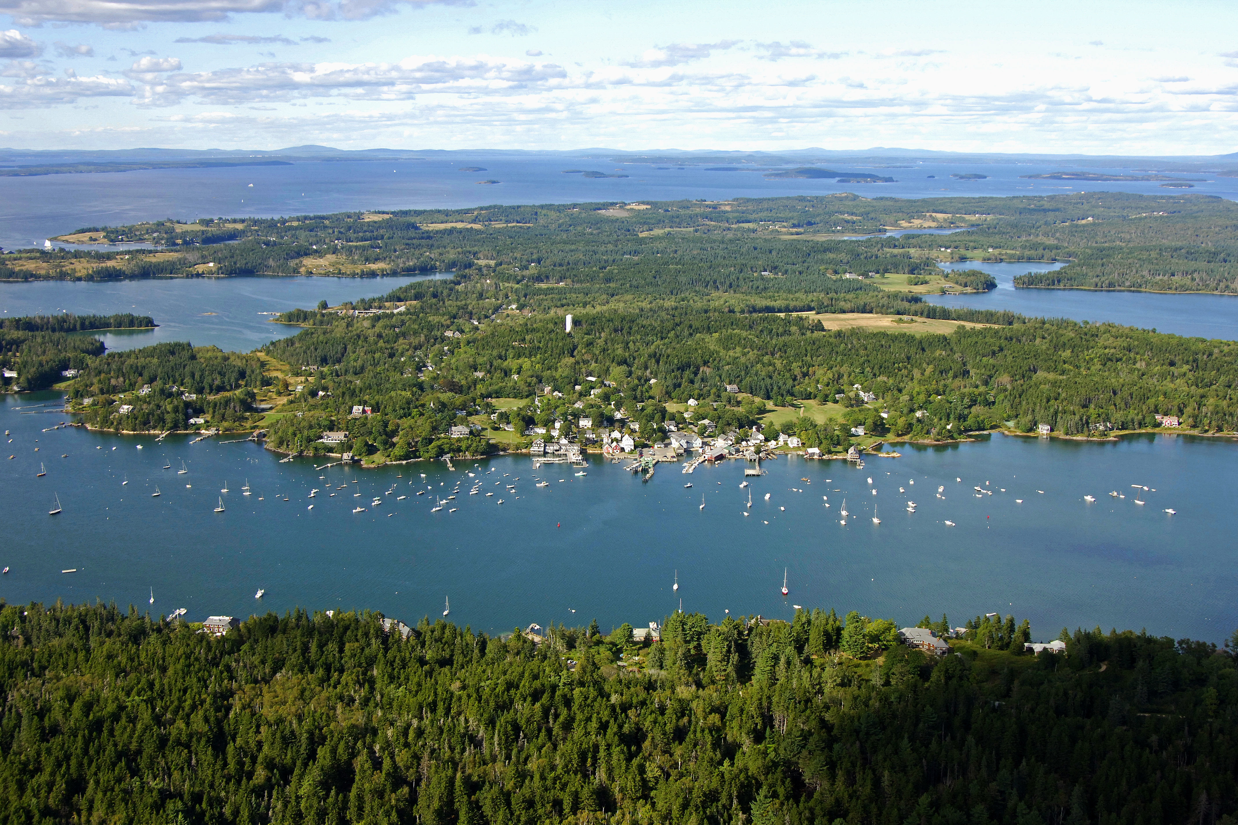
Fox Island Thorofare is a long, deep-water passage that runs east and west across the top end of Vinalhaven Island. It is bounded at its western terminus by West Penobscot Bay, and at its eastern terminus by East Penobscot and Isle Au Haut bays. In the middle of the passage is the town of North Haven, which lies on the south side of its namesake island.
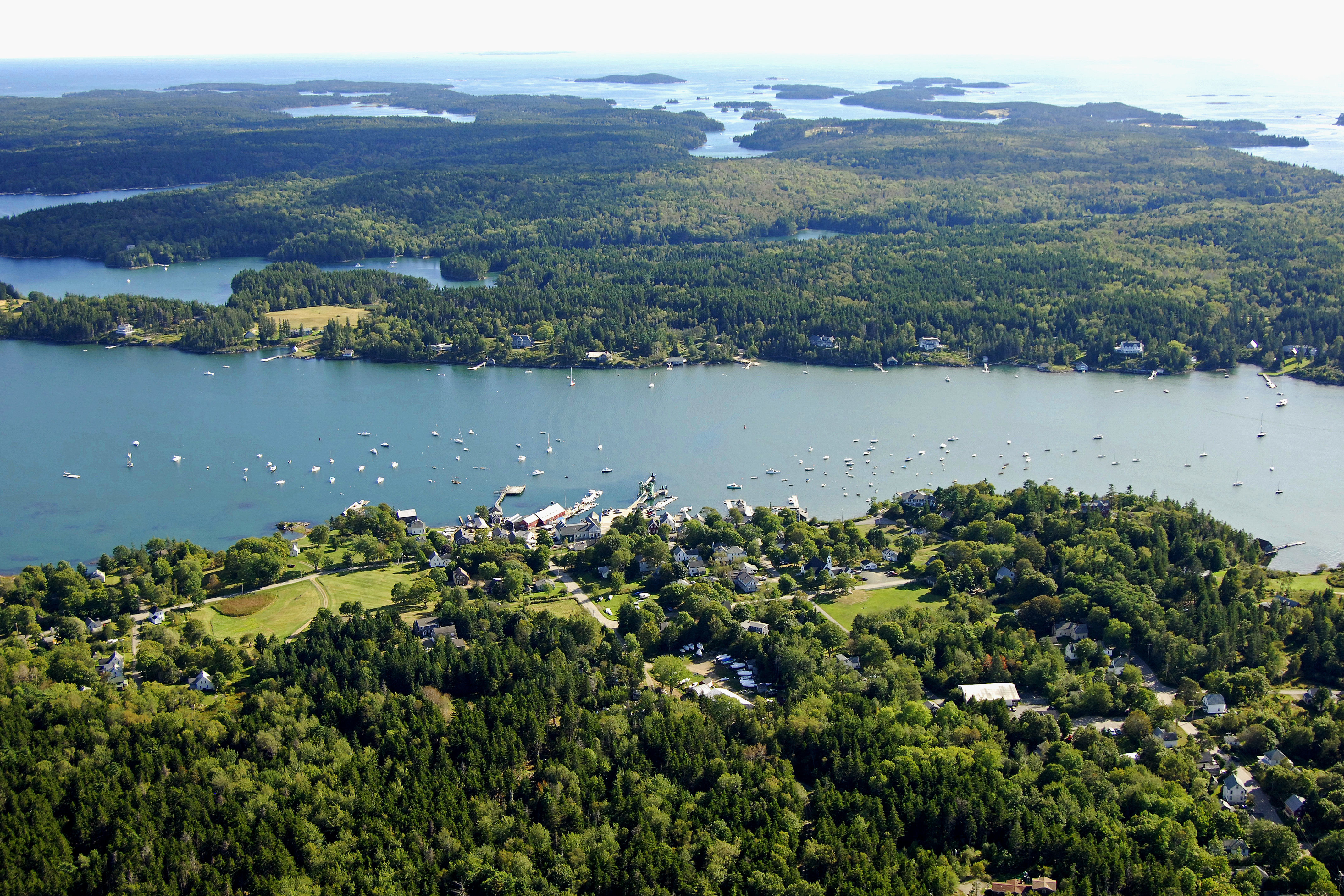
The image above is a view from the west looking east over the Fox Island Thorofare at the town of North Haven. The heavily wooded mound of land on the right (south) side of the image is the northern end of Vinalhaven Island, while to the left (north) the town and island of North Haven can be seen. Off in the distance on the horizon, East Penobscot Bay can be seen working its way north and south.
There are two marine service and marina facilities in the town of North Haven, and they are essentially the only facilities of any substance on Fox Island Thorofare. The primary facility is J.O. Brown and Son, which has moorings for rent, gas and diesel fuel, and a lift for haul-out and related repair services.
You can tie up to one of J.O. Browns moorings or set the hook just off the town of North Haven in 12- to 14-foot depths. There is also good protected anchorages in Southern Harbor to the west of town and Waterman Cove to the east.
Navigating the Water:
Use NOAA Chart 13305.
Approaching from West Penobscot Bay, first set a course for red and white Morse (A) buoy FT, which is located at an approximate waypoint of N44 05.298 W68 57.275. Keep in ind that buoys run red right returning from east to west, so on this approach, you will leave green markers to starboard and red markers to port.
Once you have safely navigated to red and white Morse (A) buoy FT, set a new course of approximately 066 degrees magnetic for about 2.7 miles to intercept green gong buoy 23, which marks the location of a steep rock ledge east of Sugar Loaves. On your way to green gong buoy 23, you can use the Browns Head Lighthouse (39 feet above the water, flashing white, horn) to guide you in.
After reaching green gong buoy 23, set a new course of about 041 degrees magnetic for about a half-mile to pick up red nun buoy 20 at Calderwood Rock. At this point, the channel makes a turn toward the northeast and about a half-mile away, you will find flashing red buoy 18 and green daybeacon 19 at Young Point.
Clear of Young Point, continue farther to the east to intercept flashing green buoy 17, and then flashing red buoy 16 at the North Haven Town waterfront.
Local Notices to Mariners:
Local Notices to Mariners are available online from the U.S. Coast Guard.