


Duxbury Harbor
Duxbury, Massachusetts United States
Marinas near Duxbury Harbor
| Name | Reviews | Max LOA | VHF | Dock Depth | Gas / Diesel | Lift / Crane | Wifi | Amps |
|---|---|---|---|---|---|---|---|---|
| Bayside Marine | 0.0' | - | Low 0.0 mHigh 0.0' | GYes | - | - | - | |
| Duxbury Harbormaster | - | - | 16 | - | - | - | - | - |
| Duxbury Bay Maritime School Marina | - | 0.0' | - | Low 0.0 mHigh 0.0' | GNearbyDNearby | - | - | - |
| Duxbury Yacht Club | - | 0.0' | - | Low 0.0 mHigh 0.0' | - | - | - | - |
| Long Point Marine | - | 0.0 m | 78 | Low 0.0 mHigh 0.0' | - | - | - | - |
| Taylor Marine | 35.0' | - | - | G$3.799/galD$3.399/gal | - | 30 | ||
| Marshfield Harbormaster | - | 16 | - | - | - | - | - | |
| Brant Rock Town Pier | - | 0.0 m | - | Low 0.0 mHigh 0.0 m | - | - | - | - |
| Safe Harbor Green Harbor | 60.0' | 65 | Low 6.0'High 0.0' | G$4.125/galD$4.09/gal | LYes | 30, 50 | ||
| Green Harbor Yacht Club | - | - | - | - | GNearbyDNearby | - | - | - |
| Kingston Harbormaster | - | - | - | - | - | - | - | - |
| The Pier at Cordage | - | - | - | - | - | - | - | - |
| North Plymouth Harbor | - | - | - | - | - | - | - | - |
| Plymouth Boatyard | - | 0.0' | - | Low 0.0 mHigh 0.0' | - | - | - | - |
| Jesse's Marine | - | - | - | - | - | - | - | - |
Introduction:
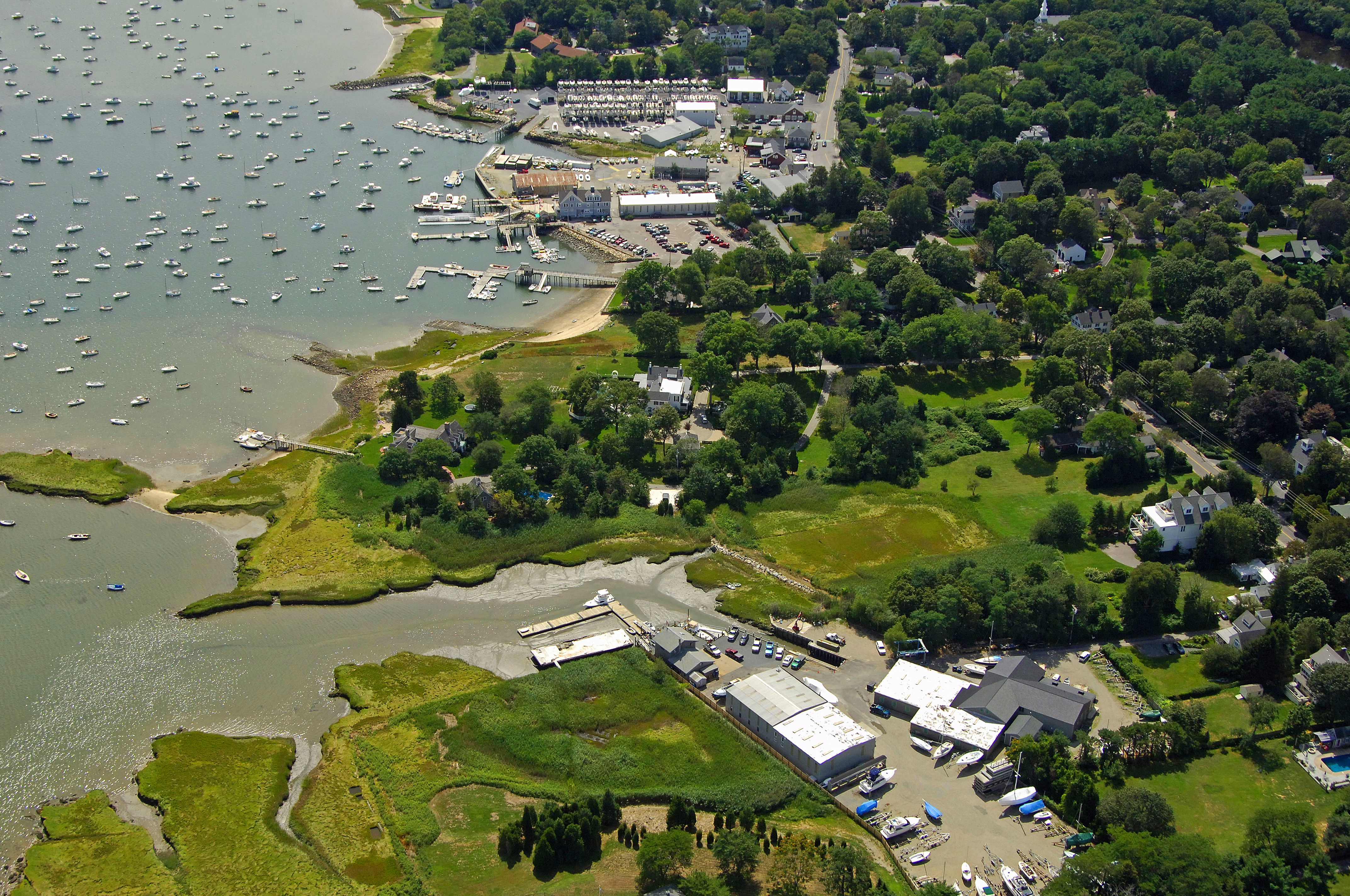
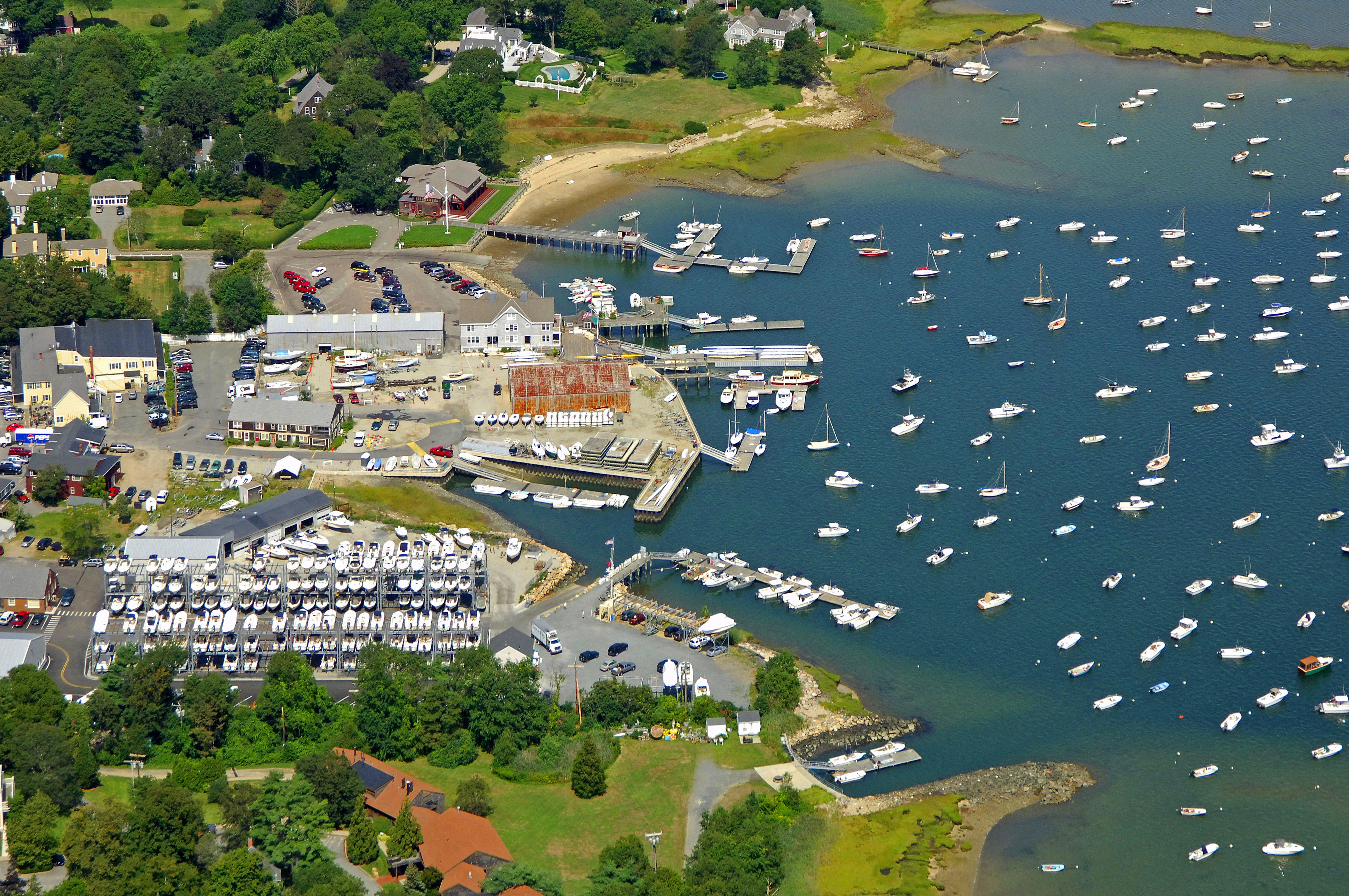
The image above is a view from the east looking west over the Duxbury waterfront with its dredged harbor in the foreground. There are three marinas on the waterfront, and while most will do what they can to accommodate transient guests, space here is tight and you should most definitely call ahead to ensure there are spaces or moorings available for you.
Navigating the Water:
Use NOAA Chart 13253.
Plymouth Harbor is reached via an approach from the east through Cape Cod Bay. The entrance to Plymouth Harbor starts with flashing green buoy 1, which is located near waypoint N41 59.713 W70 35.403. Once you have safely navigated to flashing green buoy 1, head west and leave the following buoys to port: Flashing green buoy 3, flashing green buoy 5, Green can 7, and then leave red nun buoy 6 to starboard.
Past red nun buoy 6, you will see the Duxbury Pier LIghthouse (35 feet above the water, flashing red twice every five seconds), which marks a steep shoal area on the north side of the inlet. Make sure you give it some room. Once you have arrived in the area of Duxbury Pier (obviously give it some room), head north to pick up green can 1 and red nun buoy 2.
Once you have past red nun buoy 2, set an approximate course of 35 degrees magnetic for .6 mile to reach red nun buoy 4. Just off to the north=northwest, you should be able to see green can 5 and flashing red 6, which mark the break off the channel toward Duxbury Harbor.
Next follow green can buoy 7, red nun buoy 8, green can buoy 9,red nun buoy 10, and then green can buoy 11 and red nun buoy 12 at the 5-foot-deep entrance channel to Duxbury Harbor. The channel runs west past a line of can and nun buoys, and then makes a sharp north turn at green can 15 and red nun 16. From here, be especially careful to stay inside the channel, as a false move will put you on hard sand.
Local Notices to Mariners:
See our Local Notices to Mariners blog for updates on the latest conditions and advisories for this area.