Lower Atchafalaya River Inlet
| Louisiana United States | |
| 29° 25' 3.0'', -91° 20' 40.93'' | |
| Morgan City |


You might also consider...


About
Introduction:
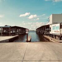
The image above is a view from the southeast looking northeast over the point where the Lower Atchafalaya empties into the Gulf of Mexico east of Marsh Island and Vermillion Bay. About 25 miles northeast of the Lower Atchafalays Gulf inlet is Morgan City, where the Lower Atchafalaya joins the Gulf Intracoastal Waterway near GIWW Mile 95 before heading south and splitting off at flashing green 1 west of Beers Island. From here, the river twists about 20 miles to the southwest to the Gulf of Mexico.
The closest facilities to the inlet are way upstream near and round Morgan City, which makes the city popular with cruising boater arriving from offshore and also from the east or west via the GIWW.
Navigating the Water:
The Lower Atchafalayas exit into the Gulf of Mexico forms a delta area, and delta areas are a settlement area for sediments, making shoals and shallow areas problematic at points. That said, depths outside the main marked channel are four to six feet, but we dont recommend you test them.
The main ship channel has a long line of buoys that start about 23 miles southwest of the entrance, but you dont have to follow the entire channel is you raw less than five feet. We do, however, recommend that you pick up flashing red 26 west of Point au Fer and follow that the rest of the way in, paying close attention to all the marks as you go.
Local Notices to Mariners:
See our Local Notices to Mariners blog for updates on the latest conditions and advisories for this area.