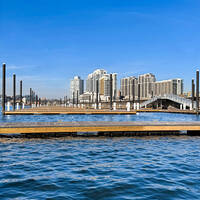
Cos Cob Harbor Inlet
| Cos Cob, Connecticut United States | |
| 41° 1' 6.96'', -73° 35' 48.84'' | |
| Cos Cob Harbor |
You might also consider...


About
Introduction:
Located three miles east of the New York State - Connecticut state line, Cos Cob Harbor and the town of Cos Cob have at least nine marinas, good provisioning stops ashore, and a quiet laid back atmosphere to enjoy. Cos Cob is actually located on the Mianus River, and there are marinas available from the mouth of the harbor all the way up to the tall fixed bridge (45-foot fixed vertical clearance) in town.
Navigating the Water:
Use NOAA Charts 12364 and 12367.
From Long Island Sound, chart a course for flashing green buoy 1 east of Little Captain Island at the entrance to Captain Harbor. Once you have picked up the flashing green buoy, you can head northwest toward green can 1A, which marks the ledge at Hen and Chickens. A little less than a mile to the northeast is flashing red buoy 2 at Hitchcock Rock, which marks the start of the approach into the Mianus River and Cos Cob Harbor.
From flashing red buoy 2, set a course for green can 3 at Packs Rock, and then green can 5 at Saw Island. Goose Island (visible in the image above) is located to port on entry and is followed by green can 7 east of Lowther Point (to the right of the mooring field in the image above). The channel leads up the east side of Cos Cob Harbor all the way to the yacht club to starboard, and then up to the bascule bridge (20-foot closed vertical clearance, opens on request) in Cos Cob.
There is a mooring field administered by a yacht club in Cos Cob Harbor Proper, and a yacht club on the east side of the harbor on entry with good facilities. Farther up the Mianus river in Cos Cob are a variety of facilities, some of which have transient slips available.
Local Notices to Mariners:
Local Notices to Mariners are available online from the U.S. Coast Guard.


