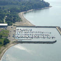
Niagara River Inlet
| Buffalo/Fort Erie, New York United States | |
| 42° 54' 24.12'', -78° 54' 11.87'' | |
| Buffalo Harbor |
You might also consider...


About
Introduction:
The end of the Niagara River where it empties into Lake Erie is located on the shores of Buffalo, NY, and Fort Erie, Canada. Upstream about 18 miles from the rivers mouth is Niagara Falls, where almost 1,000,000 gallons of water per second crash 170 feet, getting its start from Lake Ontario. Buffalo is a great place to stop and explore, and Fort Erie has some interesting historic museums in the downtown area.
Navigating the Water:
Use NOAA Chart 14833.
If you are approaching the Niagara River from Lake Erie, keep in mind that the first three miles of the river are devoid of marinas or marine facilities. The best facilities close to the inlet are located on the Buffalo River or in Black Rock Canal in Buffalo. Other facilities are available about three and a half miles up on the U.S. side of the river with transient slips.
The inlet channel officially runs entirely in Canadian waters. Flashing red buoy EU4 and red nun buoy EU6 mark the western edges of Middle Reefs, and guide you into the river inlet. Farther upstream, green can EU7 and red nun EU8 thread you through Limekin and Bird Island reefs, then then up into the Niagara River. The Peace Bridge (fixed vertical clearance) and International Bridge (22-foot vertical clearance) cross the river about one mile and two miles up the river, respectively.
Local Notices to Mariners:
Local Notices to Mariners are available online from the U.S. Coast Guard.


