Neches River Inlet
| Port Arthur, Louisiana United States | |
| 29° 58' 6.96'', -93° 51' 30.95'' |


About
Introduction:
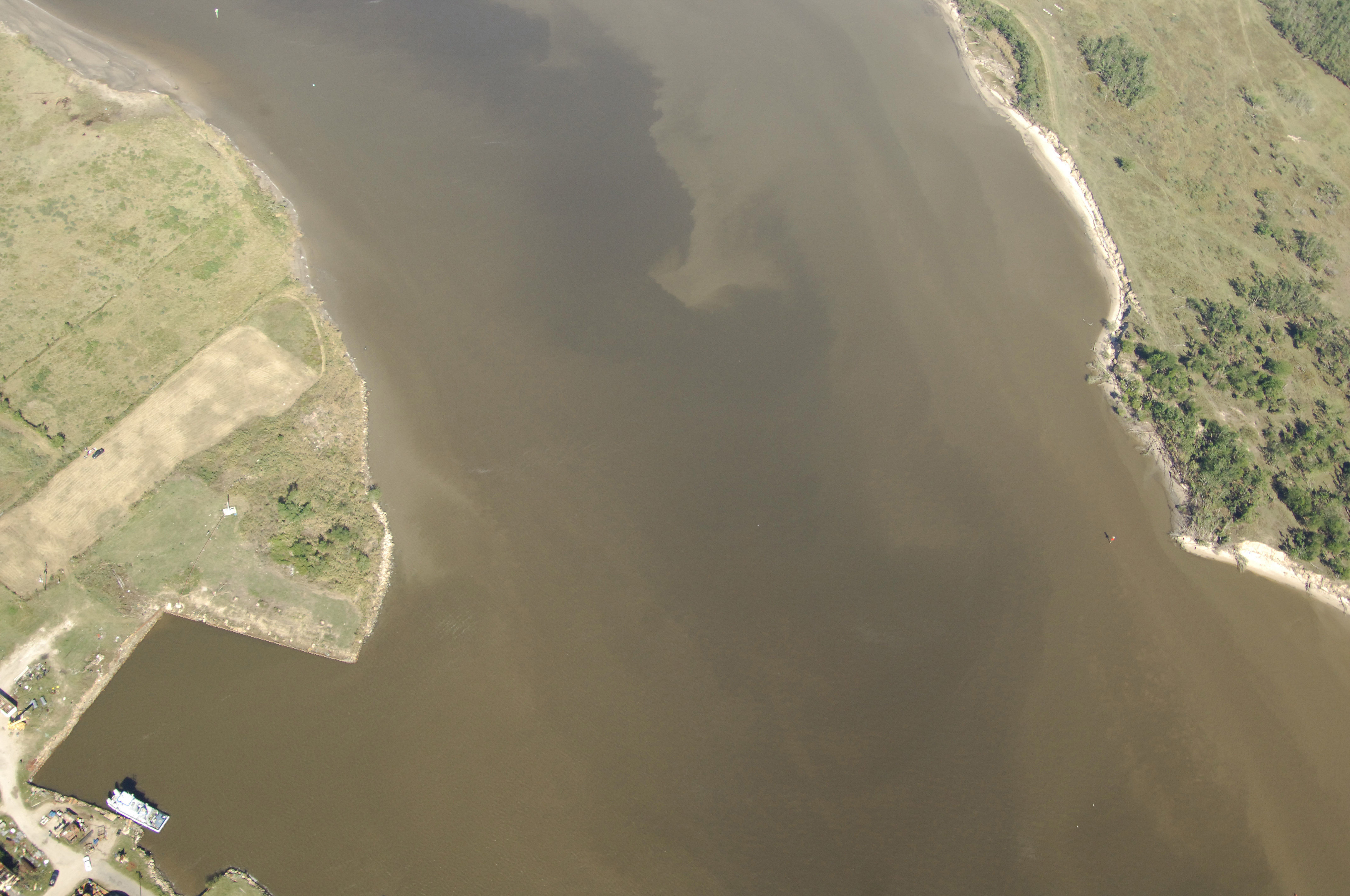
The image above is a view from the south looking northwest near where the Neches River meets the Golf Intracoastal Waterway (GIWW) east of Port Neches and northeast of Port Arthur. Galveston is only 66 miles away to the west at this point, and Lake Charles lies 41 miles to the northeast (both distances as the bird flies). As with many locations along the GIWW west of New Orleans, Port Neches and Port Arthur are primarily commercial ports and recreational facilities can be difficult to find. Consult our marina listings for further details.
Navigating the Water:
Use NOAA Chart 11331.
Entering the Neches River is simple, but currents can be strong in the area during periods of full tidal flow. If possible, time your arrival in the area with a fair current. About 1.3 miles up the Neches River from its confluence with the GIWW, two high fixed bridges with 143- and 173-foot vertical clearances cross the channel offering little challenge to cruising mariners.
Approaching from the east, a lighted range (Range N) will help guide you past Stewts Island until you reach the area near red nun buoy 2, which you will round to port, and then head north to intercept quick flashing 4 and flashing red 6 about .2 mile farther on. After you have cleared flashing red 6, you can follow the line of other lit markers up the river and under the fixed bridges toward port Neches.
Arriving from the south, line up with the lighted range originating from the mouth of the Neches River when you arrive near flashing red 62Aabout two miles south-southeast from the Neches River Inlet near red nun buoy 2, which you will round to port, and then head north to intercept quick flashing 4 and flashing red 6 about .2 mile farther on. After you have cleared flashing red 6, you can follow the line of other lit markers up the river and under the fixed bridges toward port Neches.
Local Notices to Mariners:
See our Local Notices to Mariners blog for updates on the latest conditions and advisories for this area.