Albee Road Bascule Bridge


Details
| Bridge type | Bascule |
| Closed vertical clearance | 14' |
| Vhf | 9 |
| Schedule | Opens on request. |
About
Introduction:
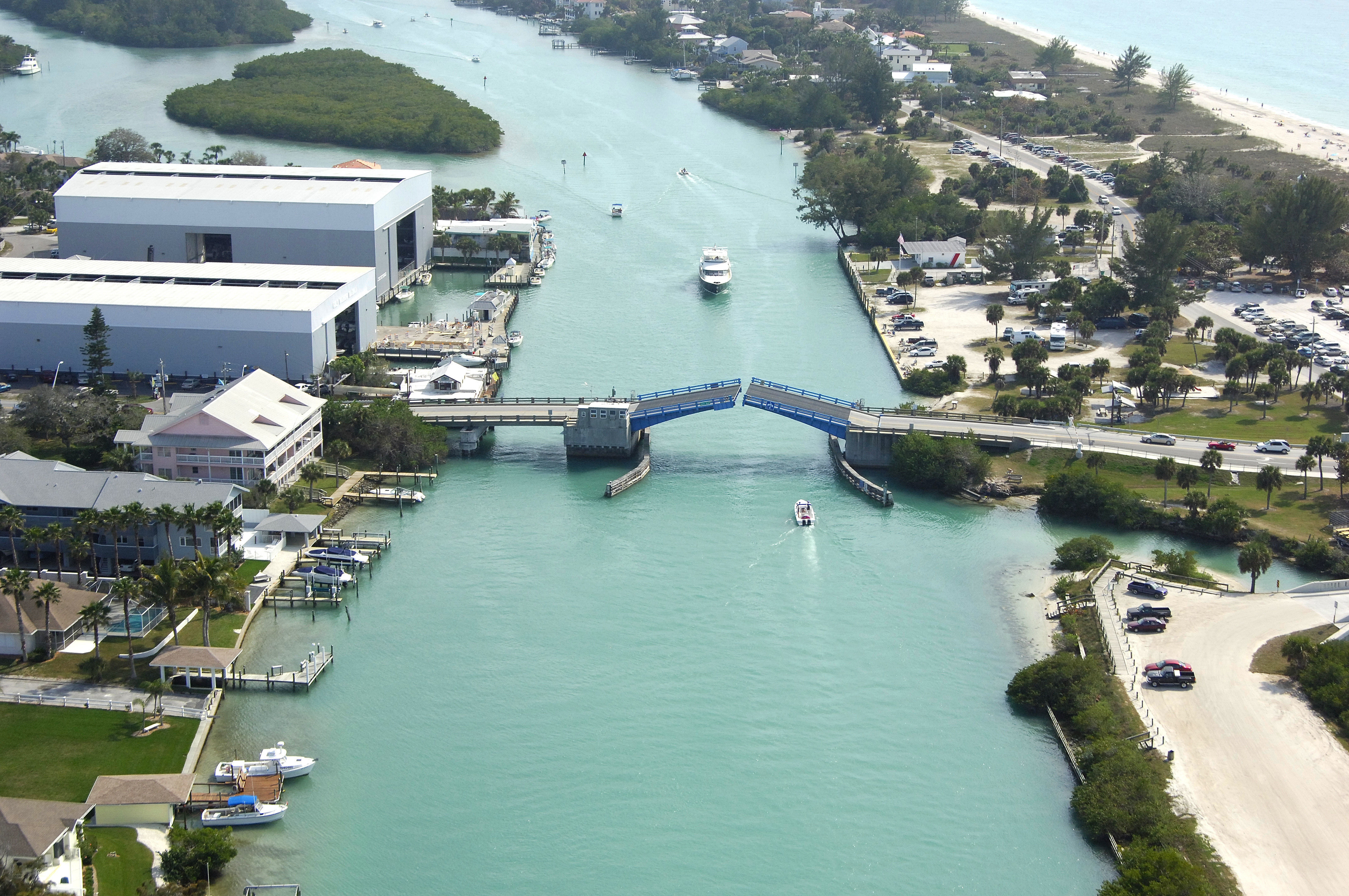
The Albee Road Bascule Bridge is located exactly one mile north of the Venice Inlet, and is tucked behind Casey Key on the Casey River Thorofare about three-quarters of a mile south of GIWW Mile 60. The bridge is easily identified with its bright blue bascule leaves.
Navigating the Bridge:
Use NOAA Chart 11425.
The Albee Road Bascule Bridge has a 14-foot closed vertical clearance with 90 feet of horizontal clearance in the center span. Currents run strong in the casey River Thorofare, as with most location on the GIWW, so if you find yourself idling waiting for the bridge to respond, keep a close eye on your position. Shoaling is prevalent in this stretch of water, but four-foot depths should be available in center channel. Regardless, proceed slowly with a close watch on the depth sounder.
Bridge Schedule:
This bridge opens on demand at all times.
The bridge can be opened by horn signal (one long, one short) or by hailing the bridge tender on VHF Channel 09. (All bridges in the state of Florida must be hailed on VHF Channel 09.)
Local Notices to Mariners:
Local Notices to Mariners are available online from the U.S. Coast Guard.