


Newport Beach Harbor
California United States
Marinas near Newport Beach Harbor
| Name | Reviews | Max LOA | VHF | Dock Depth | Gas / Diesel | Lift / Crane | Wifi | Amps |
|---|---|---|---|---|---|---|---|---|
| Newport Harbor Patrol Guest Dock | 0.0 m | - | Low 0.0 mHigh 0.0' | - | - | - | - | |
| Balboa Yacht Club | - | 0.0' | - | Low 0.0 mHigh 0.0' | - | - | - | - |
| Bahia Corinthian Yacht Club | - | 0.0' | - | Low 0.0 mHigh 0.0' | - | - | - | - |
| Bayside Marina | - | - | - | - | - | - | - | |
| Newport Beach Yacht Club | 0.0 m | - | Low 0.0 mHigh 0.0' | - | - | - | - | |
| Villa Cove Marina | - | - | - | - | - | - | - | - |
| California Recreation Company | - | - | - | - | - | - | - | - |
| Island Marine Fuel | - | - | - | - | - | - | - | - |
| Balboa Yacht Basin | - | 0.0 m | - | Low 0.0 mHigh 0.0' | - | - | - | - |
| Newport Landing Fuel Dock | - | 0.0' | - | Low 0.0 mHigh 0.0' | - | - | - | - |
| Newport Harbor Yacht Club | - | - | - | - | - | - | - | |
| ACY Yachts Newport Beach | - | - | - | - | - | - | - | - |
| Balboa Marina | - | - | - | - | - | - | - | - |
| Newport Dunes Waterfront Resort & Marina | 46.0' | - | Low 0.0 mHigh 0.0' | - | - | 30, 50 | ||
| Bayside Village Mobile Home Park & Marina | - | 0.0' | - | Low 0.0 mHigh 0.0' | - | - | - | - |
Introduction:
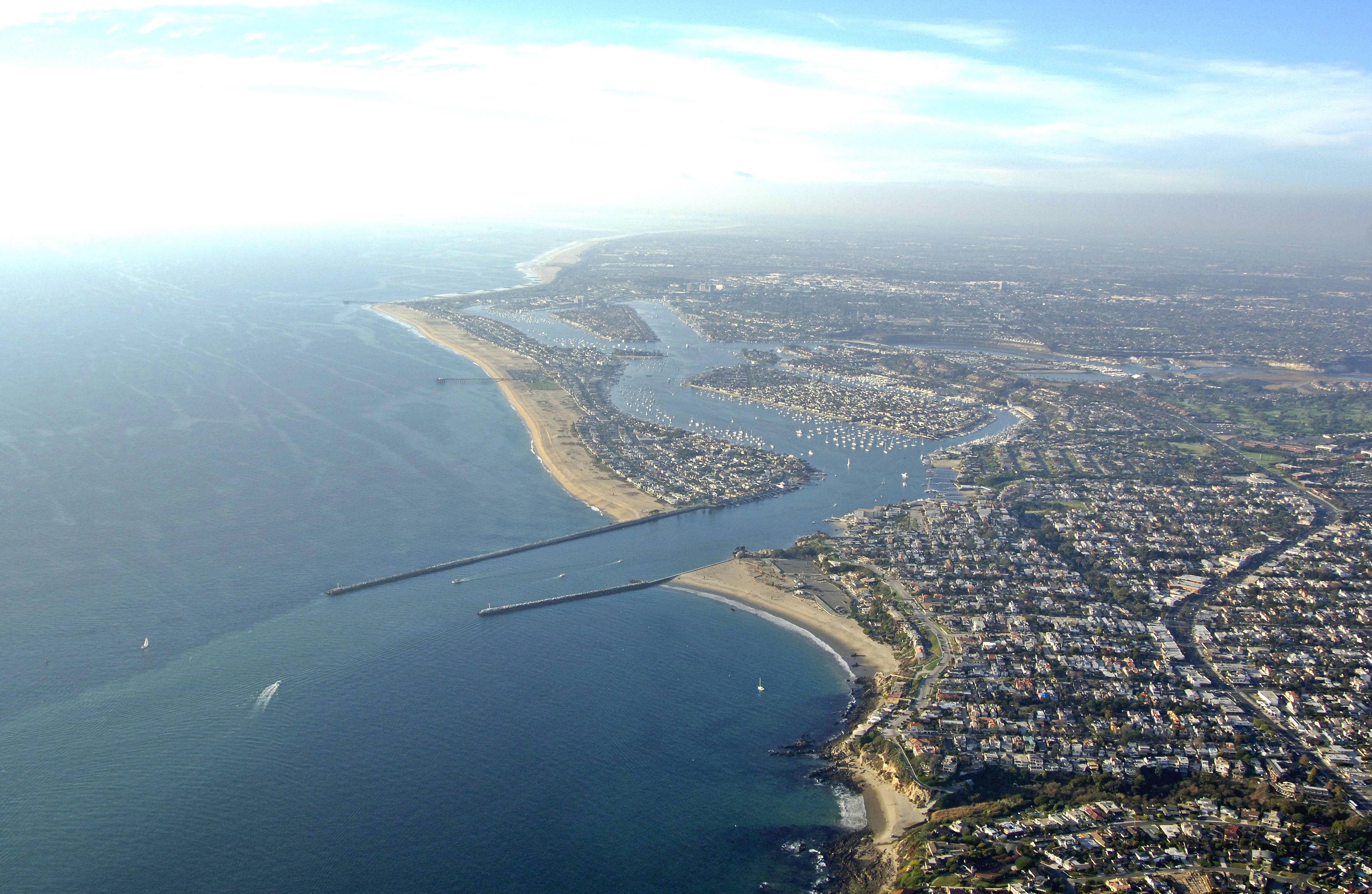
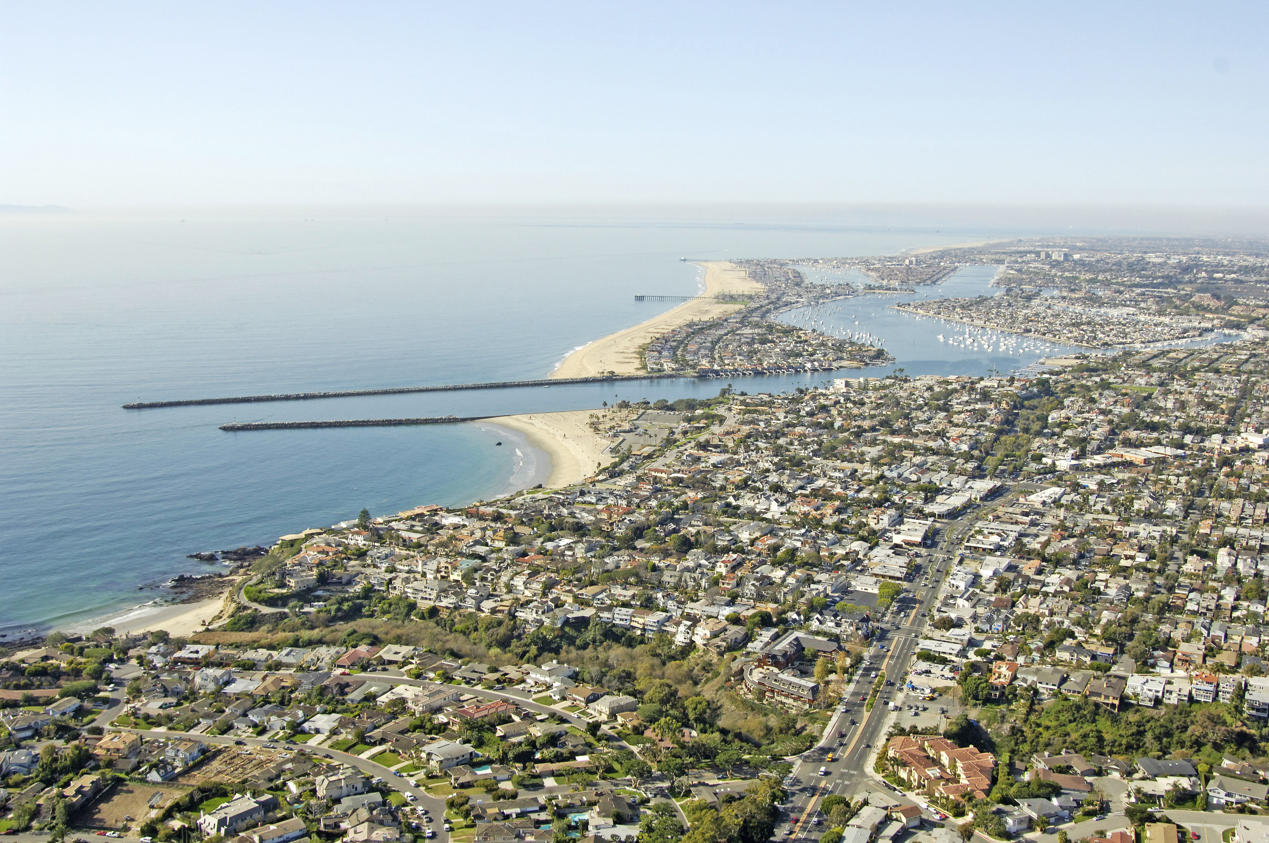
Located 23 miles south of the Los Angeles metropolis and 100 miles of San Diego, Newport beach is a haven for boaters hoping to stay out of the major hustle and bustle of both of those cities, and enjoy the relative peace and quite of this one.
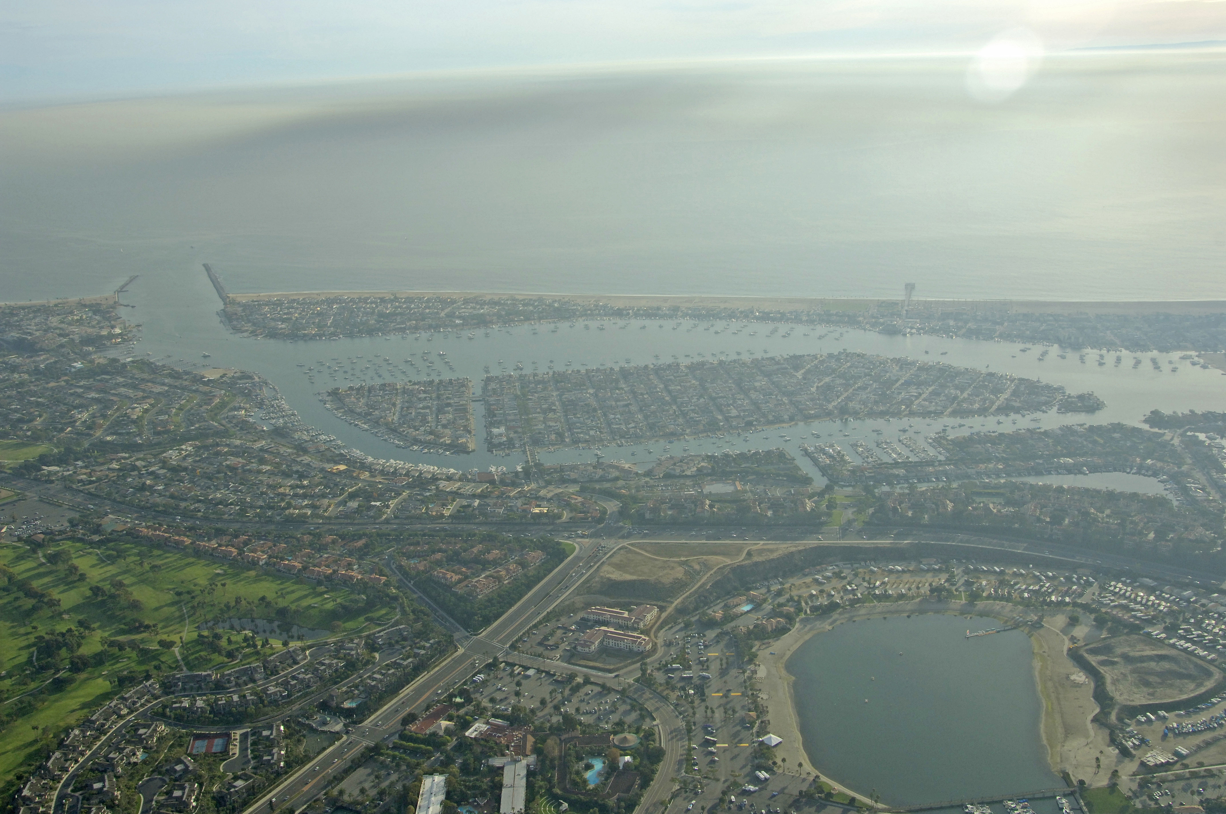
Newport Beach centers on marine activities with a large harbor and famous Balboa Island. Outside of the harbor, smooth and sandy Southern California beaches begged to be walked and played upon as Pacific surf invites swimming and surfing.
Navigating the Water:
Use Chart 18754.
The entrance to Newport beachs Harbor is well marked, deep and easy to enter. Start off by picking up red and white Morse (A) buoy NWP to the southeast of the harbor inlet. Once you have cleared the Morse (A) buoy, set a northwest course toward the harbor breakwaters, which are marked with flashing green 3 and flashing red 4.
Inside, the entrance channel makes a long run northwest, and then bends toward the west. This is officially know as the Corona del Mar Bend, Past this bend, a large fleet of moored boats sits to the starboard and port sides of flashing red 8 as you head west past Balboa Island. Balboa Island and the surrounding waterway is both chocked full of marinas and service facilities for those wishing to tie up, have a repair mad, or take on fuel.
Local Notices to Mariners:
Local Notices to Mariners are available online from the U.S. Coast Guard.
Helpful Links:
Newport Beach Chamber of Commerce