


Corea Harbor
Corea, Maine United States
Marinas near Corea Harbor
| Name | Reviews | Max LOA | VHF | Dock Depth | Gas / Diesel | Lift / Crane | Wifi | Amps |
|---|---|---|---|---|---|---|---|---|
| Corea Lobster Co-op | - | - | - | - | - | - | - | - |
| Young Brothers Moorings | - | - | - | - | - | - | - | - |
| Bunkers Harbor Pier | - | - | - | - | - | - | - | - |
| Schoodic Institute Marine Center | - | 0.0 m | 16 | Low 0.0 mHigh 0.0' | - | - | - | - |
| Winter Harbor Cooperative | - | - | - | - | - | - | - | - |
| Winter Harbor Town Wharf | - | 0.0 m | - | Low 0.0 mHigh 0.0' | - | - | - | - |
| Winter Harbor Yacht Club | 160.0' | 9 | Low 22.0'High 0.0' | - | - | - | - | |
| Millbridge Marina | - | - | - | - | - | - | - | - |
| Bar Harbor Inn | - | 0.0 m | - | Low 0.0 mHigh 0.0' | - | - | - | - |
| Bar Harbor Municipal Pier | 180.0' | 16 | - | - | - | - | 200 | |
| Whale Watch Company | - | 0.0 m | - | Low 0.0 mHigh 0.0' | - | - | - | - |
| Harborside Hotel & Marina | 165.0' | 1 | Low 8.0' | G$5.919/galD$5.739/gal | - | - | ||
| West Cove Boat Yard | - | - | - | - | - | - | - | |
| Sorrento Town Dock | - | 0.0 m | - | Low 0.0'High 0.0' | - | - | - | - |
| Bar Harbor Regency Oceanfront Resort & Marina | - | - | 1 | - | - | - | - | - |
Introduction:
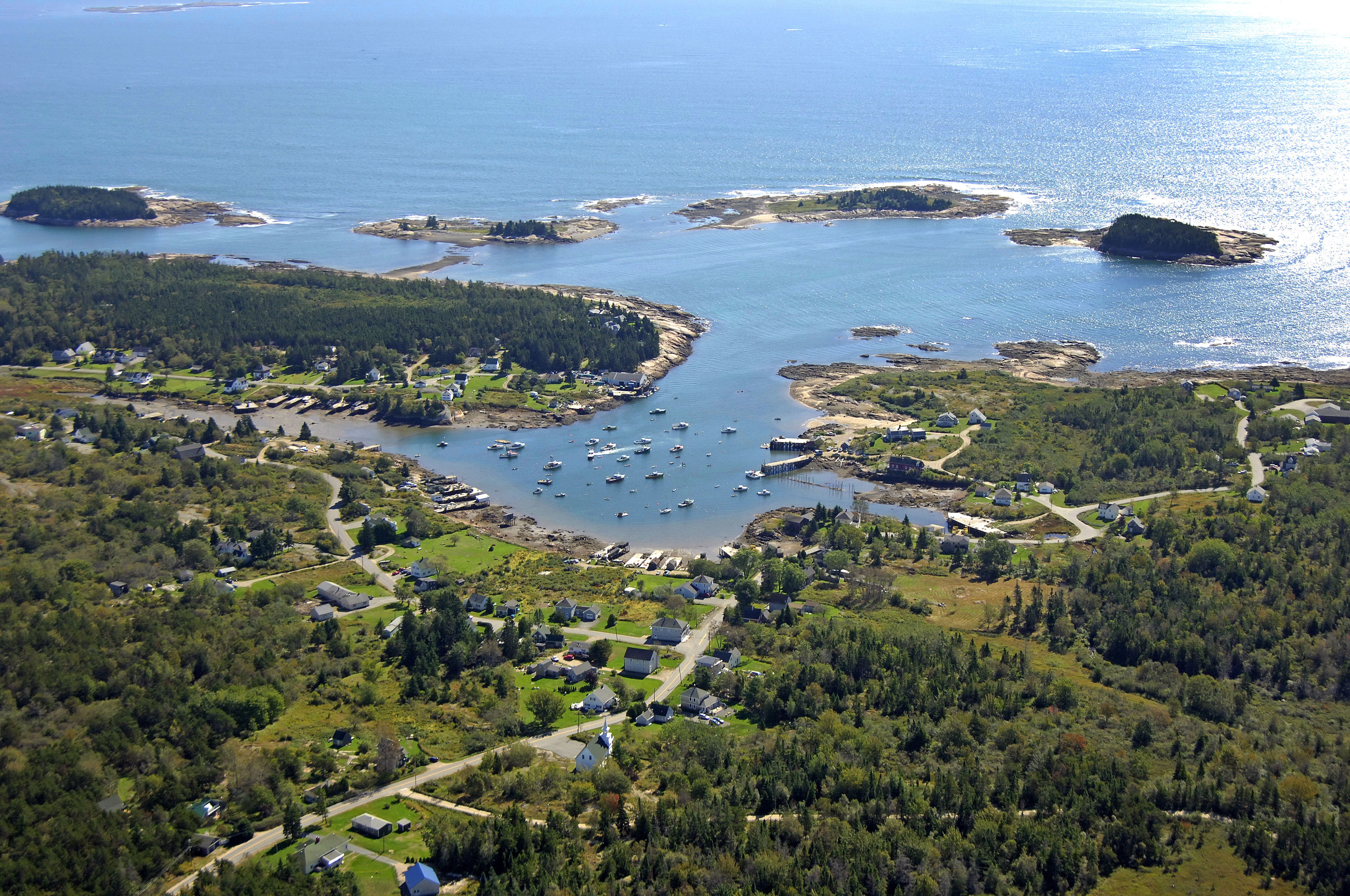
The image above is a view from the southeast looking over the opening to Corea Harbor. Corea Harbor is located east of the Schoodic Peninsula just north of Western Island. Geographically, Corea Harbor is 13 miles northeast of Mount Desert Island and 47 miles northeast of Vinalhaven.
Inside the harbor, facilities are limited (only a lobster co-op is here with a temporary mooring only available while conducting business). You might try asking for a mooring in the harbor at the co-op if you are in dire need of a place to tie up, but do not come here expecting a space to be available.
Navigating the Water:
Use NOAA Chart 13324.
Corea Harbor is reached via an approach from the south through the Atlantic Ocean. First set a course to intercept red and white buoy CE, which is located at an approximate waypoint of N44 22.915 W6757.793. Once you have reached red and white buoy CE, set an approximate course of 348 degrees magnetic for .8 mile. This will put you just northwest of Western Island.
Once you have reached this point, set a new course to the northeast between Western Island and the mainland to arrive at the mouth to Corea Harbor. Depths on the approach and in the harbor range from six to ten feet. Make sure to feel your way in carefully.
Local Notices to Mariners:
Local Notices to Mariners are available online from the U.S. Coast Guard.