


Fort Pierce Harbor
Fort Pierce, Florida United States
Marinas near Fort Pierce Harbor
| Name | Reviews | Max LOA | VHF | Dock Depth | Gas / Diesel | Lift / Crane | Wifi | Amps |
|---|---|---|---|---|---|---|---|---|
| Cracker Boy Boat Works | - | - | - | - | - | - | - | - |
| Derecktor Ft. Pierce | - | 220.0' | - | Low 20.0'High 26.0' | GYes | LYesCYes | - | |
| Taylor Creek Marina | - | - | Low 4.0' | G$5.25/galDYes | - | - | ||
| Safe Harbor Harbortown | - | 68 | Low 6.5' | GYesDYes | LYes | 30, 50, 100 | ||
| Fishermans Wharf City Marina | - | - | - | - | - | - | - | - |
| South Bridge Marina & Storage | - | 0.0 m | - | Low 0.0 mHigh 0.0' | - | - | - | - |
| Causeway Cove Marina | - | 16 | Low 5.0' | - | - | - | ||
| Blue Harbor Marina | - | - | - | - | - | - | - | - |
| Fort Pierce Yacht Club | - | - | - | - | - | - | - | - |
| Harbour Isle Marina | - | - | - | - | - | - | - | |
| Fort Pierce City Marina | 0.0' | 16 | Low 0.0 mHigh 0.0' | G$3.13/galD$2.38/gal | - | 30, 50, 100 | ||
| Fort Pierce Inlet Marina | 90.0' | - | Low 13.0' | - | - | - | 30, 50 | |
| Pelican Yacht Club | 115.0' | 16 | Low 6.0' | G$5.95/galD$5.50/gal | - | - | ||
| Little Jim Bait & Tackle | - | 0.0 m | - | Low 0.0 mHigh 0.0' | - | - | - | - |
| Dockside Marina and Resort | 150.0' | 16 | Low 16.0' | - | - | 30, 50, 3-phase 480 |
Introduction:
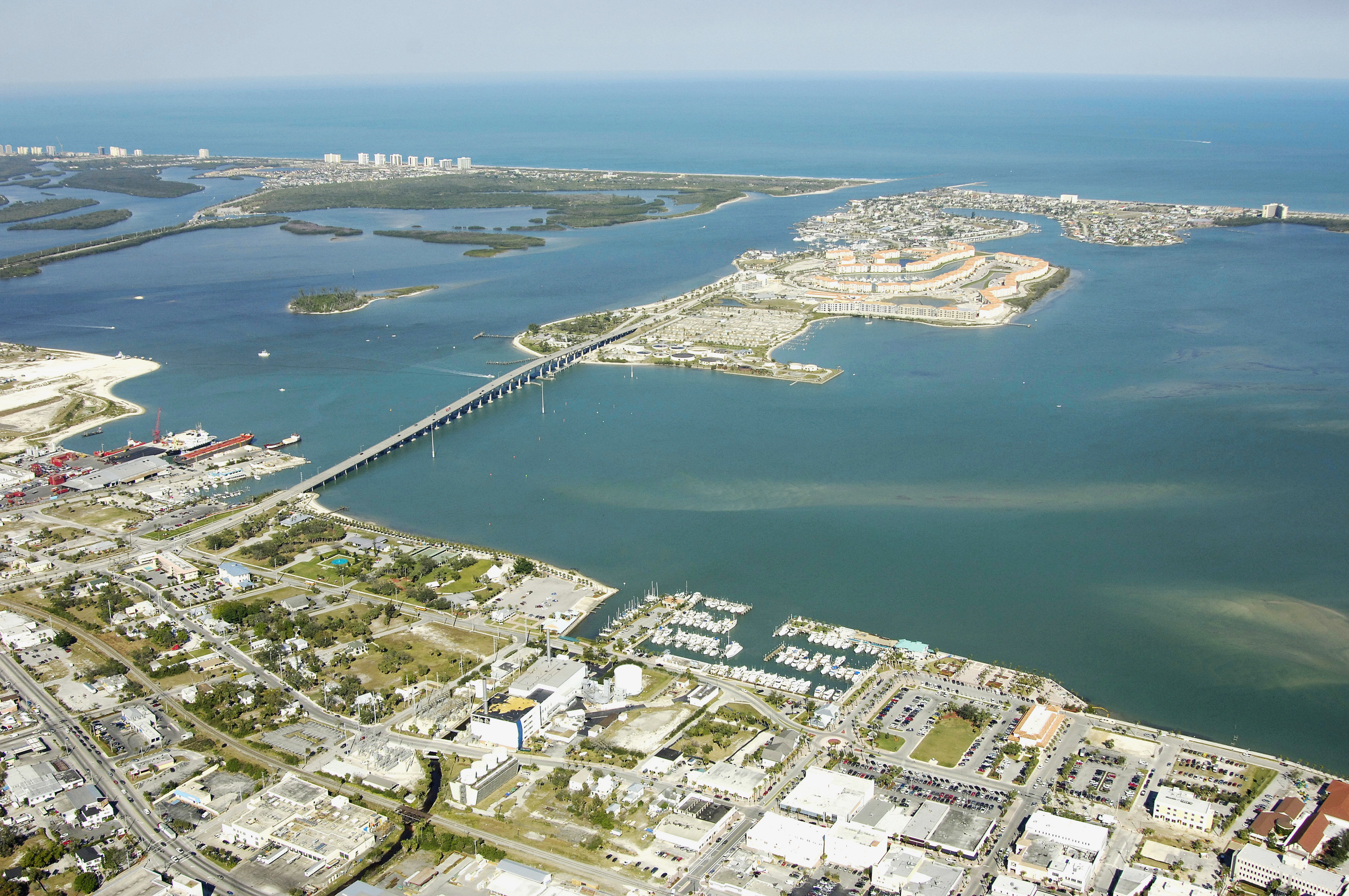
Fort Pierce is located on the beautiful Indian River and offers boaters all the amenities of small town life in a peaceful setting. With the close proximity to the Atlantic Ocean via the Fort Pierce inlet, it affords numerous fishing opportunities for both recreational and commercial fishermen and is a short distance to the Bahamas. Fishing and boating are a major part of the local economy with several boat companies and marinas located in the area.
[i]Information Courtesy of Saint Lucie County Chamber of Commerce[/i]
History:
Although it was incorporated in 1901, Fort Pierce's history begins in 1837 during the Seminole Indian War. U.S. Army Lt. Col. Benjamin Kendrick Pierce established the original fort used as the army's headquarters. After seven years of raging war, the Seminoles took refuge in the Everglades in 1842. This event left Fort Pierce free to develop as a permanent settlement.
Water transportation, fishing and canning of fish were key to the area's early economy. Pineapple was once king, but was replaced by citrus due to Mother Nature. As the city matured and with the advent of the railroad, Fort Pierce developed into the economic commercial hub of the Treasure Coast.
Today, Fort Pierce, a city of 36,000 residents and 17 square miles, is rich in history, and continues its reign as the area's commercial center. Its transportation network has grown to include Interstate 95, the Florida Turnpike, Highway 70 and the St. Lucie County International Airport. As the oldest city in the four-county area, Fort Pierce continues to play an important role in the development of the Treasure Coast. Fort Pierce has that "small town" feeling with the advantages of the "big city."
[i]Information Courtesy of Saint Lucie County Chamber of Commerce[/i]
Navigating the Water:
Use NOAA Chart 11472.
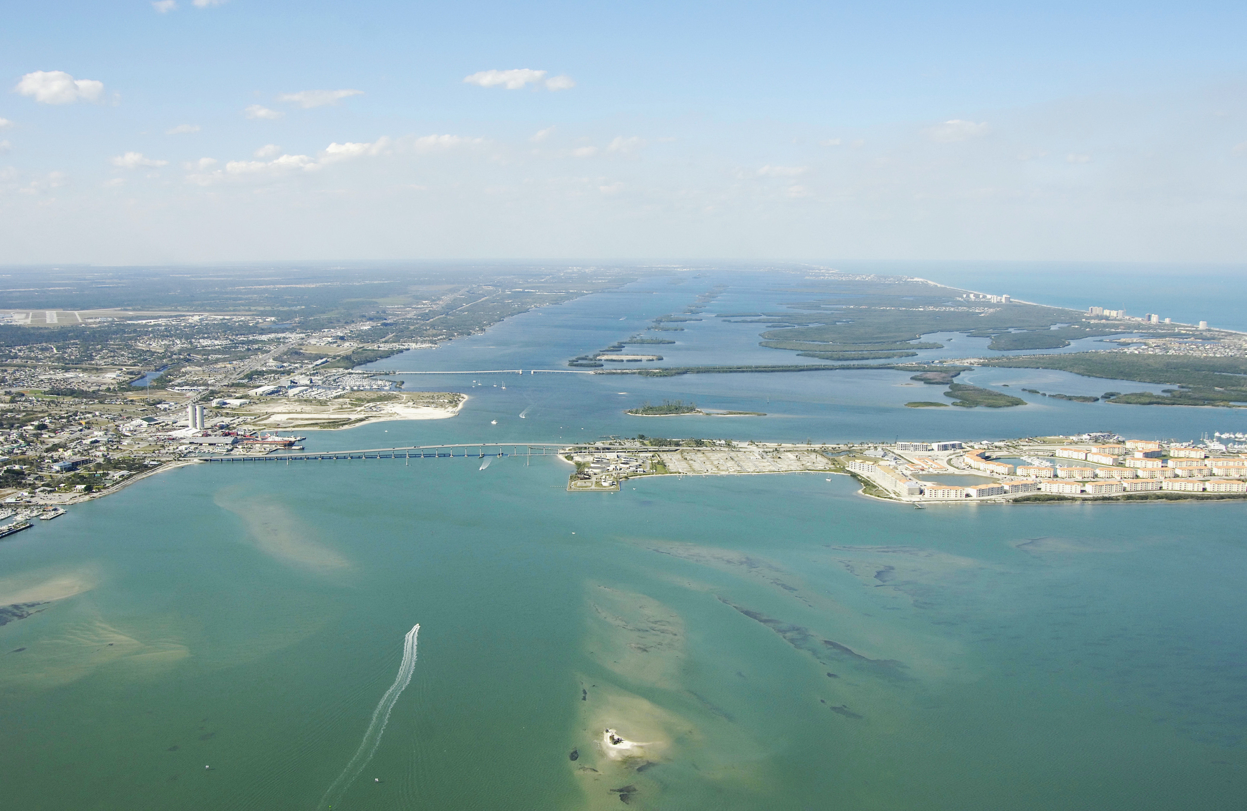
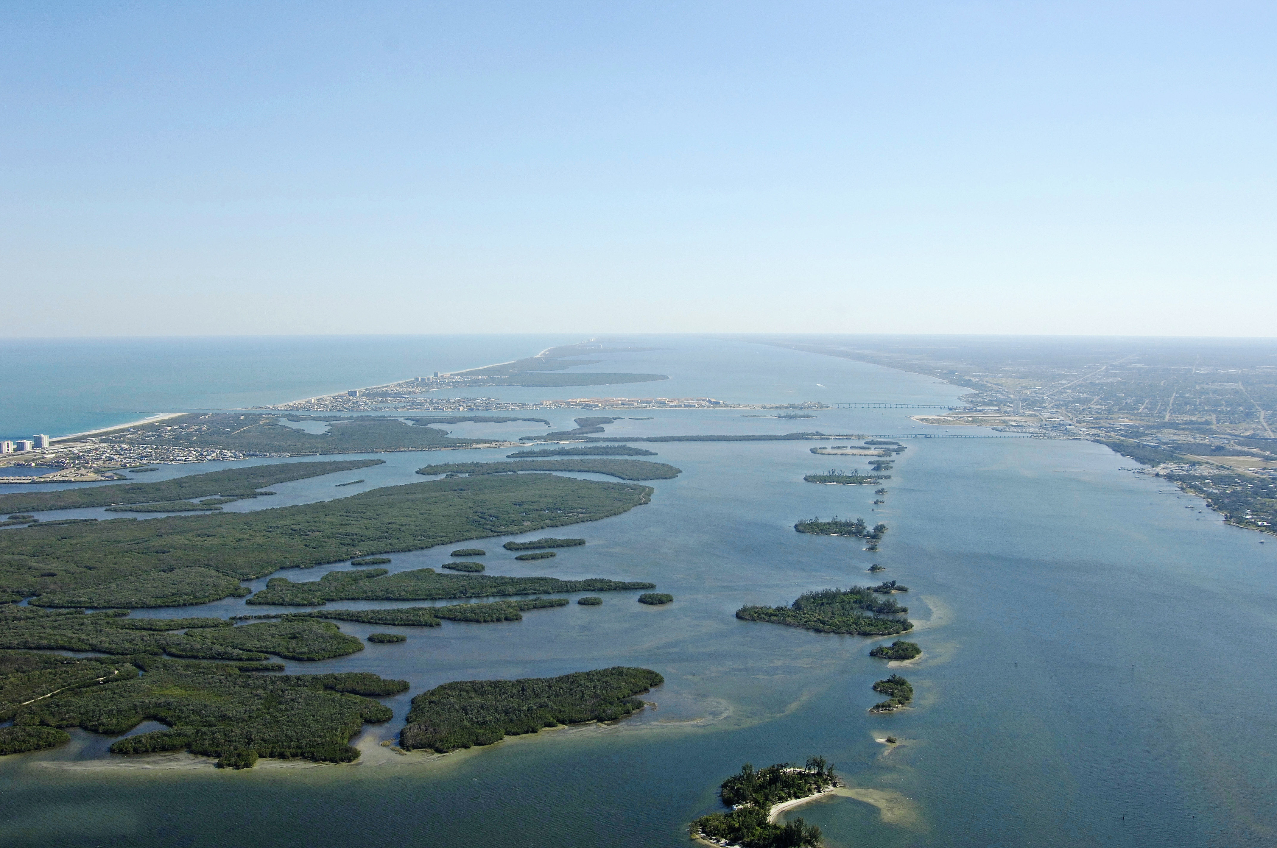
The City of Fort Pierce is located just west across the Atlantic Intracoastal Waterway (ICW)from the Fort Pierce Inlet. For those arriving from the ocean, the Fort Pierce inlet is one of the deepest and most reliable inlets on the coast with a 27-foot mid-channel depth all the way back to the ICW channel.
The Fort Pierce area has two bridges that cross the waterway. The first is a bascule bridge located at Mile Marker 964.8 (closed vertical clearance 26 feet) that opens on demand. The second is the Peter P. Cobb fixed bridge, which has a65-foot vertical clearance. Shoals are not the main concern in Fort Pierce, but currents are. The Fort Pierce Inlet has a strong influence on the local waterways, and the pull of the tide can send some underpowered boats off course here.
Local Notices to Mariners:
Local Notices to Mariners are available online from the U.S. Coast Guard.