


Easton Harbor
Easton, Maryland United States
Marinas near Easton Harbor
| Name | Reviews | Max LOA | VHF | Dock Depth | Gas / Diesel | Lift / Crane | Wifi | Amps |
|---|---|---|---|---|---|---|---|---|
| Easton Point Marina | 0.0' | - | Low 0.0 mHigh 0.0 m | GYes | - | - | - | |
| Talbot County Parks and Rec | - | - | - | - | - | - | - | - |
| Safe Harbor Oxford | 120.0' | 16 | Low 8.0'High 0.0' | G$5.779/galD$6.369/gal | LYesCYes | 30, 50 | ||
| Langwater, Inc. Moorings | - | - | - | - | - | - | - | - |
| Campbell's Custom Yachts | - | 0.0' | - | Low 0.0 mHigh 0.0' | GYesDYes | - | - | - |
| Cutts & Case Shipyard | - | 0.0' | - | Low 0.0 mHigh 0.0' | - | - | - | - |
| Campbell's Boatyard at Jack's Point | - | 120.0' | 16 | - | - | LYesCYes | 30, 50 | |
| DiMillo's Oxford | 55.0' | 16 | - | - | LYes | 30 & 50 | ||
| Tred Avon Yacht Club | 107.0' | - | - | - | - | - | ||
| St Michaels Harbour Inn Marina & Spa | 150.0' | 16 | Low 10.0' | GNearbyDNearby | - | 30 Amp 50 Amp 100 Amp | ||
| Chesapeake Bay Maritime Museum | 229.0' | 16 | Low 10.0' | GYesDYes | - | 30, 50, 100 | ||
| Campbell's Town Creek Boatyard | 45.0' | - | - | - | - | - | ||
| Sandaway Suites & Beach | - | - | Low 12.0'High 300.0' | - | CYes | - | ||
| St Michaels Marina LLC | 230.0' | 16 | Low 9.0' | G$5.259/galD$4.999/gal | - | 30 AMP, 50 AMP, 100 AMP | ||
| Higgins Yacht Yard | 100.0' | 16 | Low 6.0' | - | LYesCYes | 30 amp & 50 amp |
Introduction:
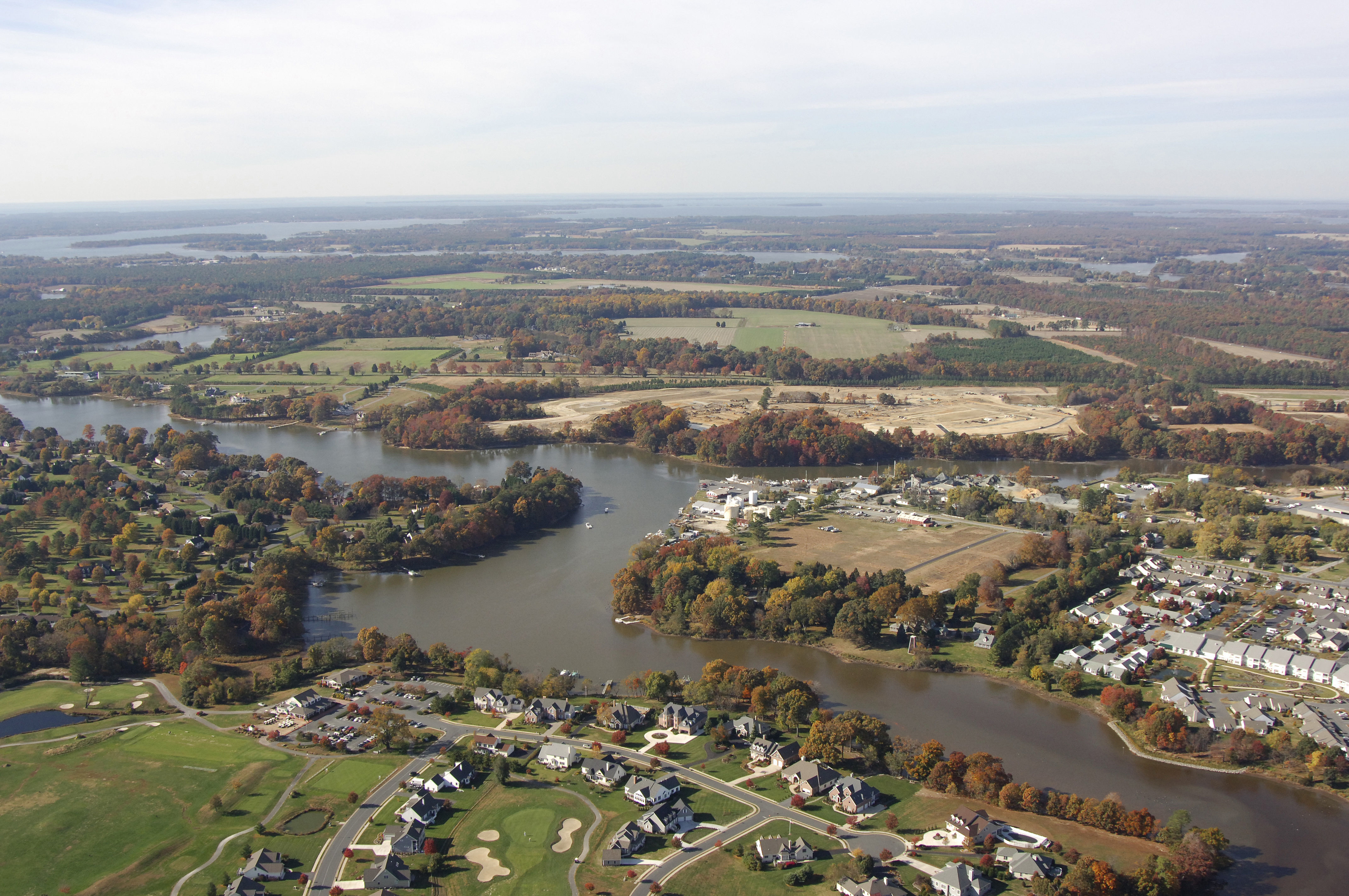
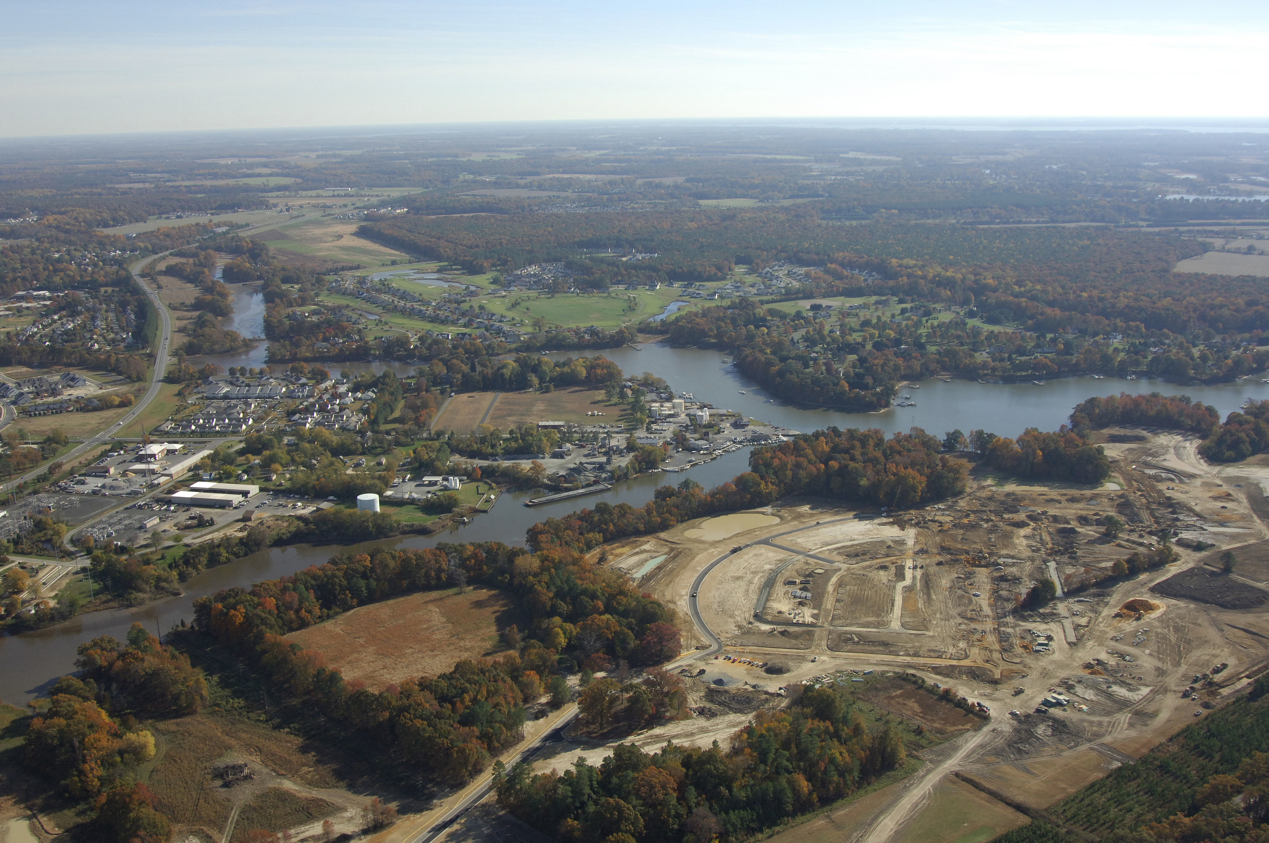
Easton is situated about eight miles upstream from Oxford, Md on the Tred Avon River in Talbot County. Easton is an important part of the Talbot Count (and Lower Eastern Shore) economy with its manufacturing, seafood packing, tourism and boating interests. Easton is also cut in two by U.S. Route 50, and a major part of the local economy is generated from beach-going traffic that passes through the city.
Easton Point Marina Stands at the foot of the city at, as the name suggests, Easton Point. The marina does not accept transients, but repairs can be facilitated here, if necessary.
Navigating the Water:
Use NOAA Chart 12266.
The entrance to the Tred Avon River is locate on the northern side ofthe Choptank River behind Benoni point directly north of the Choptank River Light (flashing white every four seconds). From the Choptank River Light, head north to flashing green 1, which marks the shoal extending southeast from Benoni Point. From here, flashing red buoy 2 is your next mark, and a series of aids will lead you farther upstream.
Depths in and around the Easton Point area range from five to 11 feet, but mariners should be advised that Papermill Pond shoals quickly to three-foot depths at Easton Point itself.
Local Notices to Mariners:
Local Notices to Mariners are available online from the U.S. Coast Guard.