


Scituate Harbor
Scituate, Massachusetts United States
Marinas near Scituate Harbor
| Name | Reviews | Max LOA | VHF | Dock Depth | Gas / Diesel | Lift / Crane | Wifi | Amps |
|---|---|---|---|---|---|---|---|---|
| Scituate Harbor Yacht Club | 0.0' | 9 | Low 0.0 mHigh 0.0' | - | - | - | ||
| Satuit Boat Club | 0.0' | 9 | Low 0.0 mHigh 0.0' | - | - | - | - | |
| TPG Scituate Harbor | 70.0' | 9 | Low 7.0' | G$5.25/galD$5.45/gal | - | 30 % 50 | ||
| Bulman Marine | - | - | - | - | - | - | - | - |
| Scituate Wharf | - | - | - | - | - | - | - | - |
| The Quarterdeck | - | 0.0 m | - | Low 0.0 mHigh 0.0 m | - | - | - | - |
| TKO Keileys Rest | - | 0.0 m | - | Low 0.0 mHigh 0.0 m | - | - | - | - |
| TPG Mill Wharf | 55.0' | 9 | Low 21.3' | G$5.25/galD$5.45/gal | - | 30, 50 | ||
| Scituate Boat Works | 0.0' | 9 | Low 0.0'High 0.0' | - | - | - | - | |
| Scituate Harbor Cole Parkway Marina | 125.0' | 9 | Low 9.0' | - | LYesCYes | - | 30/50 | |
| Scituate Marine Park Marina & Maritime Center | 50.0' | 9 | Low 8.0' | GYesDYes | LYesCYes | - | 30/50 | |
| Foster Rigging and Yacht Service | - | 0.0 m | - | Low 0.0 mHigh 0.0' | - | - | - | - |
| South Shore Dry Dock Marine | - | - | - | - | - | - | - | - |
| Scituate Launch/Waterline Moorings | - | 0.0 m | 9 | Low 0.0'High 0.0' | - | - | - | - |
| Scituate Town Dock | - | 0.0 m | - | Low 0.0 mHigh 0.0' | - | - | - | - |
Introduction:
Scituate is a small to mid-sized seacoast community located between Boston Harbor and Plymouth Harbor. In the 375 years since its incorporation, it has evolved from a summer colony to a residential community but has managed to retain some of the flavor of its past. Ocean-related recreational activities make it a very desirable place to visit and explore.
The Town Pier accommodates a working fishing fleet and that, coupled with three business areas, represents commercial interests in the town. Along with extensive marine facilities, most of the harbor is covered by an large mooring field that is administered by several entities (instructions for payment and water taxis service are labeled on most moorings). There are plenty of shopping, dining and exploration opportunities ashore.
Historic points of interest include: Scituate Lighthouse, The Old Oaken Bucket Homestead and Well, The Lawson Tower, Stockbridge Mill and the Cudworth House as well as the Little Red School House which is the home of the Scituate Historical Society. Scituate also has a strong sense of its history and commemorates its founding in August each year via the celebration of "Heritage Days."
Navigating the Water:
Use NOAA Chart 13267.
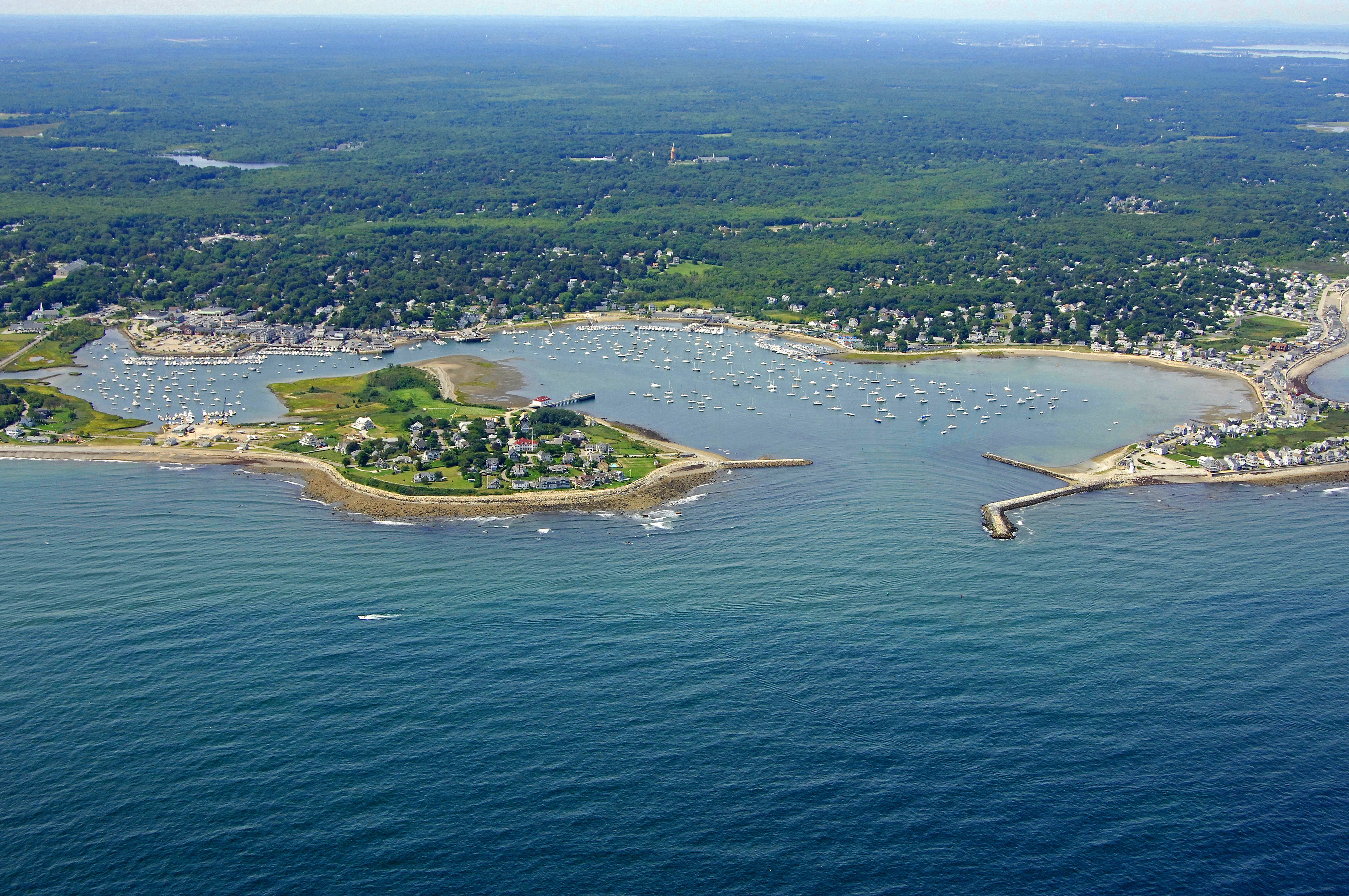
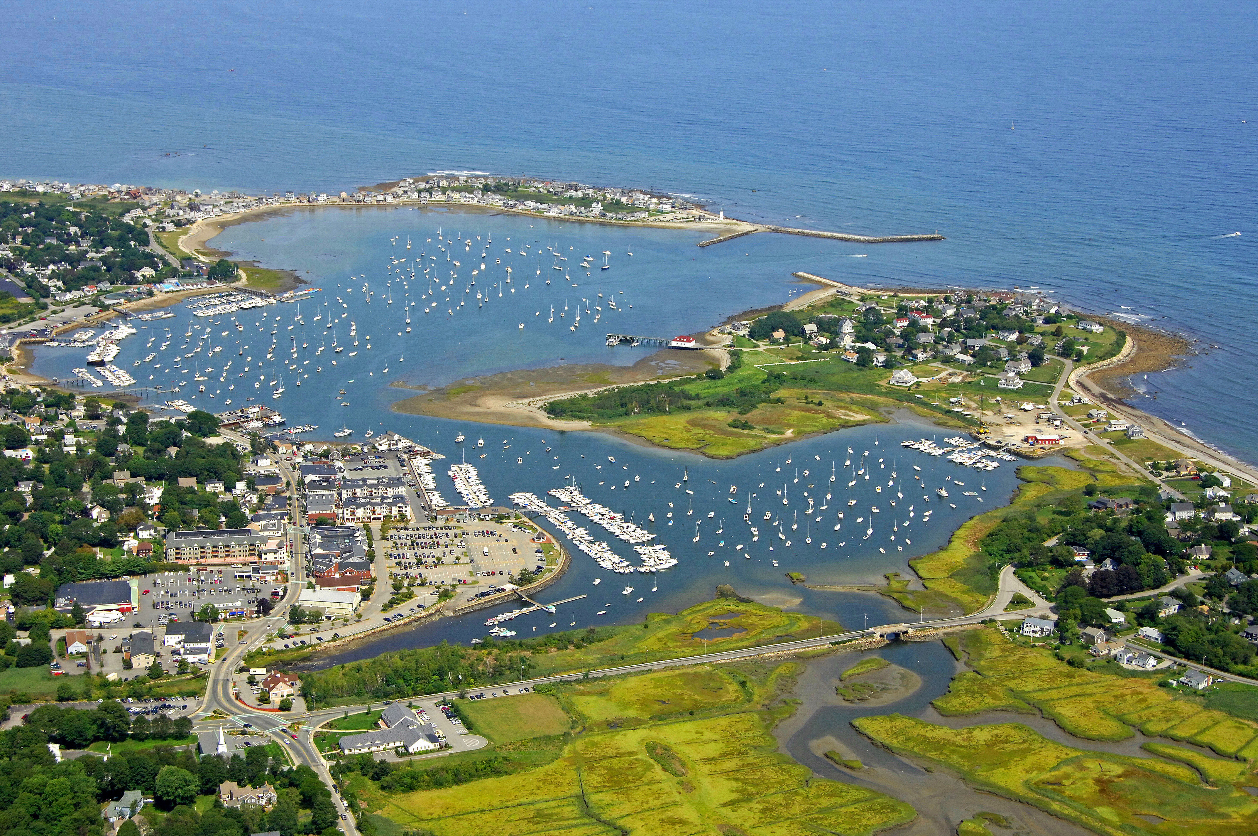
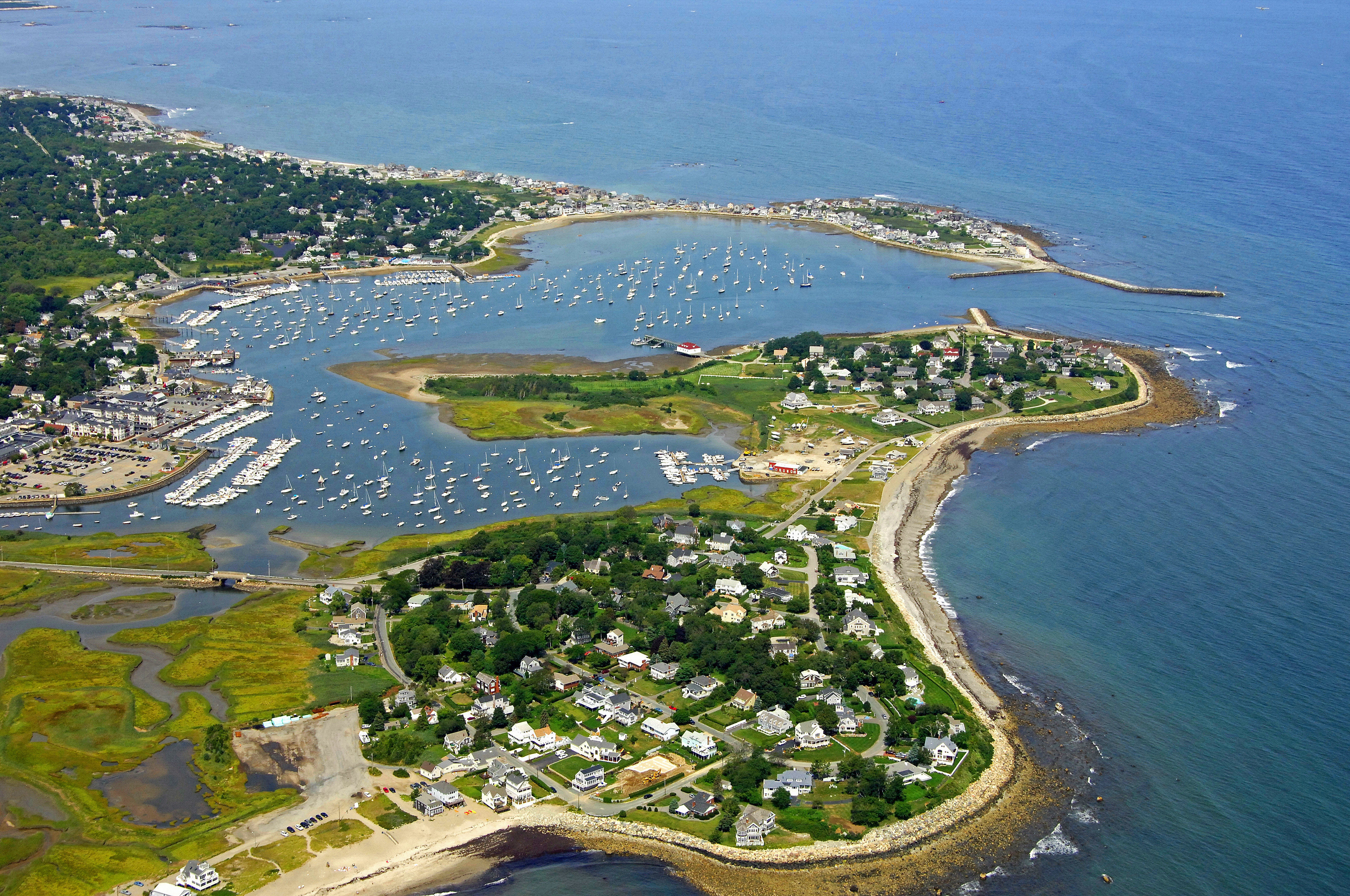
Red and white Morse (A) gong buoy "SA" starts out the approach to Scituate Harbor from the Atlantic, about one mile from the breakwatered entrance. Once you have begun your approach and cleared red and white Morse (A) gong buoy "SA," keep an eye out for red nun buoy "2" and green can "1." Directly after these marks, flashing red "2A" marks the north breakwall in Scituate Harbor.
The marina facilities line the west shore of Scituate Harbor starting at red nun "8," and continue down to the southern end of the harbor. The entire harbor is lined with moorings that are managed by the local yacht club. Just tie up to an available mooring ball and a boat will come around at some point and collect the fee. Water taxi service is available with a hail on the VHF.
Click here to see a map of Scituate Harbor
Navigating the Water:
Use NOAA Chart 13267.
Red and white Morse (A) gong buoy "SA" starts out the approach to Scituate Harbor from the Atlantic, about one mile from the breakwatered entrance. Once you have begun your approach and cleared red and white Morse (A) gong buoy "SA," keep an eye out for red nun buoy "2" and green can "1." Directly after these marks, flashing red "2A" marks the north breakwall in Scituate Harbor.
The marina facilities line the west shore of the harbor starting at red nun "8," and continue down to the southern end of the harbor. The entire harbor is lined with moorings that are managed by the local yacht club. Just tie up to an available mooring ball and a boat will come around at some point and collect the fee. Water taxi service is available with a hail on the VHF.
History:
The name Scituate is derived from an Indian word which the early settlers understood as Satuit, which means "Cold Brook", and referred to the small stream flowing into the harbor; this they spelled in various ways as Sityate, Cituate, Seteat, etc., and it was not until about 1640 that the name came to be universally spelled in its present form.
In some part of the years 1627 or 1628 a group from Plymouth augmented by new arrivals from the County of Kent in England came here and formed the first permanent settlement. They laid out their village a mile or so back from the coast behind one of the cliffs, established a public way or street, which they named Kent Street, which name it still bears, and allotted space on this street to the various householders forming the Company.
Today, Scituate is primarily a residential community that relies heavily on local tourism and industrial manufacturing to keep its coffers full.
Places to Visit:
Scituate's primary interests ashore are with history, and there are several historic sites and museums dedicated toward that slant. On the waterfront, there are miles of harbors and coves to explore in the Scituate Harbor area as well as a vibrant and active sportfishing industry.
Here are a few of our favorites nearby Scituate Harbor:
Scituate Lighthouse - 100 Lighthouse Road
Peggoty Beach - Peggoty Beach Road
Lawson Tower - 330 First Parish Road
Stellwagen Bank National Marine Sanctuary - Massachusetts Bay
Stockbridge Grist Mill - 6 Country Way
Maritime and Mossing Museum - 301 Driftway
Where to Eat, Drink, and Shop in Scituate:
Scituate Harbor is located steps away from downtown with many great restaurants and shopping that the area has to offer.
Here are some of the best places to eat, drink, and shop nearby Scituate Harbor:
Lucky Finn Cafe (Breakfast & Cafe)- 206 Front Street
Barker Tavern (Food & Drink) - 21 Barker Road
Galley Kitchen and Bar (Food & Drink) - 95 Front Street
Riva Restaurant (Fine Dining) - 116 Front Street
Mill Wharf Restaurant (Fine Dining)- 23 Mill Wharf Plaza
Circe’s Grotto (Sandwiches & Bakery) - 344 Gannett Road
Downtown (Shopping) - Front Street