


Urbanna Harbor
Urbanna, Virginia United States
Marinas near Urbanna Harbor
| Name | Reviews | Max LOA | VHF | Dock Depth | Gas / Diesel | Lift / Crane | Wifi | Amps |
|---|---|---|---|---|---|---|---|---|
| Urbanna Town Marina at Uptons Point | 0.0' | 68 | Low 0.0 mHigh 0.0' | - | - | 30 / 50 | ||
| Urbanna Boat Yard and Marina (URBBY) | - | 16 | - | G$6.20/galD$5.75/gal | LYes | - | ||
| Urbanna Yachting Center | 0.0 m | - | Low 0.0 mHigh 0.0 m | - | - | - | - | |
| Urbanna Harbor Marina | - | 0.0' | - | Low 0.0 mHigh 0.0' | - | - | - | 30 / 50 |
| The Boatyard at Christchurch | - | - | - | - | - | - | - | - |
| Bethpage Camp-Resort | - | 0.0' | - | Low 0.0 mHigh 0.0' | - | - | - | - |
| Sunset Point Marina | - | 42.0' | - | Low 4.0' | - | - | - | |
| Remlik Marina | - | - | 16 | - | GYes | - | - | - |
| Greenvale Marina | 50.0' | 68 | Low 5.0'High 0.0' | GYes | - | - | 30 | |
| Yankee Point Marina | 135.0' | 16 | Low 10.0'High 125.0' | G$7.24/galD$6.82/gal | LYes | 50 Amps | ||
| Carter's Cove Marina | 50.0' | 16 | Low 8.0'High 0.0' | - | - | 30, 50 | ||
| Rappahannock River Yacht Club | - | - | - | - | GNearbyDNearby | - | - | - |
| Rappahannock Yachts Sanders Yacht Yard | 0.0' | 16 | Low 0.0 mHigh 0.0' | - | LYes | - | 15/30/50 | |
| Seabright Marina | - | 0.0' | - | Low 0.0 mHigh 0.0' | - | - | - | - |
| Tides Inn Marina | 150.0' | 16 | Low 7.0'High 90.0' | G$5.25/gal | - | 30/50/100 |
Introduction:
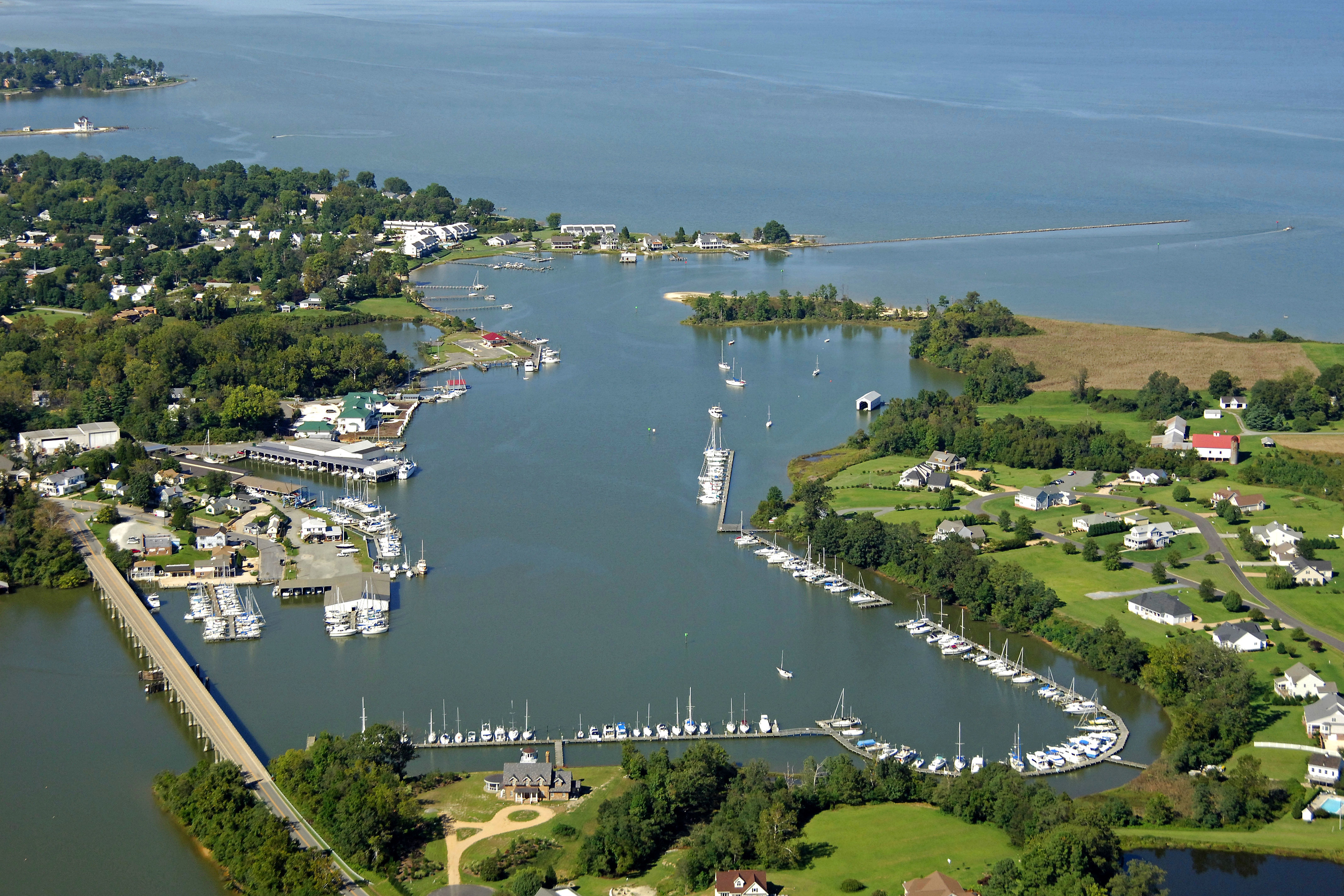
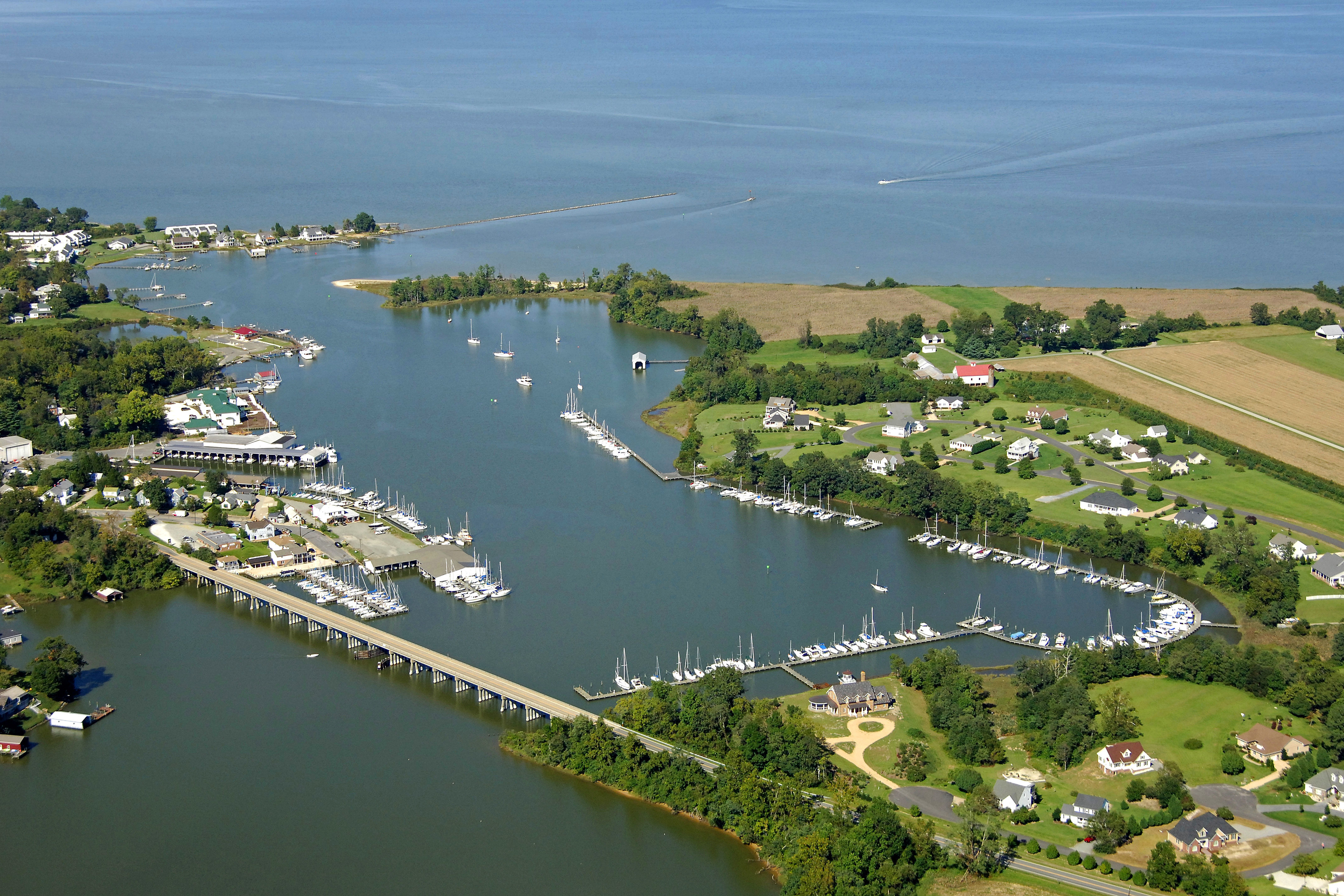
Located about 11 miles upstream from Deltaville on the Rappahannock River, Urbanna is a well-equipped and hospitable place to take a rest and kick your feet up. Urbanna Creek is extremely well-protected, and has a plethora of marine facilities, including haul-out and repair facilities. Urbanna plays host to the Urbanna Oyster Festival each year in November, an event that swells the towns population by thousands over a two-day period.
Navigating the Water:
Use NOAA Chart 12237.
Once you have cleared the Rappahannock River Bridge (110-foot fixed vertical clearance) near the opening of the Rappahannock River, set a course upstream toward Urbanna Creek, making sure to mind the mid-channel buoys all the way up.
From Towles Point, at flashing red bell buoy 6, head toward flashing red 2, near the northern breakwall for Urbanna Creek. Once you have reached the lighted mark, head in to flashing green 5 at Bailey POint, and then up Urbanna Creek to the town center. A 21-foot fixed vertical clearance bridge limits travel farther upstream at state Route 227. Most of the marine facilities lie on the east shore of the creek.
Local Notices to Mariners:
Local Notices to Mariners are available online from the U.S. Coast Guard.