


Cape May Harbor
Cape May, New Jersey United States
Marinas near Cape May Harbor
| Name | Reviews | Max LOA | VHF | Dock Depth | Gas / Diesel | Lift / Crane | Wifi | Amps |
|---|---|---|---|---|---|---|---|---|
| Corinthian Yacht Club of Cape May | - | 0.0 m | - | Low 0.0'High 0.0' | - | - | - | - |
| Snug Harbor Marina | 0.0' | - | Low 0.0'High 0.0' | - | - | - | - | |
| Canyon Club Resort Marina | 125.0' | 16 | Low 6.0' | GYesDYes | LYes | 30, 50, 100 | ||
| Utsch's Marina | 0.0' | - | Low 0.0 mHigh 0.0' | GYesDYes | - | - | - | |
| Port Marina & Restaurant | 55.0' | 66 | - | G$4.37/galD$3.98/gal | - | 30/50 | ||
| Cape May Harbor Village Yacht Club | - | 0.0 m | - | Low 0.0 mHigh 0.0' | - | - | - | - |
| Mill Creek Marina | - | 0.0' | - | Low 0.0 mHigh 0.0' | - | - | - | - |
| Tony's Marine Railway | - | - | - | - | - | - | - | - |
| Devil's Reach Marina | - | 0.0 m | - | Low 0.0'High 0.0 m | - | - | - | - |
| South Jersey Marina | - | 9 | Low 10.0' | GYesDYes | - | - | ||
| Seven Evans Marina | - | - | - | - | - | - | - | - |
| Island Creek Tower Marina | - | 0.0 m | - | Low 0.0 mHigh 0.0' | DYes | - | - | - |
| Bree-Zee-Lee Yacht Basin | 0.0' | - | Low 0.0'High 0.0' | GYesDYes | - | - | - | |
| Miss Chris Marina | 0.0' | - | Low 0.0 mHigh 0.0' | G$4.299/galD$4.299/gal | - | - | ||
| Rosemans Boat Yard | - | - | - | - | - | - | - | - |
Introduction:
Cape May is located at the southern end of New Jersey off the Atlantic Ocean and Delaware Bay about 40 miles south of Atlantic City and 30 miles across the water from Rehoboth Beach, DE. Its proximity to the Delaware Bay and Atlantic Ocean make it popular stop with cruising boaters waiting out weather, or just cruising in to explore.
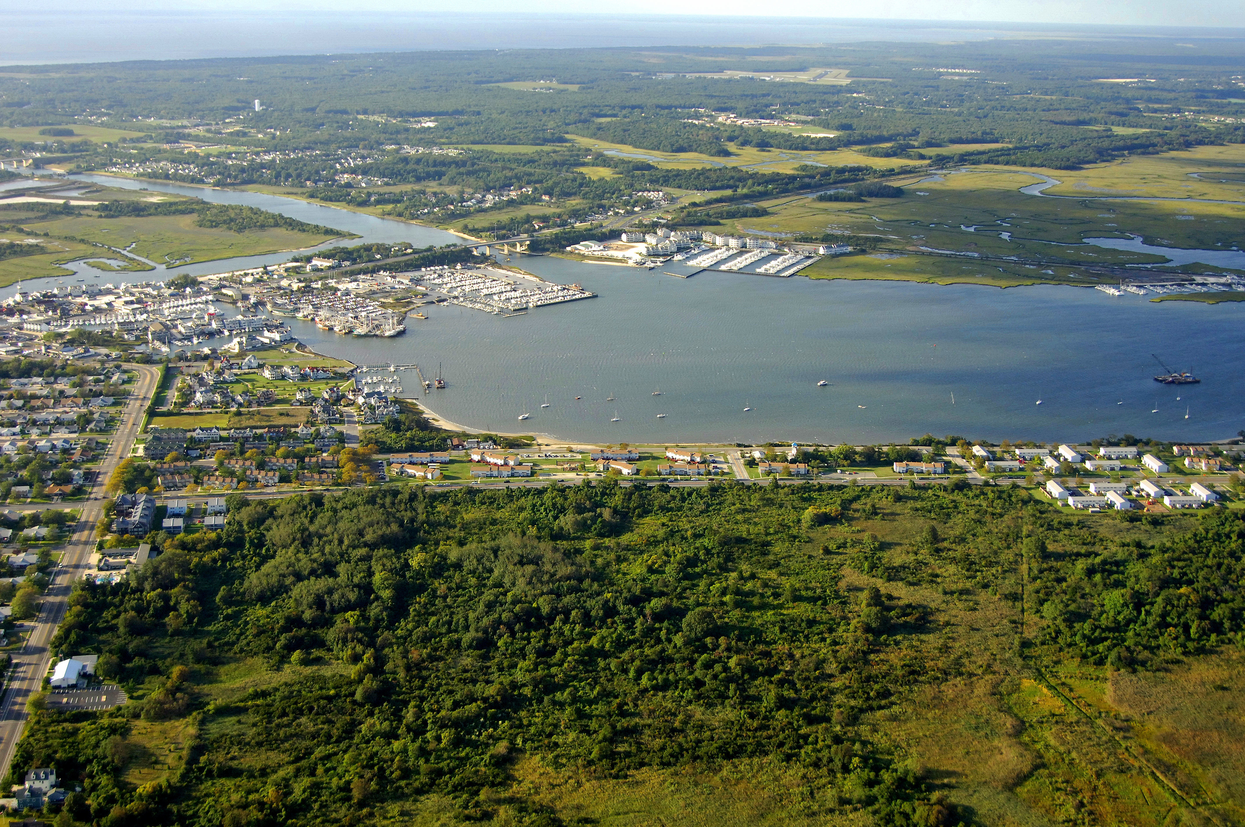
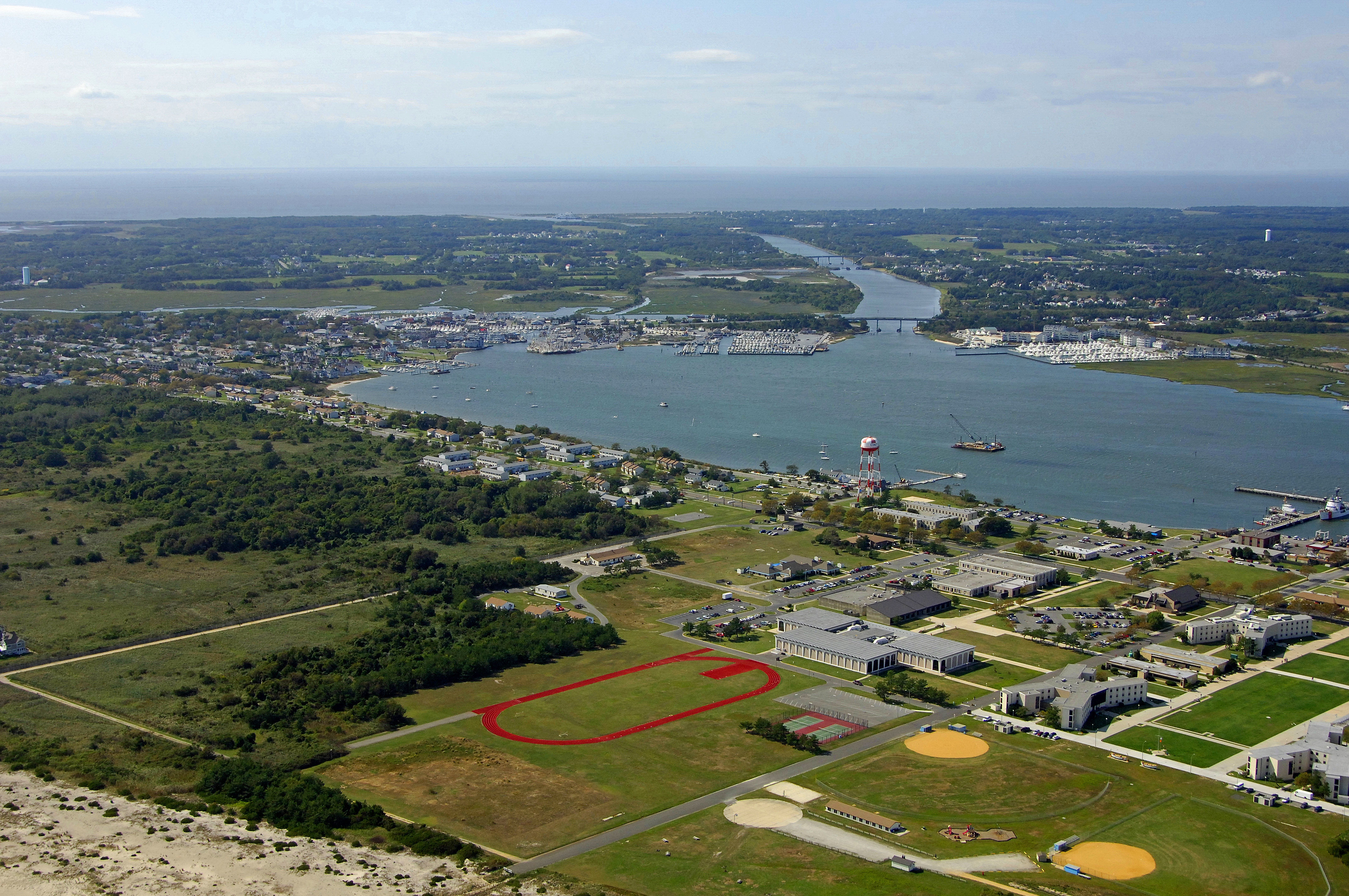
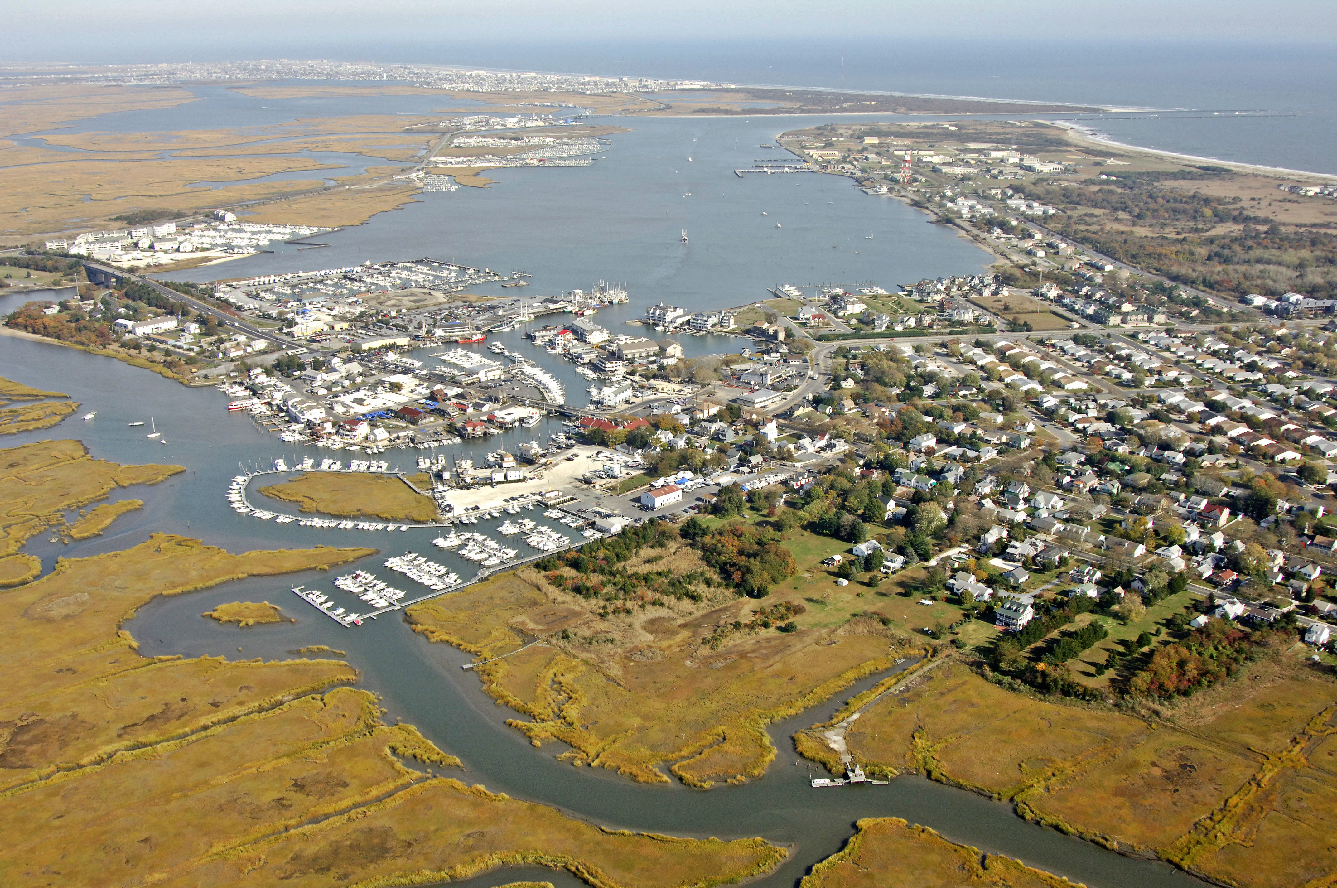
Located on the northern end of Cape May is the Cape May Inlet - a deep, all-weather inlet that allows thousands of boats to safely travel to and from the Atlantic Ocean and Cape May Harbor every year. Located five miles east of Cape May Point off the Atlantic Ocean, which is near Cape May Channel, the inlet allows access to Cape May Harbor and Jarvis Sound. Jarvis Sound leads north along the New Jersey Intracoastal Waterway toward Wildwood and Cape May Harbor leads south to meet up with the Cape May Canal, which eventually empties into Delaware Bay. Cape Harbor is also the location of southern terminus of the New Jersey Intracoastal Waterway. There are 22 marinas in the Cape May Harbor area. The largest group is centered around the Cape Island Creek and northern terminus of the Cape May Canal. The second group, located near the inlet and visible in the image above consists of about six marinas. These are among the finest in Cape May, and you can find transient slips, gas and diesel fuel, lifts for haul-outs and related repairs, and a host of sub vendors at most facilities specializing in electronics, engine, hull, and propeller repairs. Navigating the Water:
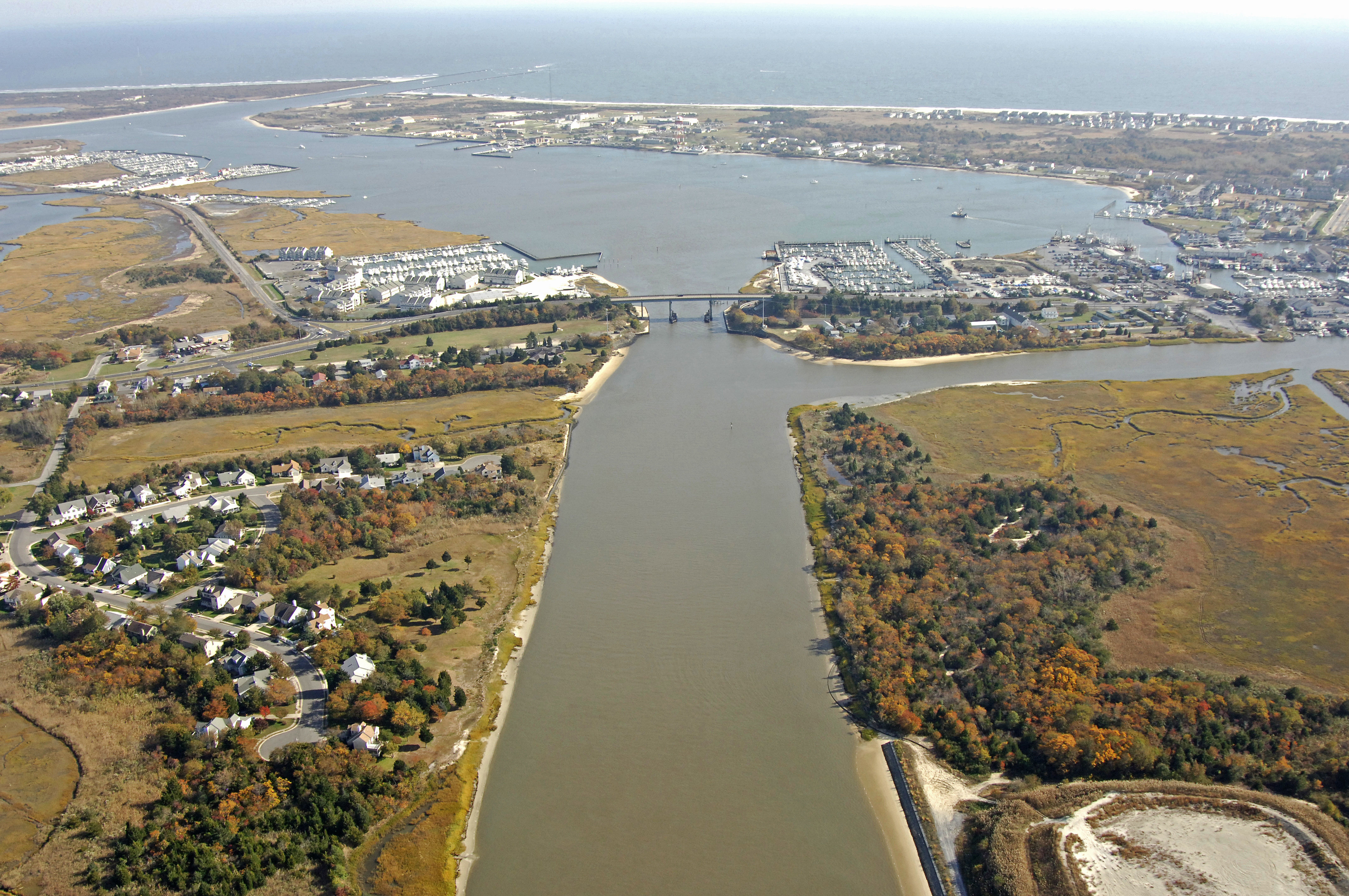
The image above is a view from the southwest looking northeast over the Cape May Harbor area. Off in the lower left-hand corner of the image is a 55-foot fixed vertical clearance bridge where t he Cape May Canal empties into Cape May Harbor. In the upper right-hand portion of the image, Cape May Canal is visible at the Atlantic Ocean. The marina facilities at Schellenger Landing and Cape Island Creek can clearly be seen in the middle section of the image.
Navigating the Water:
[b]Cape May Canal:[/b]
Use NOAA Chart 12316. From Delaware Bay, set a course to intercept flashing red buoy 8, which is about a half-mile to the west of the jetties at the canal entrance. Flashing green (horn) 11 and flashing red 10 mark the north and south jetties to the inlet, respectively. Once inside, keep a sharp eye out to port for ferry boats entering and departing the Cape may-Lewes Ferry terminal. Once you have cleared their basin, proceed east until you exit the 55-foot fixed vertical clearance bridge shown above into Cape May Harbor. From Cape May Harbor, exit the harbor channel at flashing red 12, and then set a course to the northwest to pick up flashing red 14 just before you get to the fixed bridge at the top end of the canal. If you need marina facilities upon entering or exiting the canal, you can work your way up Cape Island Creek just northwest of the 55-foot fixed vertical clearance bridge, or in Cape May Harbor at the terminus of the canal to starboard
[b]Cape May Inlet:[/b]
Use NOAA Chart 12316. Arriving from offshore, keep a sharp eye out for the charted LORAN tower on the east side of the inlet; it makes a good long-distance landmark on your arrival from offshore. Closer in, flashing red bell buoy 2CM marks the initial approach toward the Cape May Inlet. After picking up flashing red buoy 2CM, set an approximate course of 332 degrees magnetic for .6 mile until you reach flashing red 4 and flashing green 5 on the north and south jetties of the inlet, respectively. Inside the inlet you will find 19- to 25-foot depths, but keep in mind that like any inlet, a strong current that opposes the wind can stir up a bit of a chop.
Farther inside you have the choice of heading north or south. Flashing red buoy 2 is the point where you will bend off gradually to the northwest up Jarvis Sound, while flashing green buoy 3 will lead you into Cape May Harbor. The majority of Cape May Harbors marinas are situated in the southern and northwestern portions of the harbor.
Local Notices to Mariners:
Local Notices to Mariners are available online from the U.S. Coast Guard.
Things To Do/Local Events:
For birders, Cape May is an excellent location to spot your next life bird, due to its central location on the Atlantic Flyway. Each year, thousands of birders flock to observation posts scattered around the area to view shorebirds, song birds and raptors that move through the area on regular schedules.
Summer brings beach visitors to the area along with fisherman who beat the local waters looking for a trophy to take home. While in town, many visitors just walk around town and take in the unique and intricate Victorian-style homes that make Cape May different.
Transportation:
For crew changes or quick departures, the Atlantic City International Airport is only 40 miles away to the north. Shuttle service is available, but it is usually cost prohibitive due to the distance involved. Most people rent a one way car in Cape May and leave it at the airport on their departure.
If you are basing out of Cape May for further exploration of the coast, the Cape May-Lewes Ferry departs from the south end of the Cape May Canal on regular schedules across the Delaware Bay to the town of Lewes, about 15 miles away.
For detailed flight schedules and ferry departure times, see the Helpful Links section below for further details.