


Charlestown Bay
Saint Vincent and the Grenadines
Marinas near Charlestown Bay
| Name | Reviews | Max LOA | VHF | Dock Depth | Gas / Diesel | Lift / Crane | Wifi | Amps |
|---|---|---|---|---|---|---|---|---|
| Sandy Lane Yacht Club & Residences (Formerly Glossy Bay Marina) | 328.0' | 68 | Low 17.0' | GYesDYes | CYes | 16 - 630 | ||
| Bougainvilla Wind & Sea Marina | - | - | - | - | - | - | - | - |
| West Indies Restaurant Marina | - | - | - | - | - | - | - | - |
| Petite Martinique Town Dock | - | - | - | - | - | - | - | - |
| McQuilkin's Marina | - | - | - | - | - | - | - | |
| Tyrrel Bay Yacht Haulout | - | - | - | - | - | - | - | - |
| Carriacou Marine | - | 0.0' | 16 | Low 0.0 mHigh 0.0' | GYesDYes | LYes | - | |
| Daffodil Marina | - | - | - | - | - | - | - | - |
| Tradewinds Yacht Club | - | - | - | - | - | - | - | - |
| Bequia Marina | - | - | - | - | DYes | - | - | - |
| Blue Lagoon Hotel and Marina | - | 0.0' | 16 | Low 0.0 mHigh 0.0' | - | - | - | |
| Barefoot Yacht Charters Marina | - | - | - | - | - | - | - | - |
| Kingstown Yacht Dock | - | - | - | - | - | - | - | - |
| Ottley Hall Marina & Shipyard | - | 0.0 m | - | Low 0.0 mHigh 0.0 m | - | - | - | - |
| Kingstown Dock | - | - | - | - | - | - | - | - |
Introduction:
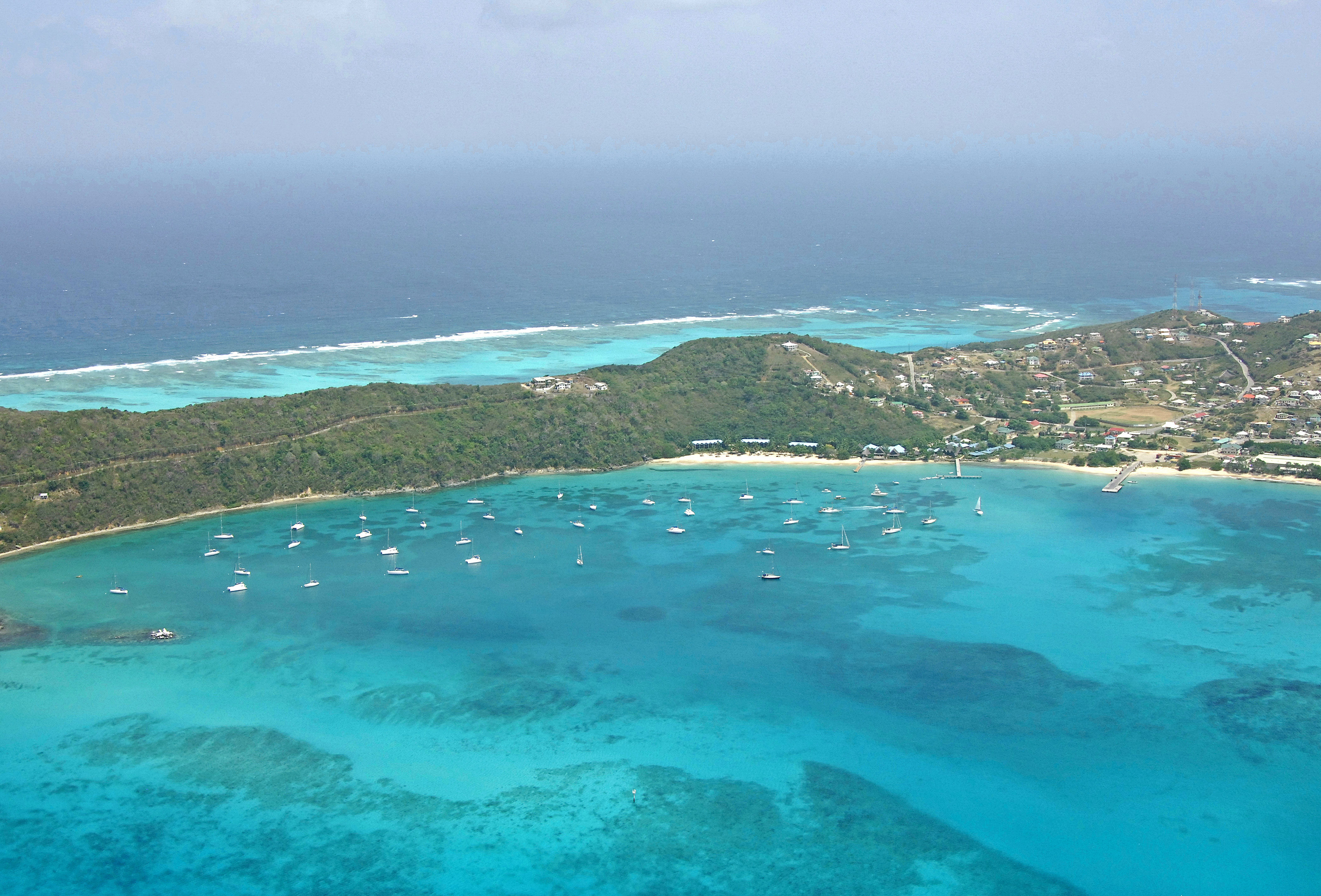
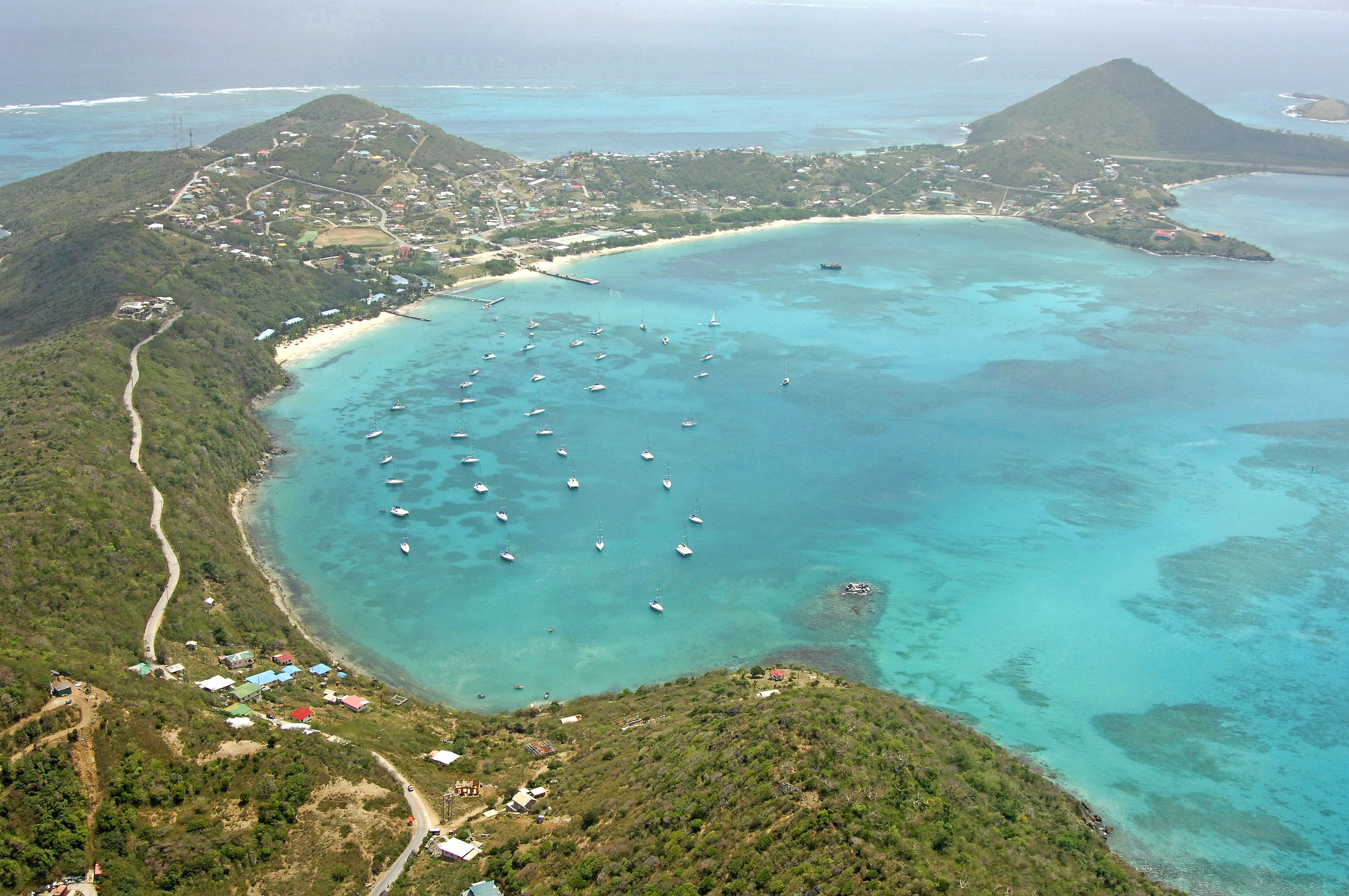
Charlestown Bay is located on the west end of Canouan Island, which is part of the St. Vincent and Grenadines island chain. Canouan Island is 48 miles south of St. Vincent and 35 miles north of St. Georges.
Charlestown Bay is the main anchorage on Canouan Island and is well protected from all directions except the northwest and west. Strong winds out of these directions can make the anchorage unusable and usually sends cruiser scurrying to Friendship Bay on the south end of the island or Corbay, which is located just to the north.
Moorings are available in Charlestown Bay for quite a fee, or you can also drop the hook wherever you are clear of harbor traffic and not swinging into other moored or anchored boats. Also ashore are several hotels and resorts if you need a break from the boat and several excellent dining choices.
History:
Set in the middle of the Grenadine archipelago, Canouan is an island of only 5 square miles. Like its sister islands, Canouan's first settlers (circa 3,000 BC) were a nomadic people from South America collectively referred to as the Ciboney. The next wave of migrants were the Arawaks who arrived around 250 BC by canoe. They brought with them the rudiments of farming and established corn and cassava crops.
In 1770, during England's claim to the islands, King George III sent a team to survey for lands. Reputedly, Canouan was granted to five families -Brisbane, Decato, De Cazeau, Patrice and Snagg-with the latter family becoming the most powerful. The Snagg brothers cultivated sugar and gradually accumulated lands until they held 1,700 of the 1,830 acres.
After the hurricane of 1921 destroyed the village on the northern side, the island was resettled in Charlestown which provided greater shelter.
[i]Information Courtesy St. Vincent and the Grenadines Ministry of Tourism and Culture[/i]
Navigating the Water:
Charlestown Bay is approached from the west via a passage from the Caribbean Sea. A set of daybeacons marks the entrance channel - simply pass between them and then pick an anchorage spot or tie up to a mooring.
Local Notices to Mariners:
See our Local Notices to Mariners blog for updates on the latest conditions and advisories for this area.
Transportation:
There is a small airport on the southern end of the island that has charter air service to connecting airports in Barbados and St. Vincent.
Helpful Links:
St. Vincent and the Grenadines Ministry of Tourism and Culture