
Hither Creek Harbor
Madaket, Massachusetts United States
Marinas near Hither Creek Harbor
| Name | Reviews | Max LOA | VHF | Dock Depth | Gas / Diesel | Lift / Crane | Wifi | Amps |
|---|---|---|---|---|---|---|---|---|
| Madaket Marine | - | 31.0' | 78 | Low 6.0' | GYesDYes | - | - | - |
| Nantucket Yacht Club | - | 110.0' | 66 | Low 15.0'High 0.0' | GNearbyDNearby | LYesCYes | - | |
| Old North Wharf | - | 0.0 m | - | Low 0.0 mHigh 0.0' | - | - | - | - |
| Nantucket Boat Basin | 200.0' | 11 | Low 12.0' | GYesDYes | - | 30, 50, 100 single & three phase; 480V | ||
| Nantucket Town Pier | 30.0' | 14 | Low 9.0' | GNearbyDNearby | - | - | - | |
| Island Marine & Restoration (Formerly Grey Lady Marine) | - | - | - | Low 8.0' | - | LYes | - | - |
| Great Harbor Yacht Club | - | - | 9 | - | - | - | - | - |
| Nantucket Moorings | 90.0' | 68 | - | - | - | - | - | |
| Glyn's Marine | - | - | - | - | - | - | - | |
| North Wharf Fueling | - | - | - | - | - | - | - | - |
| Edgartown Harbormaster | 65.0' | 74 | Low 15.0' | G$5.39/galD$6.89/gal | LYes | - | 30 / Dual 30 / 50 / Dual 50 | |
| Edgartown Memorial Wharf | - | - | 74 | Low 15.0' | - | - | - | - |
| Mad Max Marina | - | 71 | - | - | - | - | 100 | |
| Safe Harbor Edgartown | 0.0' | - | Low 0.0 mHigh 0.0' | - | - | - | - | |
| Edgartown Yacht Club | - | - | 72 | - | GNearby | - | - | - |
Introduction:
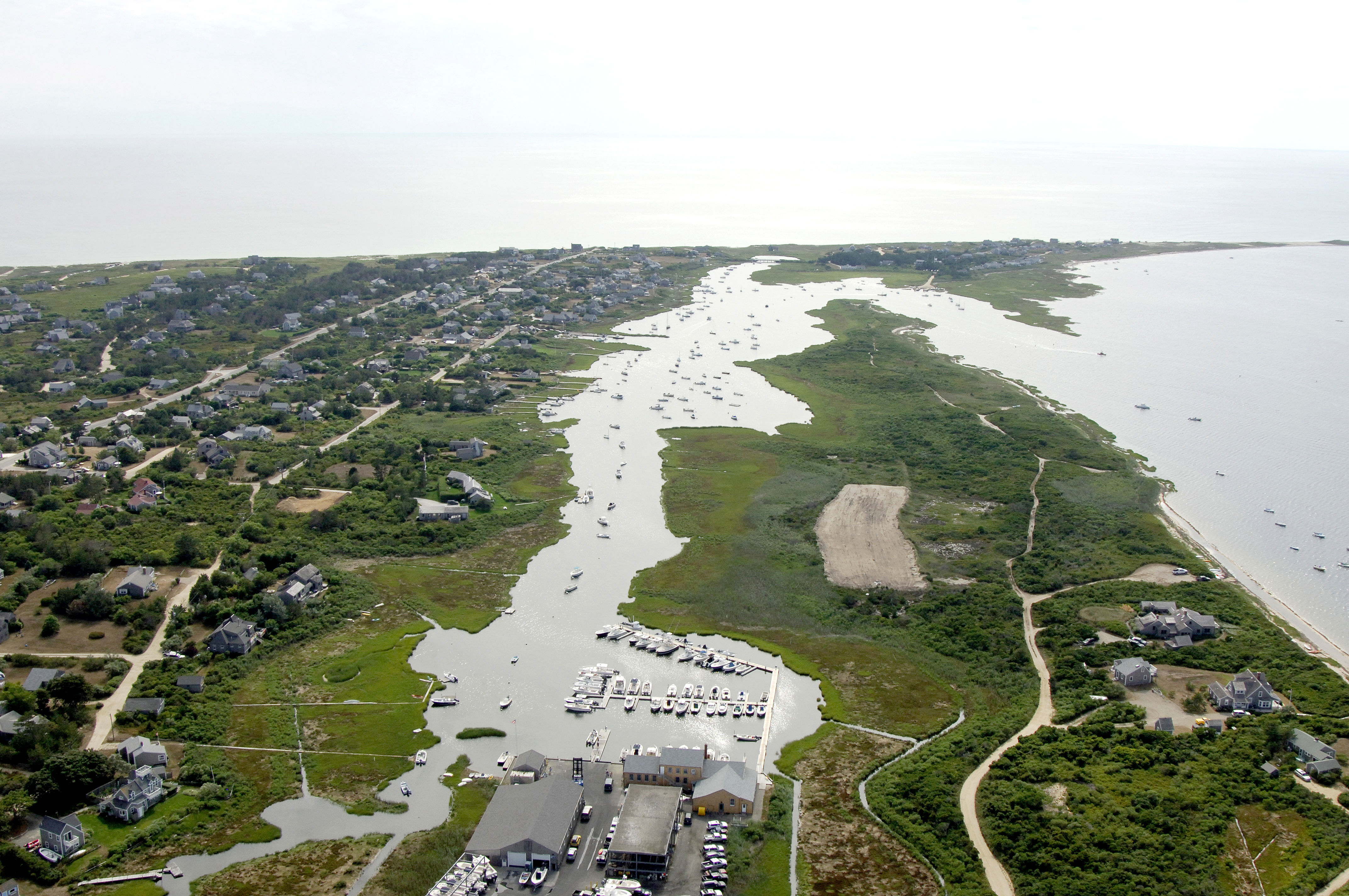
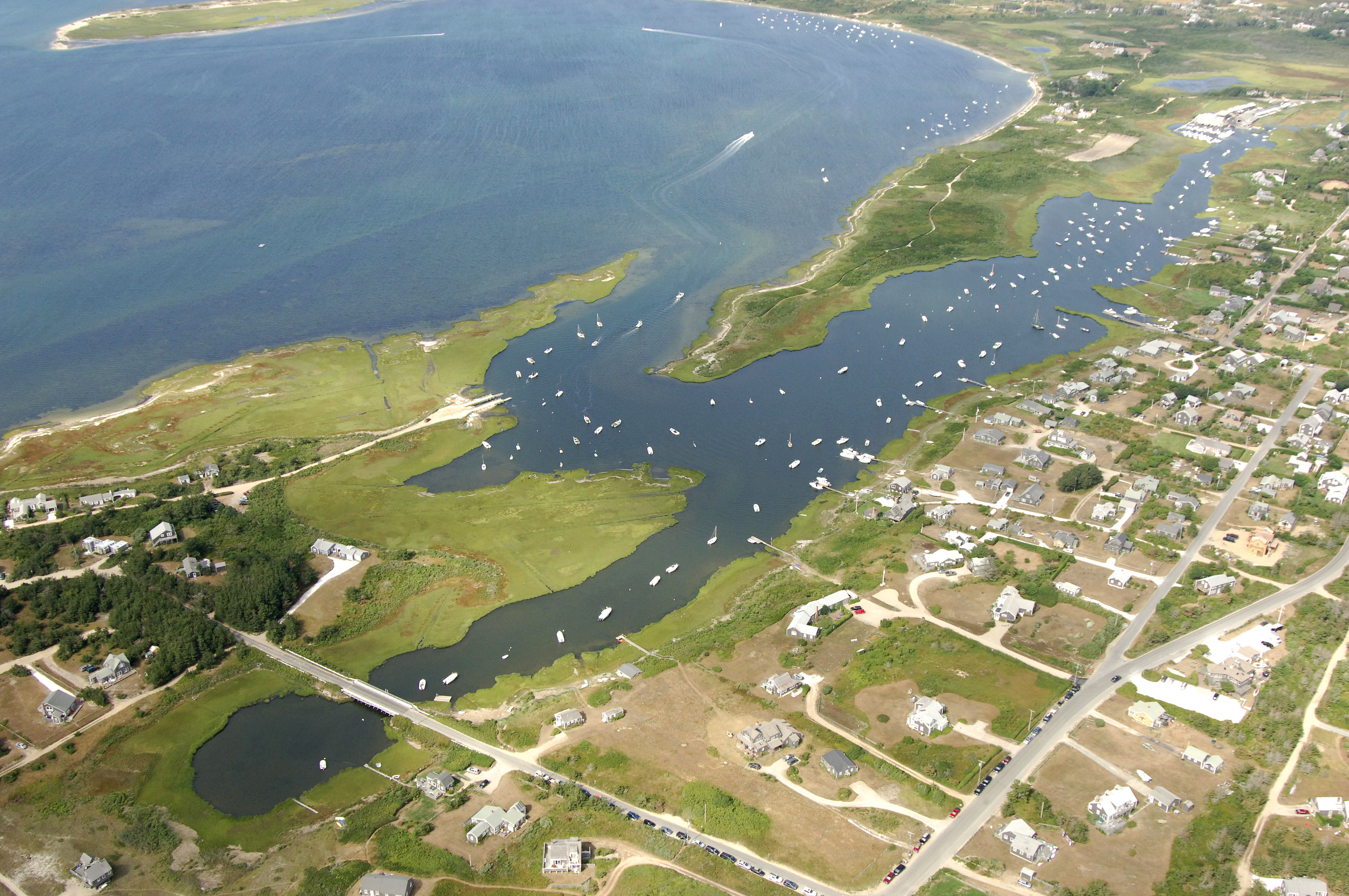
Hither Creek is located on the western end of Nantucket Island just east of Tuckerneck Island, and behind Madaket Harbor. Hither Creek is about eight miles to the west of Nantucket Harbor and has one marina with slips available to transients. Although Hither Creek is well protected, there is a confusing entry channel with spots as shallow as four feet in places. The depths remain reliable, but a careful watch on the chart and the depth sounder are necessary to ensure success here.
You can base your exploration of nantucket from Hither Harbor, but keep in mind that Nantucket Harbor is a good five miles away by road. You'd be well served to use your bicycle or try to grab a ride from one of the locals.
History:
The earliest inhabitants of Nantucket were Native Americans. In 1659, a group of nine Massachusetts Englishmen purchased the island for 30 pounds and two beaver hats. Their purpose was to raise sheep as well as to find refuge from the religiously intolerant Puritans. Among the early settlers were Thomas Macy and Tristram Coffin whose names reappear throughout the history of the island.
In 1712, a captain blown off course took the first sperm whale. Since it was larger and its oil far more valuable, the hunting of sperm whales was very profitable. Thus began the era of Nantucket whaling and economic boom for the island.
As profitable as it was, whaling was a dangerous and often lonely pursuit. Prior to the building of the Nantucket South Shoal lightship in 1853, the treacherous shoals southeast of the island claimed many returning ships. When not confronting these and other dangers, the idle hours between whale sightings were spent in the practice of nautical crafts such as scrimshaw.
[i]Portions courtesy Nantucket Cape Cod[\i]
Navigating the Water:
Use NOAA Chart 13241.
From Nantucket Sound north of Eel Point, pick up flashing red bell buoy "2," and then set a course to the southwest toward red nun "4." Keep in mind that from flashing red bell buoy "2" to red nun "4," you will have to feel your way along the shallow part of the channel, which is shown on the chart. From red nun "4," continue southwestward to red nun "6," and then set a course south to a point just west of Eel Point, making sure to keep in the unmarked channel here.
From Eel Point, round the point to the south, and then look for red nun "8," where you will proceed south to red nun "10." Have a look at the chart, your GPS and/or your chart plotter and set a specific course from red nun "8" to red nun "10." If you set a straight line course and follow it precisely, you will stay in the deepest water. Red nun "10" leads to red nun "12" and into Hither Creek, which has six-foot depths, moorings and a marina.
Local Notices to Mariners:
Local Notices to Mariners are available online from the U.S. Coast Guard.