


Tampa Bay Harbor
Tampa, Florida United States
Marinas near Tampa Bay Harbor
| Name | Reviews | Max LOA | VHF | Dock Depth | Gas / Diesel | Lift / Crane | Wifi | Amps |
|---|---|---|---|---|---|---|---|---|
| Tampa Marriott Water Street | 60.0' | 16 | Low 0.0'High 0.0' | - | - | 30, 50 | ||
| Tampa Convention Center Marina | 165.0' | - | Low 18.0' | - | - | - | 30/50 | |
| The Pointe Marina at Harbour Island | - | 0.0' | - | Low 0.0 mHigh 0.0' | - | - | - | |
| Marjorie Park Yacht Basin | - | 90.0' | - | Low 0.0 mHigh 0.0' | GYesDYes | - | - | - |
| Hixon Park Free Dock | - | - | - | - | - | - | - | - |
| Davis Island Yacht Club | 0.0' | - | Low 0.0 mHigh 0.0' | - | - | - | - | |
| Ricks on The River | - | - | - | - | - | - | - | - |
| Tampa Yacht & Country Club | 0.0' | 16 | Low 0.0 mHigh 0.0' | - | - | - | - | |
| Inter-Bay Moorings Inc | - | 120.0' | 69 | - | GYesDYes | LYesCYes | 30, 50 | |
| Rivers Edge Lounge and Marina | - | - | - | - | - | - | - | - |
| Tampa Bay Marina | - | 38.0' | - | - | - | - | - | - |
| AJ's on the river | - | - | - | - | DYes | - | - | - |
| Marina Pointe | - | - | - | - | - | - | - | - |
| Oystercatchers | - | - | - | - | - | - | - | - |
| PORT 32 Tampa | - | - | - | G$5.00/galD$5.00/gal | - | - | - |
Introduction:
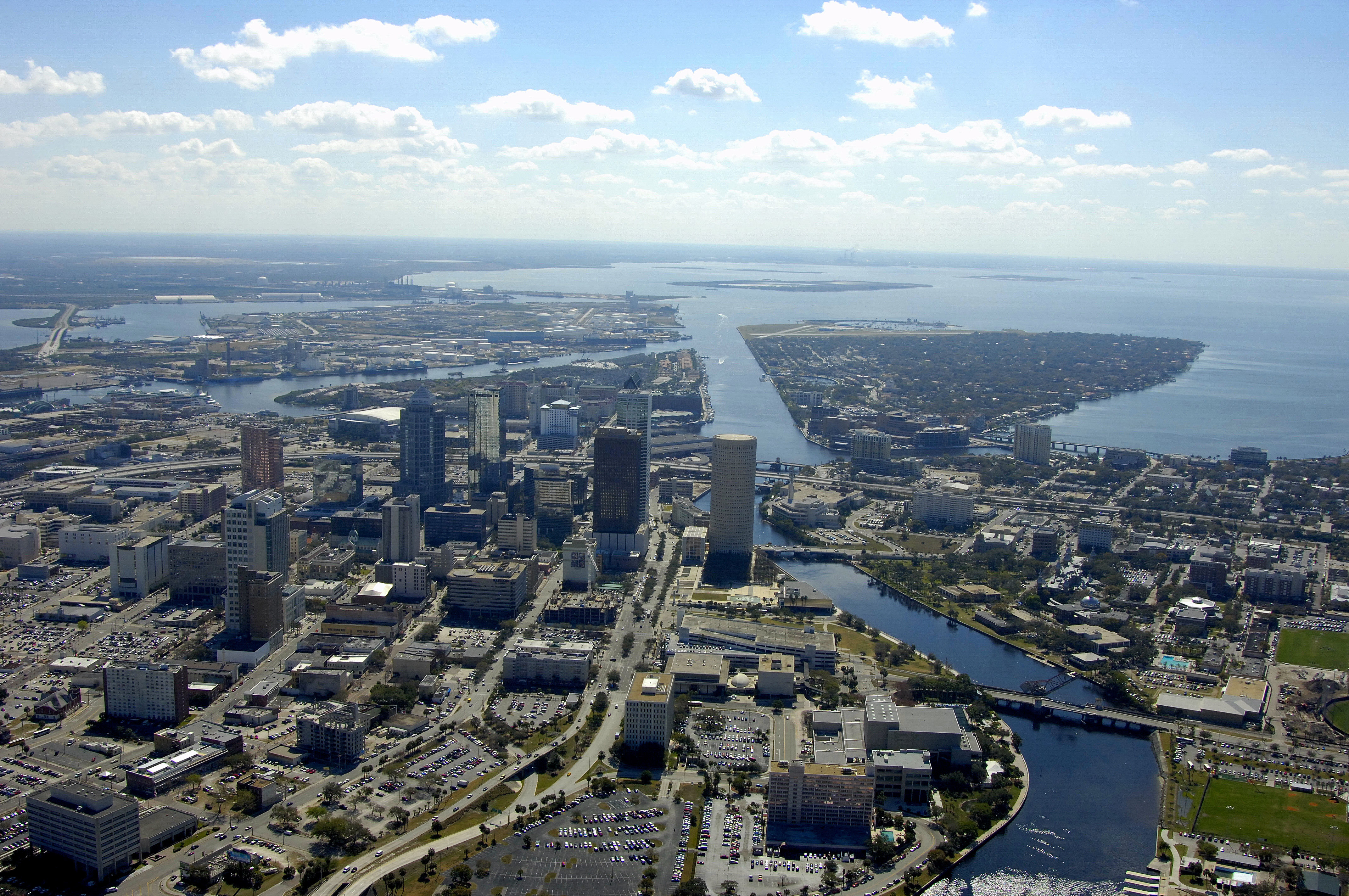
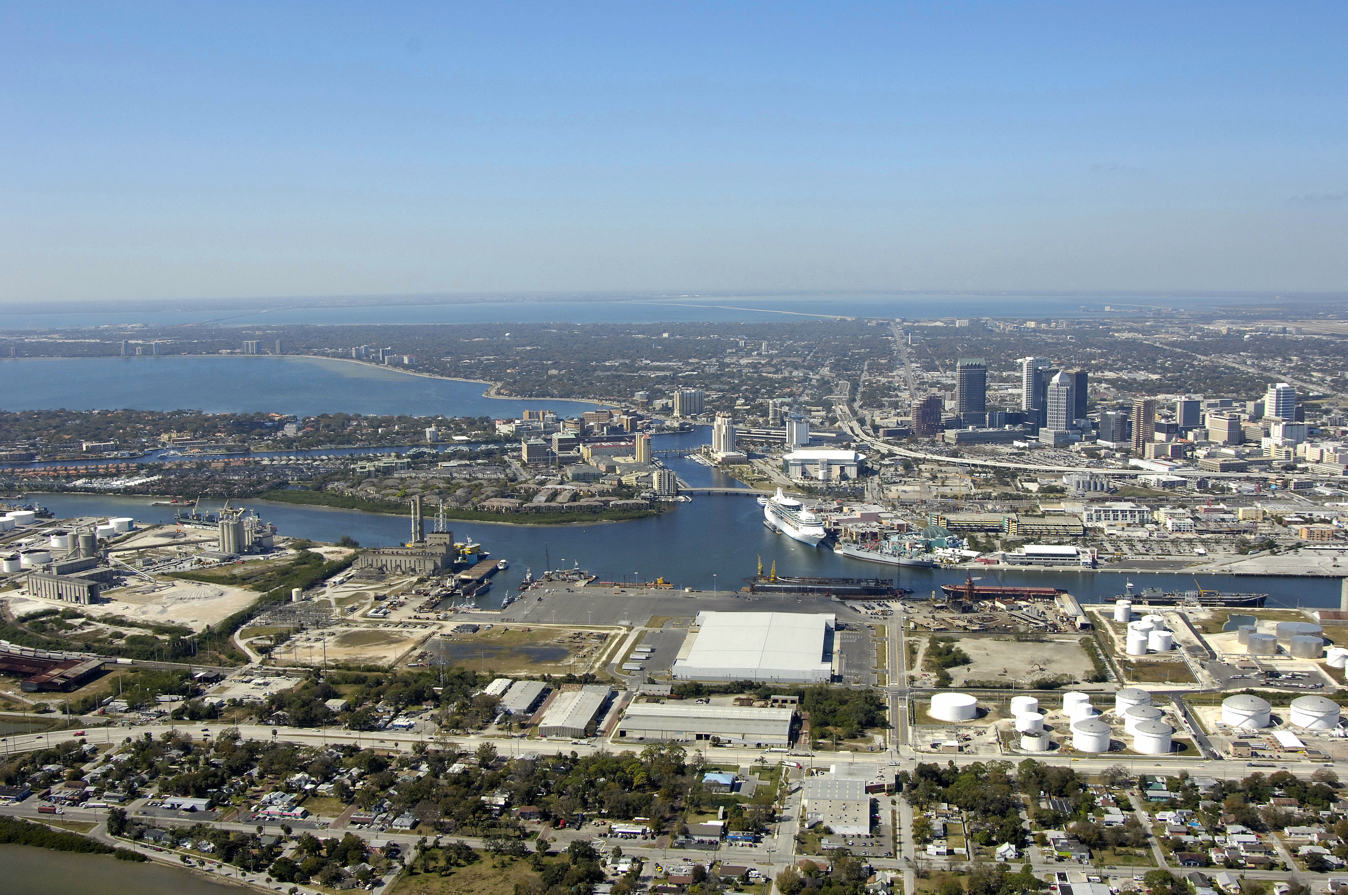
Tampa Bay is ideally located on Floridas West Coast, and features miles of waterways and sandy shorelines. Its central location provides easy access to the nearby Gulf beaches and surrounding areas. Tampas waterfront consists of both Hillsborough Bay and Tampa Bay, as well as the beautiful Hillsborough and Alafia rivers and several area lakes.
History:
Spanish explorer Ponce de Leon first arrived in the Tampa Bay area in 1513, but the Spaniards focused their attention on settling eastern Florida and left the western areas alone. In 1824, only two months after the arrival of the first American settler, four companies of the U.S. Army established Fort Brooke to protect the strategic harbor at Tampa Bay.
Tampa owes its commercial success to Tampa Bay and the Hillsborough River. When phosphates were discovered nearby in the late 1880s, the resulting mining and shipping industries prompted a boom of growth and wealth that lasted through the 1890s. Tampa's port is now the seventh largest in the nation; today phosphate shipping is supplemented by trade in shrimp. A pleasure cruise line operates as well.
Navigating the Water:
Use NOAA Chart 11416.
The first thing you are most likely to notice as you progress up Cut C toward the north part of HIllsborough Bay is the Tampa International (Peter O Knight) Airport to port, and Pendola Point with its commercial traffic to starboard.
Transiting the Tampa Area is fairly straightforward, as long as you keep your distance form commercial traffic and maintain a sharp lookout. All of the basins are deep and well-marked, and bridge only mar the upper p[arts of any voyage to the Tampa downtown area.
Local Notices to Mariners:
Local Notices to Mariners are available online from the U.S. Coast Guard.
Things To Do/Local Events:
In addition to boating, beaching and surfing, there are a myriad of cultural and shore-side activities to be had in Tampa. Museums, art galleries and an expansive aquarium are all within reach of public transit and the waterfront. Check out Helpful Links section for more details.
Transportation:
Tampa Bay boasts one of the most popular and admired airports in the world, Tampa International Airport (TPA). A comprehensive menu of motorcoach, trolley and shuttle systems, taxis and rental cars keep visitors on the move and on schedule during their stay in Tampa Bay. See the Helpful Links section below for detailed schedules and route maps.
Helpful Links:
Tampa Convention and Visitors Bureau