


Wakefield Harbor
Wakefield, Rhode Island United States
Marinas near Wakefield Harbor
| Name | Reviews | Max LOA | VHF | Dock Depth | Gas / Diesel | Lift / Crane | Wifi | Amps |
|---|---|---|---|---|---|---|---|---|
| Ram Point Marina | - | 50.0' | - | - | G$5.10/galD$5.45/gal | - | - | |
| Town Dock Marina & Park | - | 0.0 m | - | Low 0.0 mHigh 0.0' | - | - | - | - |
| Marina Bay Docking | - | 0.0 m | 9 | Low 0.0 mHigh 0.0' | - | - | - | - |
| URI Sailing Club | - | - | - | - | - | - | - | - |
| Point Judith Yacht Club | - | 0.0 m | - | Low 0.0 mHigh 0.0' | - | - | - | - |
| Safe Harbor Silver Spring | 50.0' | 7 | Low 4.0' | - | LYes | - | ||
| Stone Cove Marina | - | 0.0 m | 71 | Low 0.0 mHigh 0.0' | - | - | - | - |
| Long Cove Marina & Campground | - | 0.0' | - | Low 0.0 mHigh 0.0' | - | - | - | - |
| Long Cove Marina and Campground | - | 0.0' | - | Low 0.0'High 0.0' | - | - | - | - |
| Billington Cove Marina | - | - | - | - | - | - | - | - |
| Narragansett Harbor Master | - | - | - | - | - | - | - | - |
| Point View Marina | 0.0 m | - | Low 0.0 mHigh 0.0' | - | - | - | - | |
| Point Judith Marina | 0.0' | 9 | Low 0.0 mHigh 0.0' | GYesDYes | - | - | - | |
| Belle Vue Yachting Center at Point Judith Marina | - | 0.0 m | 9 | Low 0.0 mHigh 0.0' | - | - | - | - |
| Gooseberry Marina | 50.0' | - | - | - | - | - | - |
Introduction:
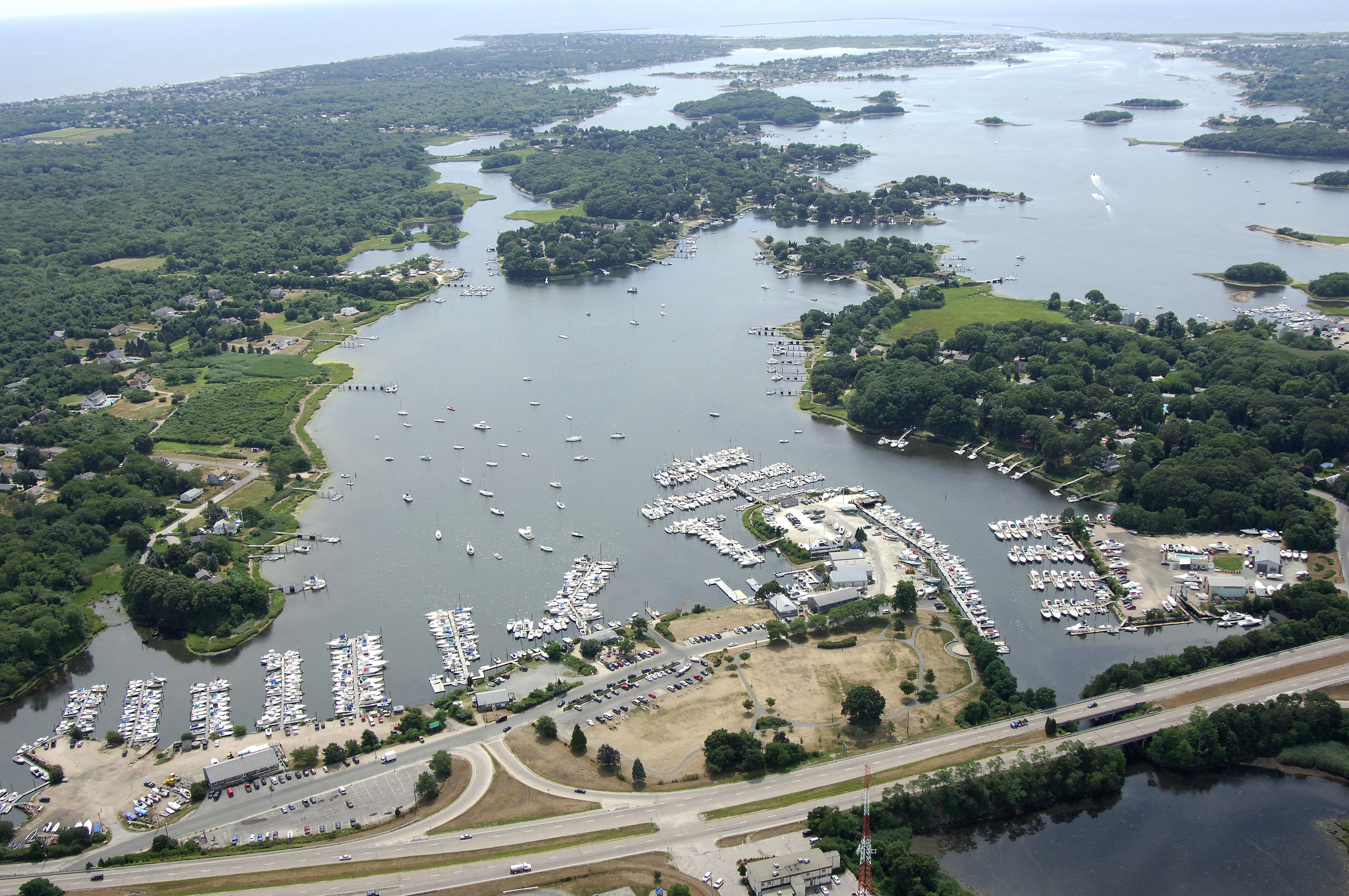
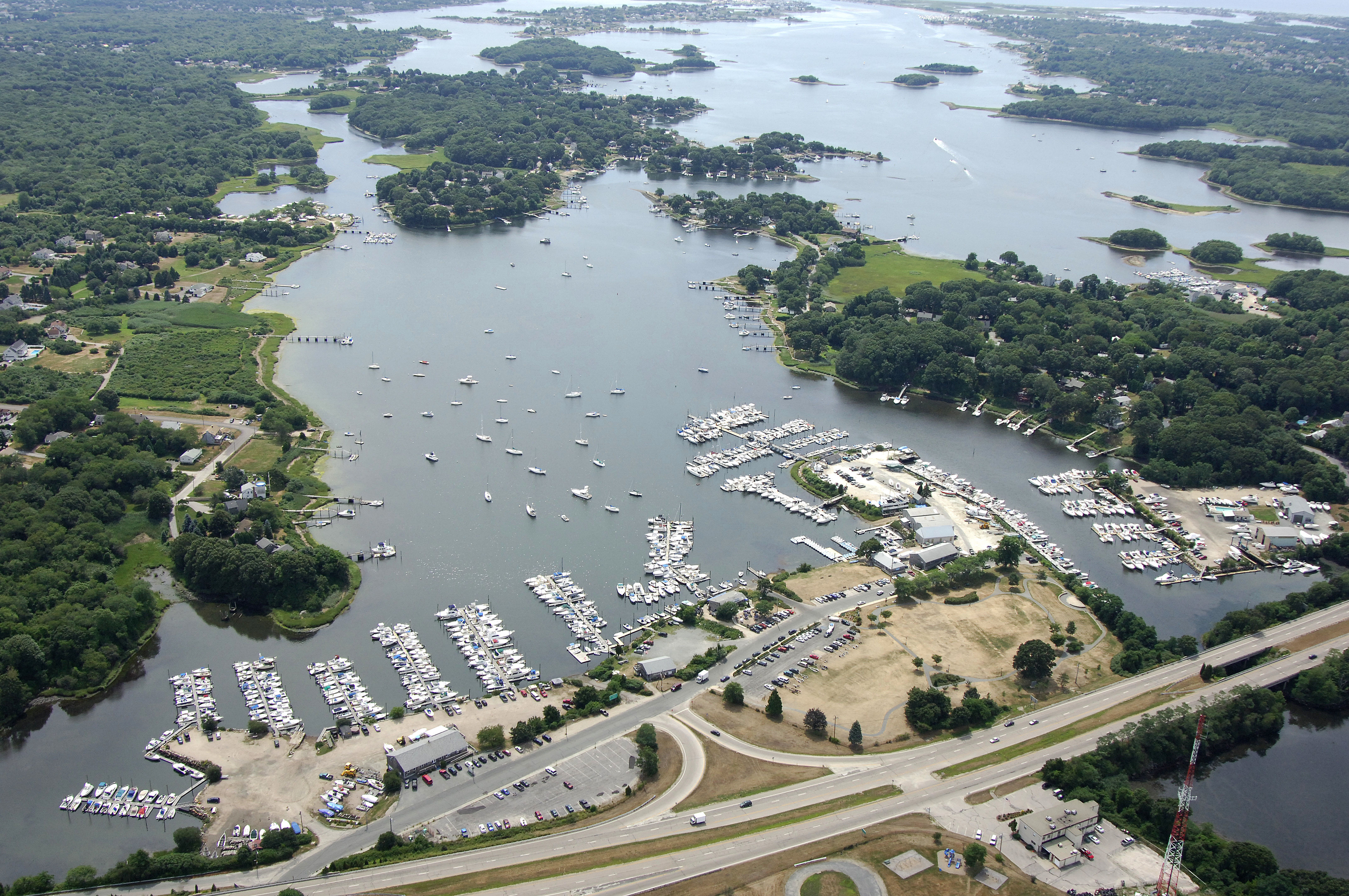
Wakefield is located at the northernmost point of Point Judith Pond (known to locals as Salt Pond). Wakefield is 10 miles southwest of Newport and nearly 30 miles south of Providence. Most of the area around Wakefield is filled with private moorings, so there is not much room for anchoring, but for what it lacks in anchoring room, it makes up for in marinas. There are several fine facilities here, and a couple of them have very nice parts/ships supply shops in case you need to stock up on spares.
Navigating the Water:
Use NOAA Chart 13219.
To reach Wakefield you must first enter from the Atlantic Ocean at Point Judith Harbor of Refuge. There are two breaks in the outer jetty, and either entrance is safe for passage (although the east entrance is deeper). Inside at the Point Judith Harbor of Refuge, there is a designated anchorage behind the V- shaped notch in the jetty, but holding is poor, especially in windy weather.
From the Atlantic Ocean, first set a course for flashing red 2 and flashing green 3 (horn) on the dividing breakwaters at the west entrance. From here, you will take a sharp turn to port to follow the channel up the west breakwater to the inlet opening itself. Red nun buoys 2, 4 and 6 mark the channel up to the inlet entrance, which is marked with flashing red 8.
Depths in the point Judith Harbor of Refuge and in the Point Judith Inlet are about 10 feet, but mariners are advised to use the area with caution. Swift currents, submerged objects and a summertime lawn of lobster pots add to the challenge of navigating here. Once inside, both Galilee and Jerusalem have marinas with transient space.
Once you have cleared the swift running inlet, head north and pick up green can 7 and red nun 8 off Snug Harbor. From here, you will follow (strictly) the following buoys to Crown Point, about a mile away: green can 9, green can 11, red nun 12, red nun 14, green can 15. red nun 16, green can 17, red nun 18, green can 19, red nun 20, red nun 22 (at Plato Island), red nun 24 (at Gardner Island) and green can 10 south of Crown Point. From here, you will favor the east side of Point Judith Pond to intercept red nun 26 at Pine Tree Point near The Narrows, and then work your way into Wakefield, paying close attention to all the markers.
Local Notices to Mariners:
Local Notices to Mariners are available online from the U.S. Coast Guard.