

Santa Barbara Harbor
California United States
Marinas near Santa Barbara Harbor
| Name | Reviews | Max LOA | VHF | Dock Depth | Gas / Diesel | Lift / Crane | Wifi | Amps |
|---|---|---|---|---|---|---|---|---|
| Sea Landing | - | - | - | - | - | - | - | - |
| Santa Barbara Harbor | - | - | 12 | - | GYesDYes | LYes | - | 30, 50 |
| Santa Barbara Yacht Club | 0.0 m | - | Low 0.0 mHigh 0.0' | - | - | - | - | |
| Santa Barbara Fuel Dock | 0.0' | - | Low 0.0 mHigh 0.0' | GYesDYes | - | - | - | |
| Santa Barbara Sailing Club | - | - | - | - | - | - | - | - |
| Lake Casitas Recreation Area | - | - | - | - | GYes | - | - | - |
| Harbortown Point Marina Resort | - | - | - | - | GNearby | - | - | - |
| Kinship Marina | - | - | - | - | LYes | - | - | |
| Mavcco Market Fuel and Bait | - | - | High 18.0' | G$5.05/galD$4.50/gal | - | - | - | |
| Oceans West Marina | - | 93.0' | 68 | Low 15.0' | GYesDYes | - | 30/50 | |
| Portside Marina | - | - | - | - | - | - | - | |
| Ventura Yacht Club | - | - | - | - | - | - | - | - |
| Ventura Harbor Village Marina | - | - | 16 | - | - | - | - | - |
| Safe Harbor Ventura Isle | - | - | - | GYesDYes | - | - | ||
| Ventura West Marina | 65.0' | 68 | Low 12.0' | - | - | 30/50 |
Introduction:
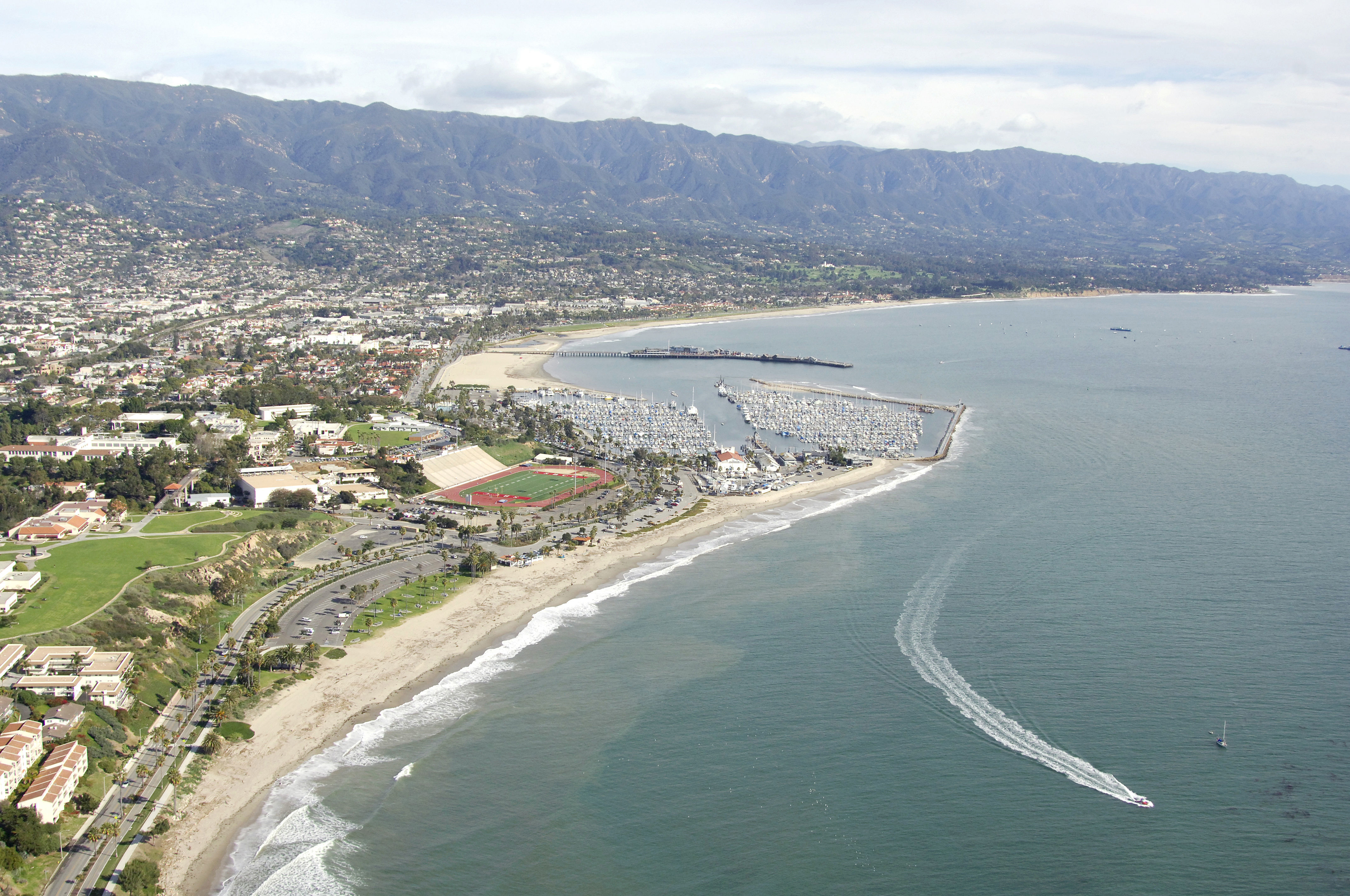
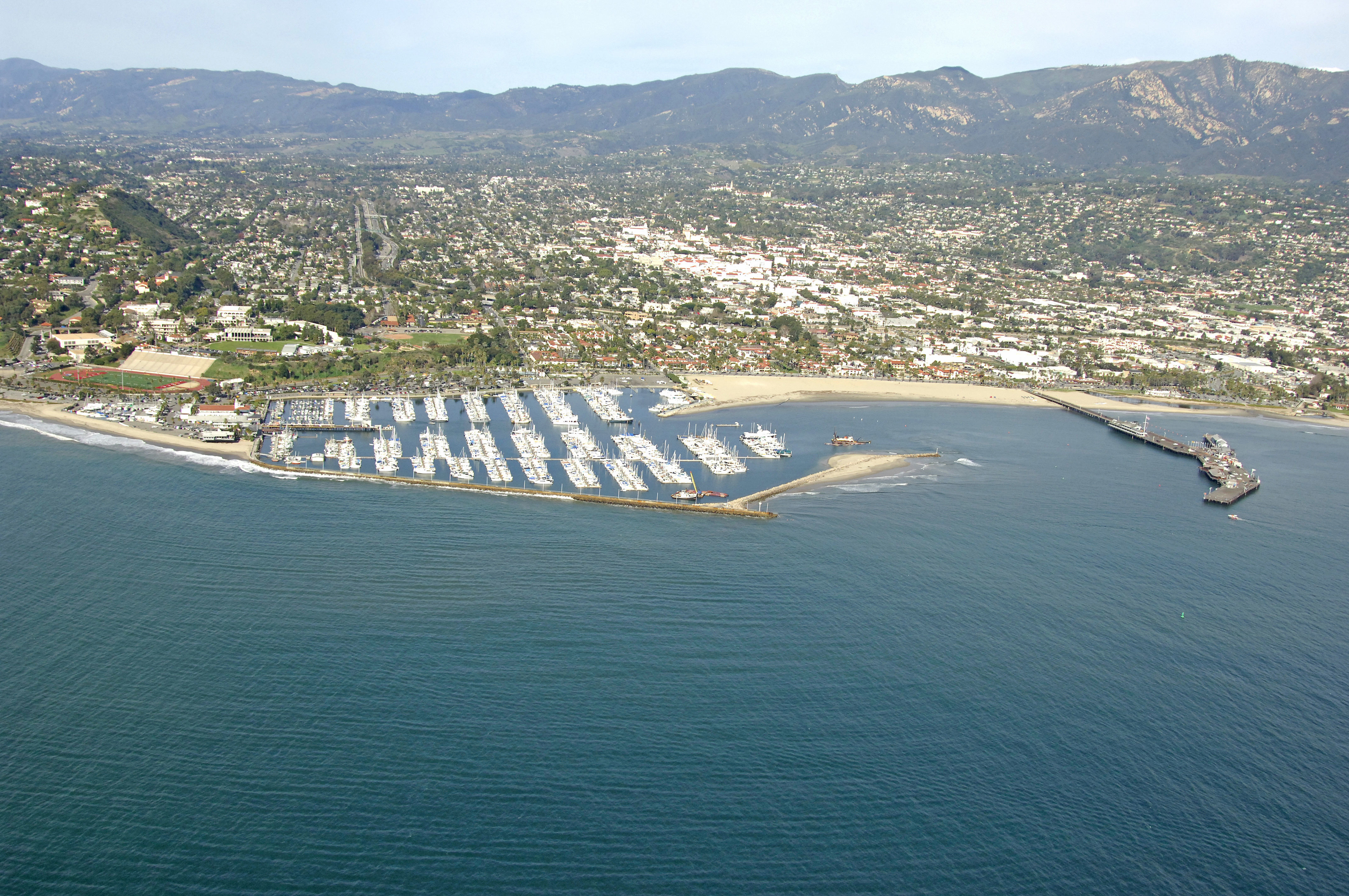
Just a 45-minute drive up the coast from Ventura, Santa Barbara is a beautifulif not ritzycoastal town with a well-protected man-made harbor and unprotected moorings on the south side for the brave-hearted.
Nestled on the foothills of the Santa Ynez Mountains, Santa Barbara is a mix of swanky upscale houses, a salty local wharf and proper yacht club that races offshore every week. With good transportation opportunities, excellent shopping and good facilities in the harbor, this is a good stop for cruisers (if you can negotiate the tricky inlet).
Navigating the Water:
Use NOAA Chart 18725.
This chart is in fathoms. Keep in mind that one fathom equals one foot in depth.
Approach from the southeast. Red and white Morse (A) marks the initial approach east of Santa Barbara Point and south of Stearns Wharf, the towns pier. Flashing green buoy 3 starts you in toward the entrance. Stearns Wharf marks the east boundary of the inlet, and is capped with flashing red 4. The breakwaters easternmost point is marked with a flashing white light.
In all honesty, this is a tricky inlet, and can even be dangerous for deeper-draft boats. Have a current chart handy and notice that the deepest part of the channel is to the west. Do not attempt this inlet in bad weather without prior local knowledge.
Local Notices to Mariners:
Local Notices to Mariners are available online from the U.S. Coast Guard.
Things To Do/Local Events:
See the Helpful Links section at the bottom of this page for more detailed information.
Transportation:
The Santa Barbara Metropolitan Transit District provides an attractive transportation option for commuters and shoppers who may otherwise drive cars or have no way around. For more information, see Helpful Links below
Helpful Links:
Santa Barbara Convention and Visitors Bureau