


Sebastian Harbor
Sebastian, Florida United States
Marinas near Sebastian Harbor
| Name | Reviews | Max LOA | VHF | Dock Depth | Gas / Diesel | Lift / Crane | Wifi | Amps |
|---|---|---|---|---|---|---|---|---|
| Captain Hiram's Resort | - | - | - | - | - | 30, 50 | ||
| Mulligans Marina | - | - | 16 | - | - | - | - | - |
| Fins Marina | 70.0' | - | Low 5.0' | - | - | - | 30/50 | |
| Sebastian Saltwater Marina and Lodge | - | 70.0' | - | Low 5.0' | G$5.25/galD$4.25/gal | - | 20-30-50 amp | |
| Sportsman Lodge Motel | - | - | - | - | - | - | - | - |
| San Sebastian Yacht Club | - | 0.0 m | - | Low 0.0 mHigh 0.0 m | - | - | - | - |
| BG Bayside Marina | - | 0.0' | - | Low 3.0'High 0.0' | - | - | 30 Amp | |
| Sebastian Inlet Marina | - | - | Low 4.0' | GYesDYes | - | - | ||
| Cay Marine | - | - | - | - | G$5.02/galD$4.84/gal | - | - | - |
| Marsh Island Yacht Club | - | 0.0' | - | Low 0.0 mHigh 0.0' | - | - | - | - |
| Sea Oaks Marina | - | - | - | - | - | - | - | - |
| Jone's Fruit Dock | - | - | - | - | - | - | - | - |
| Honest John's Fish Camp | - | 0.0' | - | Low 0.0 mHigh 0.0' | - | - | - | - |
| Treasure Coast Marina | - | - | - | - | GYes | - | - | - |
| Loggerhead Marina at Vero Beach | 120.0' | 16 | Low 0.0 mHigh 0.0' | GYesDYes | - | - |
Introduction:
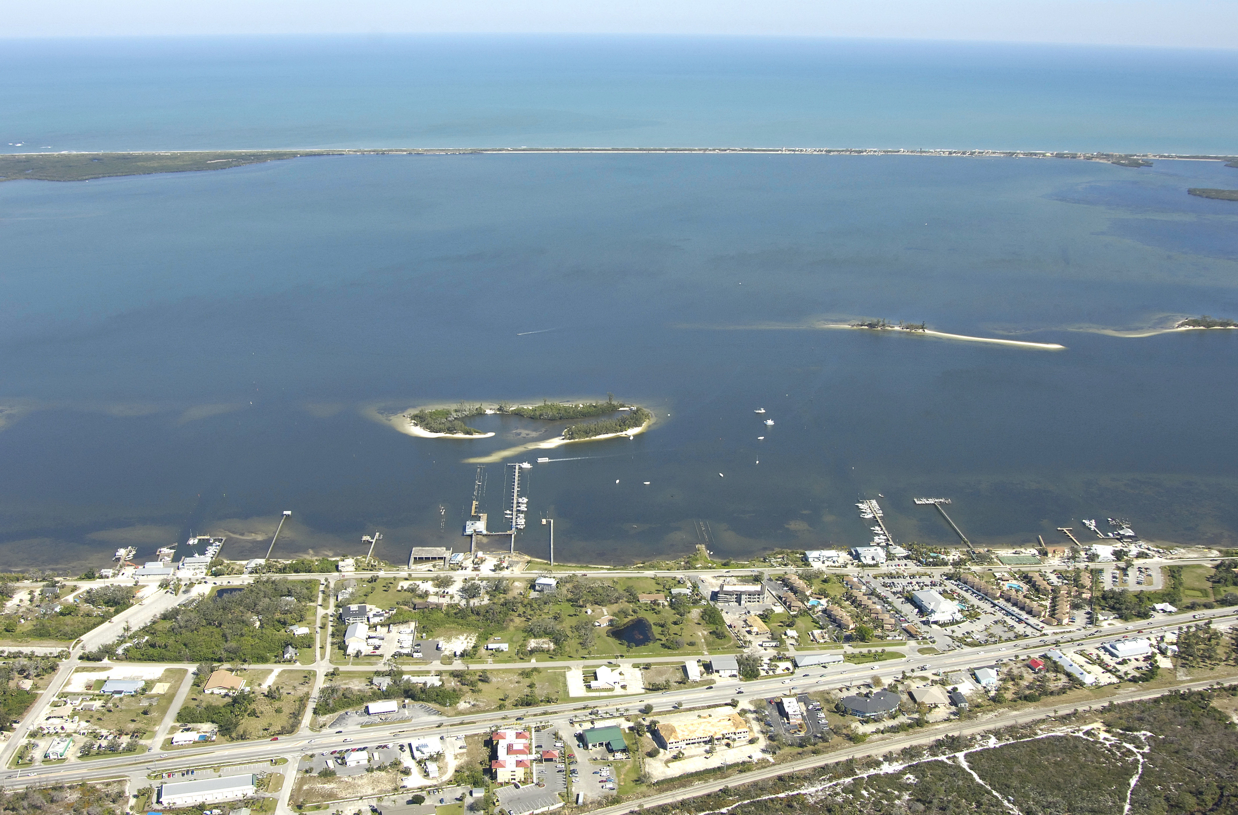
The Sebastian Inlet, although not technically the point at which the Saint Sebastian River ends, is located just across from its shared-name counterpart near Intracoastal Waterway Mile 935. The inlet is the major water feature in the Sebastian/Roseland area.
The Sebastian Inlet allows access to and from the Indian River via the Atlantic Ocean. The image above is a view from the east looking west over the Sebastian Inlet with the Indian River/ICW behind it.
History:
Vestiges of 18th century Spanish culture can be revisited at the various historical and archaeological museums in the area, while treasure hunters continue to search these waters for gold, jewelry, and other artifacts lost in the sinking of the 1715 Spanish Fleet not far off our shores.
[i]Information Courtesy of Sebastian River Area Chamber of Commerce[/i]
Navigating the Water:
Use NOAA Chart 11472.
Passage through the Sebastian Inlet is not recommended without advance local knowledge from one of the local marinas such as Captain Hirams Sebastian Inlet Marina or the Sebastian River Marina. If you are at all in doubt, it is recommended that you use the Ft. Pierce Inlet (29 miles to the south) instead, as it is more reliable with better depths. A fixed bridge crosses the mouth of the inlet with a vertical clearance of 37 feet, limiting overhead clearance.
There are no aids to navigation to help lead you into the inlet, save for a flashing white light on the north inlet jetty. Navigational aids continue at green can 1 about a mile in from the inlet mouth. Shoals line both the west and east approaches, but the channel is extremely shallow on its western end.
Most of the marinas are scattered along west shore of the Indian River/ICW route north and south of the town of Roseland, which is situated on the Saint Sebastian River. There are at least four marinas north and south of ICW Mile 935, and all but one have facilities for transient guests. If you are in need of repairs or haul-out, the Sebastian River Marina has a 40-ton lift. All four marinas have gas and diesel fuel.
Local Notices to Mariners:
Local Notices to Mariners are available online from the U.S. Coast Guard.
Things To Do/Local Events:
See the Helpful Links section below for a full calendar of events and suggestions on what to do while in the Sebastian area.
Transportation:
The Sebastian River area is serviced by four airports, depending on where you are coming from. Orlando International Airport and West Palm Beach airport are only an hour and a half drive away, and the Melbourne International Airport is most conveniently located twenty minutes away from the waterfront.
Helpful Links:
Sebastian River Area Chamber of Commerce