Oyster Pond River Inlet
| Stage Harbor, Massachusetts United States | |
| 41° 39' 50.03'', -69° 58' 48.01'' | |
| Stage Harbor |


About
Introduction:
The Oyster Pond River is located off Stage Harbor at the southern end of Cape Cod. Oyster Pond River and Oyster Pond are an excellent spot to anchor for those seeking quiet or a bit more protection than is afforded by Stage Harbor. There are three marine facilities in Oyster Pond River, and anchorage is available off channel for the length of the river up to Oyster Pond. Depths in the river, however are a shallow three to five feet, so only shoal-draft boats need apply.
The Oyster Pond River is 25 miles north of Nantucket and 35 miles northeast of Vineyard Haven. The entrance channel to Stage Harbor, which leads to the Oyster Pond River, has a minimum depth of 9.5 feet, and the channel is reliable, even during stormy weather.
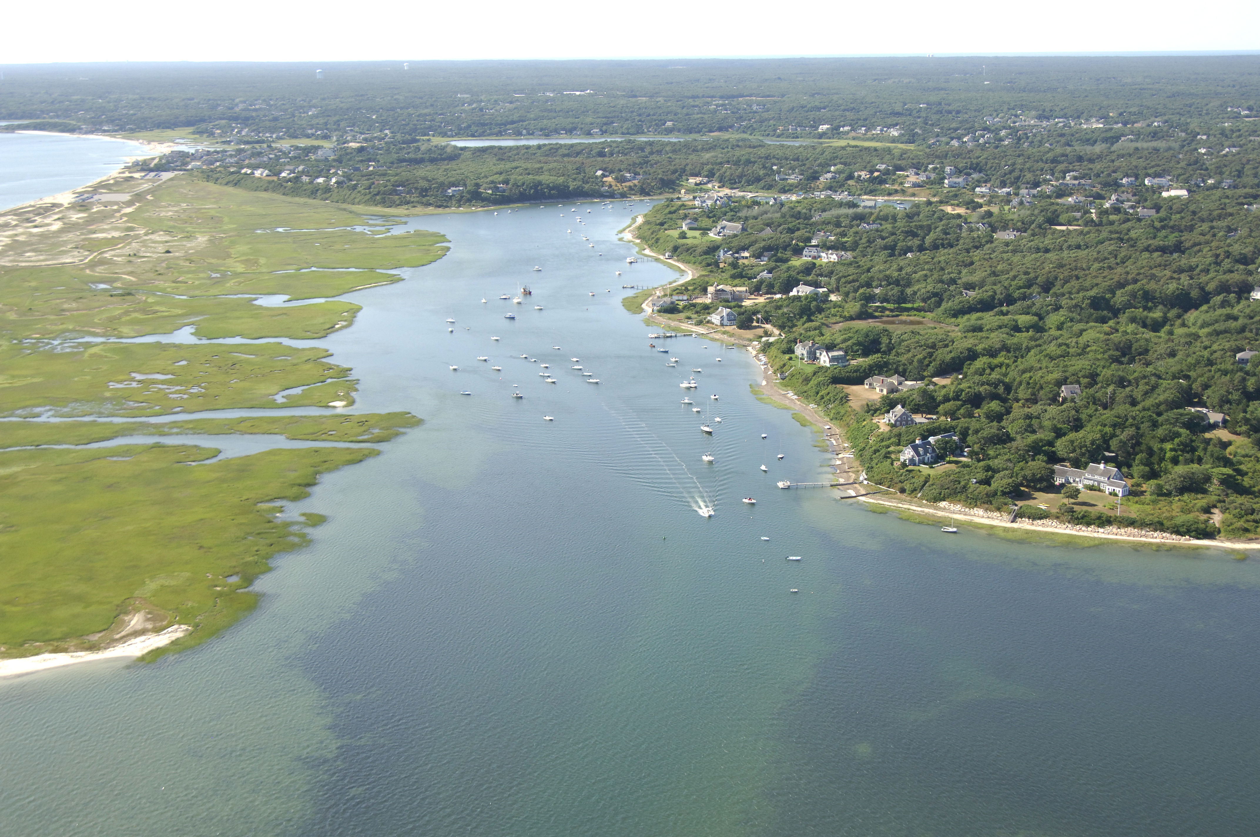
The image above is a view from the southeast looking northwest over the entrance to the Oyster Pond River Inlet where it empties into Stage Harbor near the Stage Harbor Inlet. Off to the left (south) is Harding Beach, while to the right (north) is a large piece of land know as The Neck.
Navigating the Water:
Use NOAA Chart 13229.
The initial approach to Stage Harbor is an entry from the southwest via Nantucket Sound. Once you have navigated your way to the area, set a course for red and white Morse (A) buoy SH, which is located at an approximate waypoint of N41 39.168 W69 59.970. If you are arriving from a good distance offshore, Stage Harbor Light (42 feet above water, flashing white every six seconds) is sometimes visible up to 20 miles into Nantucket Sound.
Once you have picked up red and white Morse (A) buoy SH, set a course to the west to intercept flashing green buoy 1 and red nun buoy 2 at the beginning of the channel cut into Stage Harbor. From flashing green buoy 1 and red nun buoy 2, head northeast past red nun 2A, green can 1A, red nun buoy 2B green can buoy 3, and then flashing red buoy 4 (visible in the image above) just off Harding Beach Point.
From flashing red buoy 4, set an approximate course of 60 degrees magnetic for a distance of about .4 mile to intercept red nun buoy 6. From red nun 6, make a hard turn to port, and with a close eye on the depth sounder, work your way up the river.
Local Notices to Mariners:
Local Notices to Mariners are available online from the U.S. Coast Guard.